Fb

  • Budget Travel
  • Cheap Flights
  • Driving Canada
  • Paved Roads
  • Gravel Roads
  • Train Travel
  • Hitchhikers Guide
  • Tourist Visa
  • Working Holiday Visa
  • Hospitality Work
  • Organic Farms
  • Ranch Jobs in Canada
  • Canada Topo Maps
  • Climate & Weather
  • Alaska Highway
  • Thompson Okanagan
  • Kootenay Rockies
  • Cariboo Chilcotin
  • Northern BC
  • Alberta Rockies
  • Southern Alberta
  • 19 Best Alberta Towns
  • Yukon & Alaska
  • Northwest Territories
  • Saskatchewan
  • Guided Tours in 2024
  • Camper Rental
  • Accommodation
  • Travel Insurance
  • Basic Packing List
  • Campfire Cooking
  • Campfire Recipes
  • Multi Day Hikes
  • Horseback Adventures
  • National Parks Canada
  • Small Town Rodeos
  • Heliskiing Canada
  • Canada Facts
  • Wilderness Dangers
  • Black Bears
  • Grizzly Bears
  • Polar Bears
  • Canada With Kids
  • Canadian Food
  • Canadian Currency
  • Outdoor Store
  • Travel Resources
  • Backcountry Newsletter

Road To Bella Coola – Wilderness Town in Canada’s Great Bear Rainforest

Bella Coola,Grizzly

(“The Road to Bella Coola” was first published in the November 2018 publication of Globerovers Magazine. I have travelled Highway 20 again since then and updated the blog)

Venturing to Bella Coola, the little town at the end of the road. is a journey like no other. The unique town can be reached by sea on a British Columbia (BC) ferry vessel, skipping along the spectacular mountainous coastline of BC, or by air cruising above and around the highest mountains in BC.

I chose to drive 457 km (284 miles) on Highway 20 from Williams Lake. This is the only road leading to the Bella Coola Valley. The highway is paved for the first 319 km (198.2 miles) to Anahim Lake, through the Chilcotin plateau, along prosperous farms and forests. At Anahim Lake, the paved road changes to an all-season gravel road, and that is where the true adventure begins.

Gravel Road to Bella Coola

Table of Contents

Glimpse into the past

The Bella Coola Valley was first known as the valley of Nuxalk, meaning “becoming one” and was inhabited by the Nuxalk Nation. Nestled in the heart of the Coast Mountains the valley is a remote, natural paradise, rich with First Nation history and culture and abundant wildlife. Here you experience authentic wilderness, natural wonders, glacier-fed rivers, unique flora and plenty of adventures.

When I approached the eastern boundary of Tweedsmuir Provincial Park I looked north. I tried to detect the mountain pass where Alexander Mackenzie, one of North America’s first great adventurers, entered the history books in 1793. He was known for his overland journey across North America to the mouth of the Bella Coola River.

Map of Bella Coola and Highway 20

road trip vancouver to bella coola

Approaching “The Hill”

The road to Bella Coola

Tweedsmuir Park is the largest Provincial Park in British Columbia . When I reached the top of The Hill at the Heckman Pass Summit, I took a couple of deep breaths while looking at the narrow stretch of road ahead, where Highway 20 begins its traumatic descent to the sea.

Bella Coola’s famous Hill is legendary for its steep descent. The actual Hill is a 15 km (9.3 miles) gravel road dropping 5,000 feet from the Chilcotin Plateau into the Bella Coola Valley near sea level. The road is cut into the hills with steep switch-backs and grades of up to 18 % with narrow one-line sections, unprotected drop-offs, and no shoulders on the side of the road. No guard rails are preventing me from going over the edge.

While the stretch of road is commonly known as “The Hill” it is also called the Freedom Road. This is what residents christened the road after a persistent, tough group of locals built it in the 1950s. This was after the highway engineers said that it couldn’t be done, that this road couldn’t be built.

Driving “The Hill”

The Hill Bella Coola

Driving in low gears and fully concentrating on the road is necessary when traversing the hair-pinned killer curves. I knew that leaning on the brakes too much could make the wheels slip under me. Fortunately, along the way, there are many pullouts to yield to oncoming traffic, photo opportunities, as well as run-offs, in case of brake failure.

Being used to the backcountry and mountain roads I didn’t find The Hill intimidating. I geared into low, was cautious, kept my eyes perched on the road, and prayed that no big rig or truck would want to pass on the narrow stretches.

For drivers accustomed to city roads, The Hill can be scary. According to locals, it’s not uncommon for travellers to leave their rental car or RV behind and depart by plane or ferry to not have to drive back up The Hill.

Once I got to the valley floor I pulled over for a while and felt a sense of accomplishment.

The grizzly bears at Belarko

Grizzly Bears in Canada on the road to Bella Coola

A short drive down the road, I stopped at the bear viewing station at Belarko. There I had the opportunity to watch the bears dive and splash in the river and catch salmon from the rocky shore.

From here, another hour of relatively flat driving took me through Hagensborg, 16 km (9.94 miles) east of Bella Coola. Hagensborg is where the Norwegian-speaking colonists settled between 1894 and 1910.

Welcome to Bella Coola

Welcome to Bella Coola

It was a late afternoon in early September when I arrived in the Bella Coola wilderness village. The fog hung low and it started to drizzle. The Bella Coola Museum and other historic buildings were shut down for the season.

Fortunately, I found other treasures to explore. At the harbour, I strolled around the Government Wharf surrounded by fishing boats, walked between giant trees at Snootli Creek, found the trail to Clayton Falls and visited the House of Numst’ with its totem pole entry.

Bella Coola’s Petroglyphs and the kayaking tour have to wait until I return.

Bella Coola Harbour

Tips before you go

  • Get yourself a  Backroad Map
  • Prepare for your Wilderness Road Trip
  • Be ready for backcountry camping in the wild
  • Find out how to find Free camping in Canada
  • Make sure your vehicle is up for the challenge
  • Invest in a good zoom lens to capture the wildlife
  • Learn about bear behaviour

Other Road Trips in the Cariboo

  • Camping in the old Ghost Town of Quesnel Forks
  • Wilderness Road Trip through the Cariboo Mountains
  • Barkerville Highway 26 BC Travel Guide
  • Cariboo Chilcotin Guide

Sign up for my Newsletter,  LIKE me on  Facebook , Follow me on Instagram to get notified of new posts, and follow me on my journey.

road trip vancouver to bella coola

Yrene lives in the Okanagan, British Columbia, Canada, and is the founder of BackcountryCanadaTravel.com. She was born in Switzerland, lived and worked on different continents and has travelled the world. Yes, that's me, an Entrepreneur, wilderness nut and animal lover who prefers off-the-beaten-track places. I write about things I love. Mostely.

10 Comments

That is helpful. We are trying to decide the type of vehicle to hire to drive from Vancouver to Bella Coola. Have looked at 4 x 4’s which have very limited kilometers included in teh cost. Do you think we need a 4×4?

Hello Gail, I don’t think a 4×4 is necessary as long as the car has good quality tires and is not too low to the ground and the roads are dry. Myself, I just feel safer with a 4×4 and don’t have to worry in any weather. Enjoy! Let us know how it goes.

Cinthia St-germain

I would love to move in bella coola but i was wondering if the road on ferrie’s side is ok to travel with an RV ? I enjoyed the reading, thank you !

The road is steep and narrow in places, with no barrier on the downside. There are several places to pull over. Big trucks and buses use the road, so be aware when you get to a sharp curve. I have seen RVs and everything from trucks and campers to 5th-wheel trailers and class-A motorhomes. All of Highway 20 from Bella Coola to Williams Lake is paved, except for The Hill which is usually well-maintained gravel or seal coated. Drive slowly and enjoy!

The Hill was a great experience. Absolutely beautiful, and breathtaking as well. Along the way we stopped to photograph the fire that did indeed close the hwy in both directions. The drive down had its moments of grandeur, but the bottom was equally breathtaking as well. Can’t wait the drive back up and see it from a other perspective

Thanks for sharing your experience. Safe travels!

Eric Hollman

Can u safely travel from Williams Lake to Bella coola in a motorcycle??

Hi Eric, you definitely can and you will find some great videos online. To have some gravel road experience might be a good idea for when you get to the gravel section of the highway approaching Tweedsmuir Provincial Park. Take it slow down The Hill and you will be fine and enjoy a great riding experience.

Stan Swartz

I drive a 24 foot RV on a Mercedes Benz 3500 Sprinter chassis. It a low range or ascent and descent of steep roads. I have taken it on gravel all through out to.north woods of Maine. Can I safely navigate Highway 20 with my rig? Any advice would be helpful.

Hi Stan, I drove the road with my RAV4 which of course is a totally different experience. There are definitely large vehicles and trailer on this road and with your experience, I can’t see any problems. It’s extremely steep wit narrow switchbacks, but there are quite a few pullouts. Go slow, gear down and drive in dry weather. Bella Coola Tourism says the following: “It is important to note that the road to Bella Coola is a challenging mountain road, and it includes sections with steep grades, sharp curves, and narrow lanes. Therefore, it is recommended to have experience driving on mountain roads, especially if you plan to drive an RV or a larger vehicle.” I hope that helps. Good luck and let us know how it goes.

Leave a Reply Cancel reply

Your email address will not be published. Required fields are marked *

This site uses Akismet to reduce spam. Learn how your comment data is processed .

Search this blog

The road to bella coola: bc highway 20.

The itinerary for Monday, May 3rd, Day 10 of the trip, was to drive from Farwell Canyon to Bella Coola. It would include one of the big Adventures of the journey – driving “The Hill” into Bella Coola. It’s been infamous due to its very steep drop, and winding, gravel sometimes-one-lane surface.

Now that I have good Internet, I can include some extra features, like this interactive map of the day – just clic k here to open a large one in a new window.
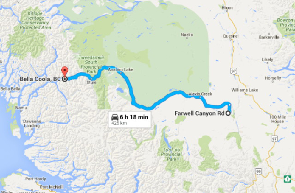
Map of the drive from Farwell Canyon to Bella Coola

I was in no hurry to leave Farwell Canyon – I’d love to spend a few days there. But, just before 09:30, we were ready to hit the road.
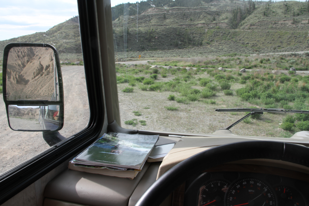
Ready to leave Farwell Canyon in the RV

The Farwell Canyon Forest Service Road’s one-lane bridge across the Chilcotin River.
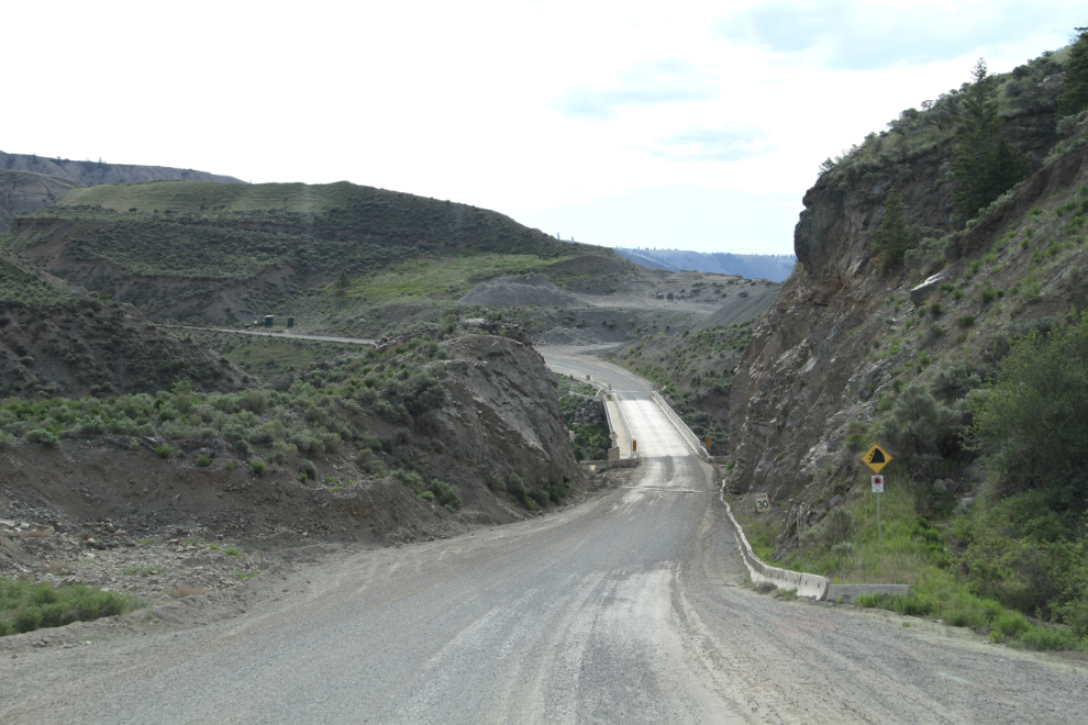
The one-lane bridge across the Chilcotin River at Farwell Canyon

The climb up from the canyon looks good on the GPS 🙂
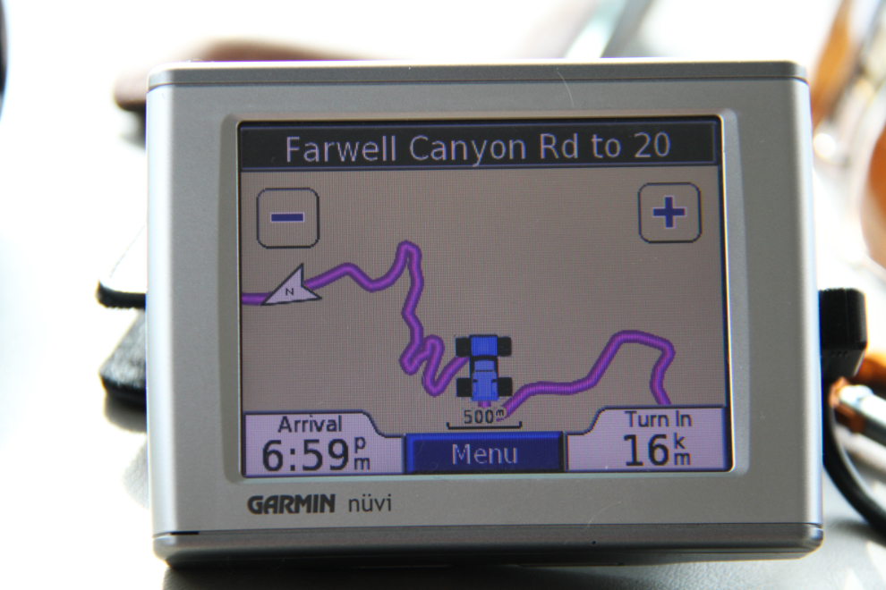
The Farwell Canyon Forest Service Road on a GPS

As I had the previous day, I spaced myself between 2 logging trucks to both stay out of their way, and stay out of their dust as much as possible. This was shot about 2 km from the junction with Highway 20 at Riske Creek.
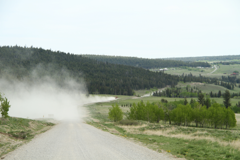
Dust from a logging truck on the Farwell Canyon Forest Service Road

I’d be going through 2 of the 3 regions covered by the Cariboo Chilcotin Coast Tourism Association , and had been in the third region for part of the previous few days, from high-elevation, dry cattle country, though the Coast Mountain Range and down to sea level. The region sees relatively few visitors, and visitor services are few and far between.

This was shot just west of Riske Creek at 10:00.
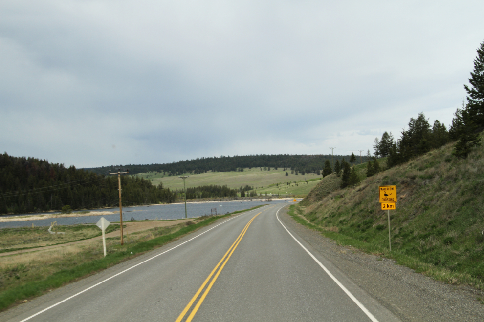
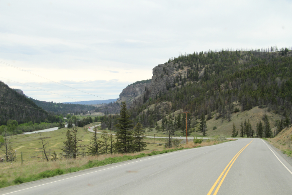
BC Highway 20 just west of Riske Creek

The Discovery Coast Circle Route is a 7-10 day, 2,116 km (1,315 mi) loop from Vancouver to Bella Coola by ferry and road.
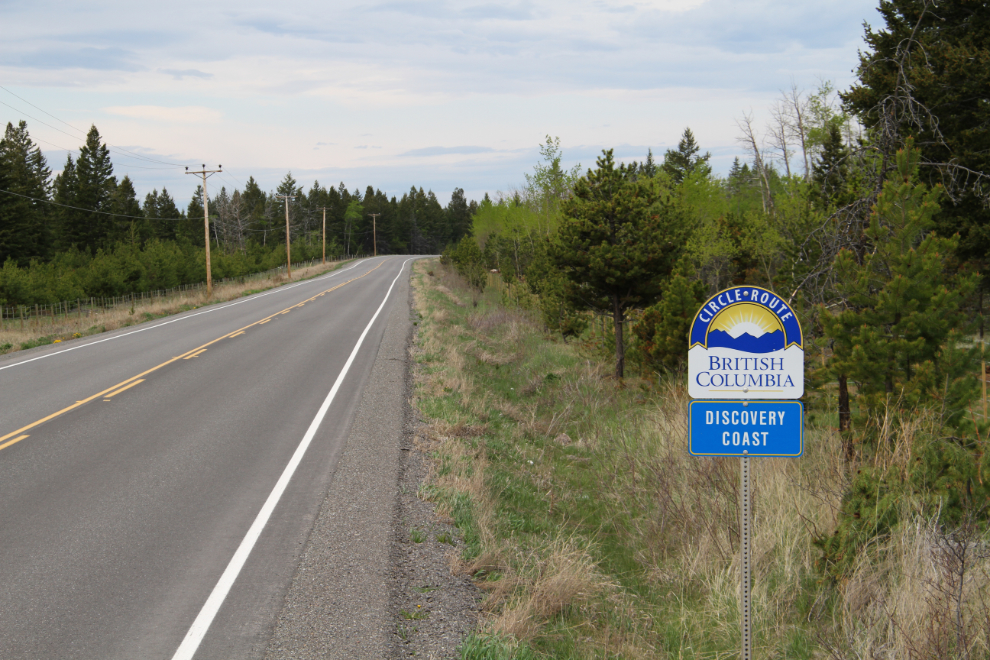
Discovery Coast Circle Route

The view from the Hanceville Lookout Rest Area at 10:25.

The view from the Hanceville Lookout Rest Area on BC Highway 20

Alexis Creek, population about 140.

Alexis Creek, BC

Bull Canyon Provincial Recreation Area, with a lovely little campground on the Chilcotin River.

Bull Canyon Provincial Recreation Area, BC

At the village of Redstone, a few miles past Bull Canyon, a large and heavily-harnessed dog was laying on the narrow (less than 2 feet wide) gravel shoulder of the highway, apparently guarding a cooler whose contents were spilled around it. While I was trying to figure that out, I came to a man peacefully sleeping on the shoulder, perhaps a foot from the pavement. It was nearing noon.

Turning into a viewpoint is always a big of a risk, as you can’t be sure that there will be room to turn around. This one was just barely big enough. I mentioned to a flagperson that you can’t back up when you’re towing a car, and he assumed, as I used to, that it was because the driver didn’t have the skill. But Cathy and I discovered that it’s because the front wheels of the towed vehicle don’t track, they just go sideways.

 A viewpoint along BC Highway 20

The Rest Area at Pollywog Marsh, a Ducks Unlimited conservation area, is very nice, the nicest I saw along Highway 20. Bella and Tucker and I got a long walk here.

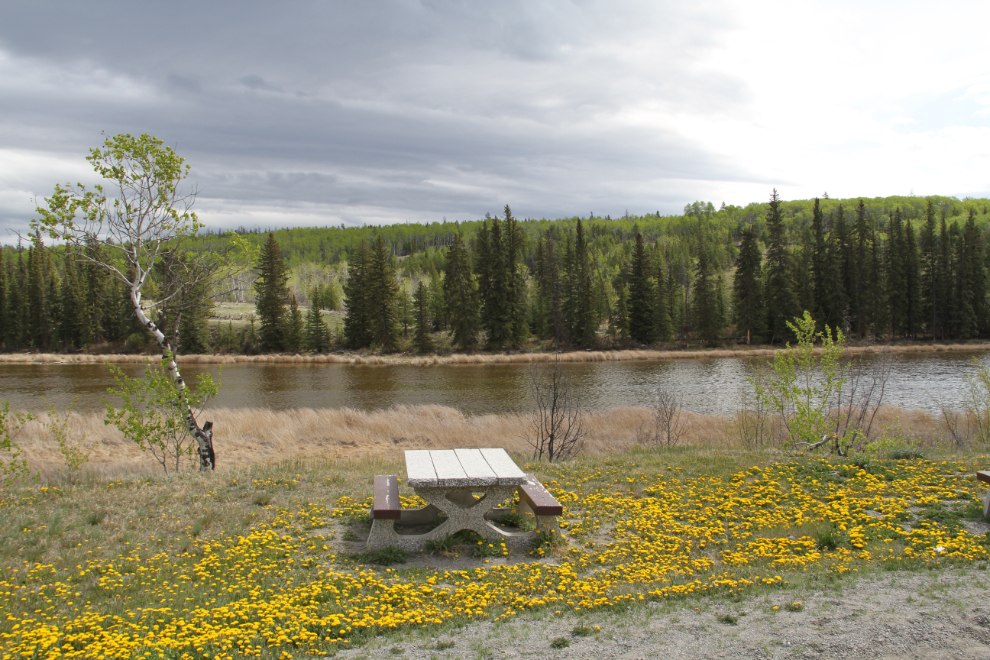
The Rest Area at Pollywog Marsh, a Ducks Unlimited conservation area

The view to the west at 12:45 with the Coast Mountains getting closer.

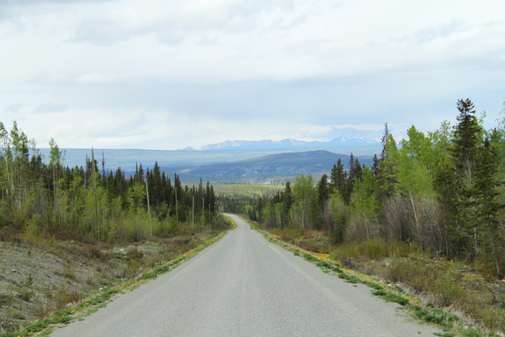
A view along BC Highway 20

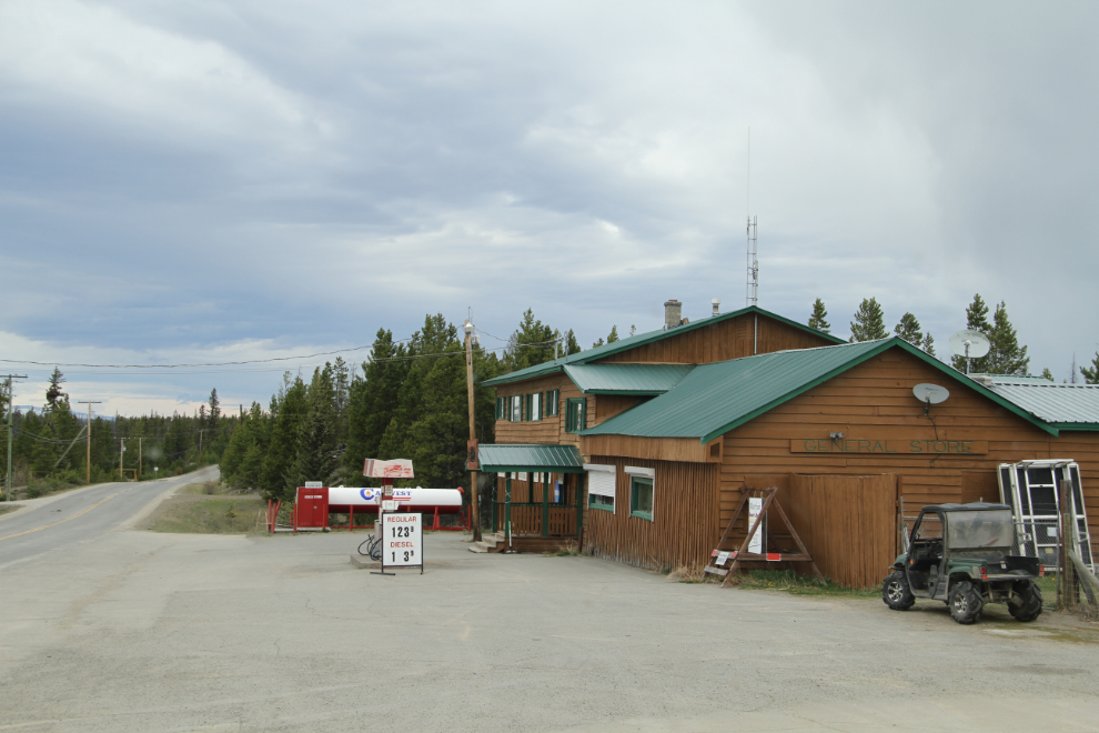
I was going to fuel up at Nimpo Lake, and should have – the price, $1.239, wasn’t high for this region.

Gas station at Nimpo Lake, BC

Anahim Lake, where I planned to fuel up, is the largest community in the Chilcotin (population about 1,500) but whatever services there are, are off the highway somewhere. At Anahim, the road turns to gravel for some 60 km (37 mi). This is as close as I’d driven to Bella Coola before. In 1970 I got this far before a landslide on The Hill closed the road for several days. My goal on that trip was to drive from the Fraser Valley (Vancouver) to Bella Coola without ever touching pavement, and I almost made it (did that get me into some odd places!).

BC Highway 20 turns to gravel at Anahim Lake

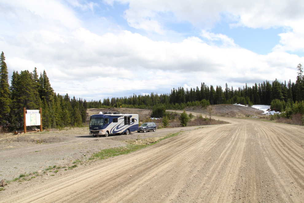
The gravel was in a great shape, and speeds of 80-90 kmh were easy. This pullout had a large sign with tourist information, primarily aimed at fisherpeople

A pullout along BC Highway 20

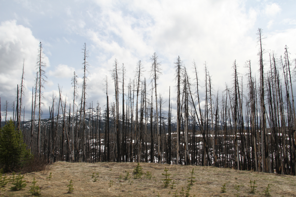
A forest fire burned a large area at the eastern boundary of Tweedsmuir Provincial Park. Now I was heading into an area that I have a lot of photos of, but shot from 35,000 feet.

A forest fire burned a large area at the eastern boundary of Tweedsmuir Provincial Park

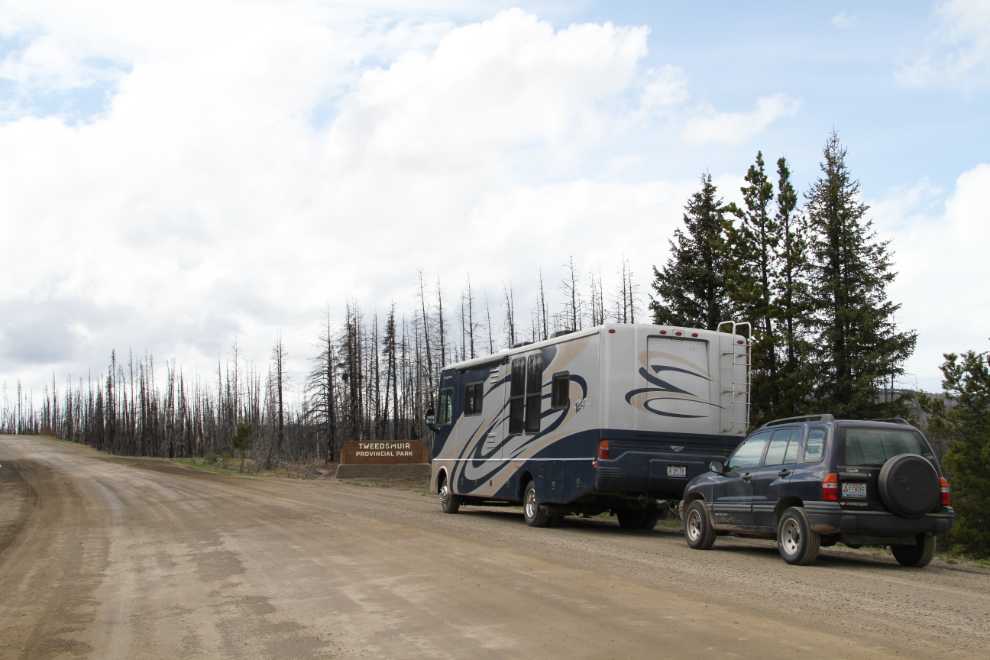
Entering Tweedsmuir Provincial Park, at 2:50 pm. The light really sucked for photos for most of the day.

Entering Tweedsmuir Provincial Park on BC Highway 20

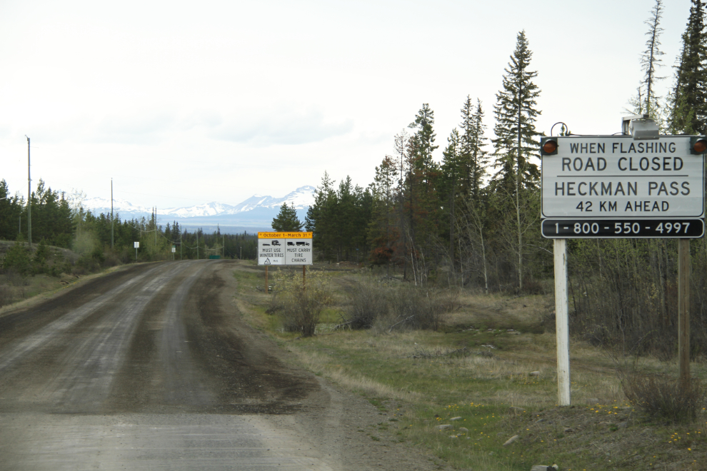
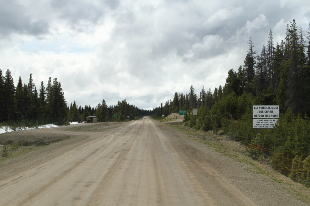
Approaching The Hill . The sign on the right says “All vehicles must use chains beyond this point”, and several more warning signs follow.

Warning signs on BC Highway 20

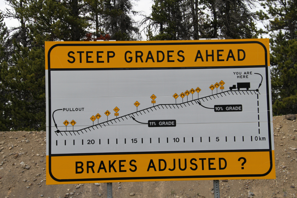
The amount of misinformation about this hill is amazing – even this sign, which should be definitive, has the length of it wrong (I discovered the following day). But its main purpose is to warn about the grades ahead – 10%, 11%, 14%, 12%, and finally 15%. A common figure seen online and even in The Milepost, is 18%, and there is no 18% grade.

Grades on The Hill into Bella Coola

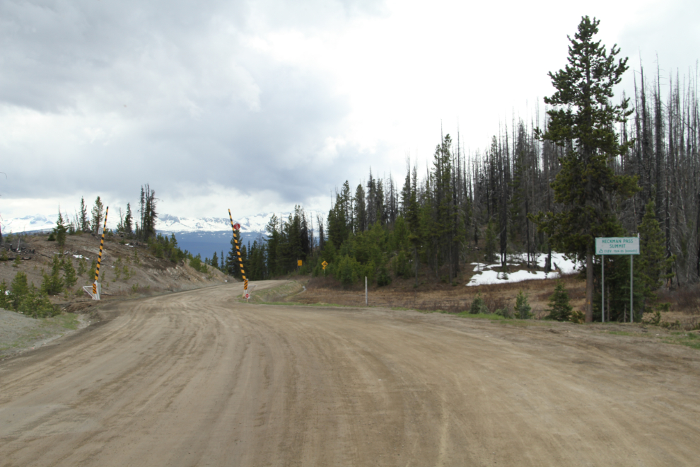
Heckman Pass Summit, elevation 1,524 meters (5,000 feet), the start of The Hill.

Heckman Pass Summit, elevation 1,524 meters (5,000 feet), the start of The Hill.

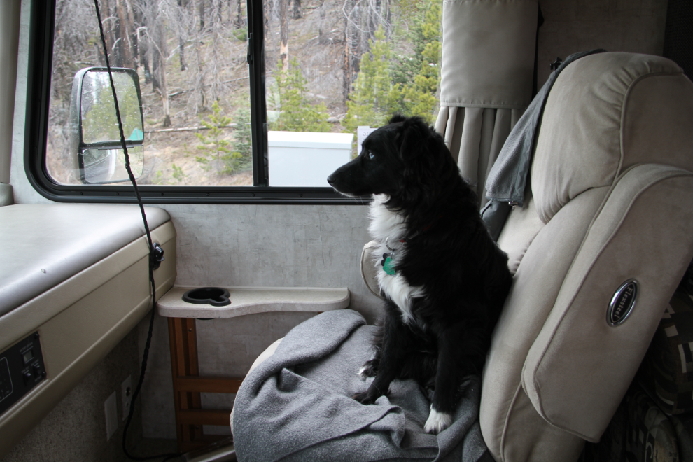
My little adventurer wanted a window seat! 🙂

Tucker, my canine RV co-pilot

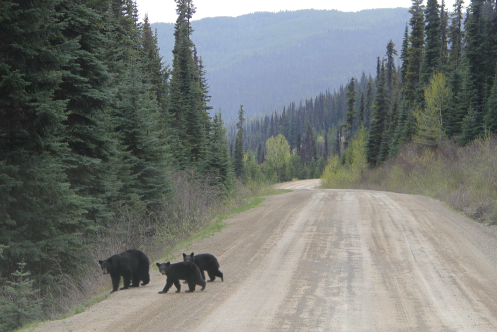
A black bear with twins slowly crossed the road on a fairly level stretch of the hill.

A black bear with twins on BC Highway 20

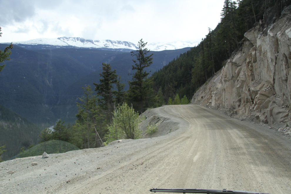
One of the narrow sections, with the Atnarko River far below.

One of the narrow sections of The Hill into Bella Coola

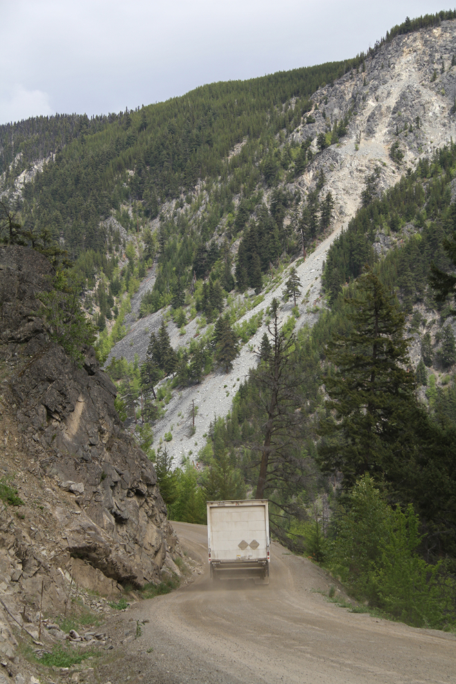
Another narrow section. I wasn’t worried about the grades, but on a steep hill these could be a challenge.

One of the narrow sections of The Hill into Bella Coola

It started raining as I reached the valley bottom, and got heavier and heavier. I was going to stay at the Gnomes Home RV Park, but both of the guys at at gas station in town said that the Rip Rap across the road from the Gnomes Home was better. It was mostly very good – more about that in the next post 🙂

road trip vancouver to bella coola

Related Posts

Days 3 & 4: driving from dawson creek to farwell canyon, bc rving: summit lake to dawson creek, driving the north end of the stewart-cassiar highway, about the author.

' src=

Murray Lundberg

  • Plan a Road Trip
  • Plan a Flight
  • Find an Airport
  • Where to Stay
  • All Questions

Trippy

Vancouver to Bella Coola via Comox

Vancouver to bella coola road trip planner.

Here's a sample itinerary for a drive from Vancouver to Bella Coola. If you're planning a road trip to Bella Coola, you can research locations to stop along the way. Make sure you check road conditions to double check the weather. Traveling with a dog or cat? Find pet-friendly stops . Camping along the way? Search for RV campgrounds . Find the best hotels, restaurants, and attractions based on the most talked about places recommended by Trippy members.

11:00 am  start in Vancouver drive for about 4.5 hours

day 1 driving ≈ 4.5 hours find more stops

10:00 am  leave from Comox drive for about 3 hours

12:49 pm   Port Mcneill stay for about 1 hour and leave at 1:49 pm drive for about 2.5 hours

4:24 pm  arrive in Bella Coola

day 2 driving ≈ 5.5 hours

Where should I stop along the way?

Comox Port Mcneill

What are some things to do in Bella Coola?

This section could be endless, so rather than trying to suggest every local activity or attraction, we'll leave it open-ended.

Of course, Trippy is the perfect place to ask questions because there's an entire community of travelers talking to each other and sharing tips and advice. Trippy is where you can get answers personalized for your tastes, budgets, trip dates & more!

Click the button below to explore more questions and answers related to Bella Coola.

Do I really have to go back home?

Yes, even this step is optional, because if you're on vacation who wants the trip to end? It's okay, you can start planning your next trip!

Want to plan the trip back? Get the reverse directions for a Bella Coola to Vancouver drive , or go to the main page to plan a new road trip .

You can also compare the travel time if you're flying or driving by calculating the distance from Vancouver to Bella Coola . Or get a full Vancouver to Bella Coola flight plan .

Don't forget about exploring your own hometown with a staycation. You can also find some cool day trips or get away for a weekend.

And if you know Vancouver well, please help your fellow travelers and answer their questions about Vancouver!

More info on this route:

road conditions from Vancouver to Bella Coola

places to eat

alternate routes

Google driving directions

Vancouver Island View

Bella Coola: A Gateway to Wilderness Adventures

Bella Coola lies in the heart of the Great Bear Rainforest on the Central Coast of British Columbia, and for outdoor enthusiasts especially, it is a stunning place to explore.

Bella Coola Valley. Vancouver Island View

A Bit of History

The towering mountains, lush forests, and glacier-fed waters of the Bella Coola valley is where the Nuxalk people have called home for over 10,000 years.

The valley saw its first European encounter in 1793 when Alexander Mackenzie, his voyageurs, and Native guides completed the first recorded land trek across Canada.

In 1858, the valley became a busy port and supply centre for the interior when gold fields were discovered in the Cariboo Region. The Hudson's Bay Company then established a trading post in 1867. However, significant growth didn't happen until 1894, when homesteads were granted to a large group of Norwegian colonists from Minnesota.

The area now called Hagensborg is where many settled because the landscape reminded them of home. Farming, lumber, and fishing industries began shortly after their settlement.

road trip vancouver to bella coola

Bella Coola, BC Highlights

Tweedsmuir provincial park.

In 1938, Tweedsmuir Provincial Park was established, and at 989,714 hectares, it is one of British Columbia's largest parks. The northern section of this park is almost entirely pristine wilderness, which means wildlife is widespread and fairly prevalent throughout the park. Woodland caribou frequent the mountainous slopes, while other areas see mountain goats, mule deer, moose, black bears, grizzly bears and wolves.

The park's southern portion provides many walking trails, leading to some of its most spectacular features. These include, but are not limited to, grizzly bear viewing, shield volcanoes, a suspension bridge, a canoe chain, and Hunlen Falls (Canada's highest free-falling waterfall).

View this trail guide for a complete list of amazing hikes in the Provincial Park and the entire Bella Coola Valley.

Purgatory Lookout in Bella Coola. Vancouver Island View

The Scenery

Drive through the glacier-topped mountainous Bella Coola Valley; spectacular sights will greet you at every turn. Spot the many beautiful waterfalls, gorgeous turquoise-coloured bodies of water (including the ocean inlet itself), lush green foliage and pretty wildflowers absolutely everywhere (even in August!). It's truly a photographer's paradise.

Purgatory Lookout

For an amazing backcountry drive that gives you the whole shebang, including a close-up view of a large glacier, head to the Purgatory Lookout. This route winds through alpine meadows with pretty roadside ponds, steep rocky slopes with jagged peaks, and dense high-elevation forested areas. The many deciduous trees in the area would make it an even more gorgeous drive in the fall!

Worthy stops include Odegaard Falls (an easy to moderate 2 km walking trail) and/or Hammer Lake (a moderate 4 km walk to the lake).

The forest road to Purgatory Lookout is steep and does require a 4×4. If you only plan to go to Odegaard Falls, a 2-wheel drive vehicle is fine. Just make sure you go slow, are prepared for anything, and have a spare tire…just in case. There is no cell service in the area!

Getting There

To access this area, you are looking for the West Nusatsum Forest Service Road near Hagensborg. Head east from Hagensborg towards the Nusatsum River bridge, which crosses a short but dramatic vertical canyon. The forest road is located on the west side of the bridge.

Follow this steep, winding gravel road for approximately 25 km to the first stop (Odegaard Falls). Hammer Lake trailhead is another 3 km past this stop, with Purgatory Lookout another 5 km again. The further you go, the rougher and narrower the terrain gets. For the adventurer, the long and challenging drive to the final attraction is more than worth the effort!

Bella Coola Valley. Vancouver Island View

Grizzly Bears

The Bella Coola Valley is said to be one of the best places to view grizzly bears in the world. Prime viewing times are during the late summer and fall when the rivers teem with salmon.

Tweedsmuir Park offers a self-guided wildlife viewing area called Belarko. It's a raised platform with electric fencing and is fully staffed to provide a safe way to see and photograph the bears. Both BC Parks and the Nuxalk Nation operate the platform. There is no charge to visit the viewing area. It is, however, only open for the month of September.

If you visit Bella Coola during September, watch for signs along Highway 20 to guide you to this viewing area.

Clayton Falls in Bella Coola. Vancouver Island View

Bella Coola

Bella Coola is known for its craftsmanship in woodcarving, painting and ceremonial dress. Museums all over the world house Nuxalk art. Sign up for a guided tour with Copper Sun Journeys to see 5000-year-old petroglyphs and/or an immersive totem walk. (Neither can be done without booking a tour).

A quick boat ride on a guided tour across the inlet will get you to the old Tallheo Cannery . Built in 1916, the buildings have remained relatively unchanged since the cannery was in operation. While on tour, you can explore the general store, complete with stocked shelves of merchandise left behind. You can also inspect the office and look through cannery records and newspapers from long ago. A Bed and Breakfast operates out of a restored 1920s guesthouse if you want to stay on the property.

Located near the marina, Clayton Falls is the most accessible waterfall, but no less beautiful than the rest. And the Clayton Falls recreation day-use area is the only ocean-front park in Bella Coola. Follow the gravel road approximately 1.8 km west and downhill from the government wharf. The parking area will be on your left-hand side, just past the BC Hydro generating station. The trail to the waterfall is along the fence on the upper side of the generating station. It's a short 200-metre walk. You will find the beach trail across the road from the parking area.

Norwegian Heritage House in Bella Coola. Vancouver Island View

To this day, the quaint village of Hagensborg has a Norwegian influence. One can still experience what life was like long ago by visiting the Norwegian Heritage House. It's a time capsule furnished in traditional Norwegian fashion and displaying the household tools of the late 1800s.

For a tasty treat, I highly recommend stopping at Cafe Bella ! They specialize in fresh pastries, desserts, specialty coffee, tea and smoothies. They also have an assortment of yummy sandwiches to go.

Bella Coola and Hagensborg both have a small grocery store, as well as several options for accommodations. Restaurants are extremely limited, so preparing your own meals is best.

We had a lovely stay at the Nasatsum River Guest House , located 10 minutes east of Hagensborg.

road trip vancouver to bella coola

Getting to Bella Coola

Getting to Bella Coola is a highlight of its own. Whether you do the circle route through Williams Lake/Chilcotin/Whistler/Vancouver or the Discovery Coast route by road and ferry to or from Port Hardy, you are in for a scenic treat. Either way, it's a very long road trip. The fact that Bella Coola isn't an overly easy place to get to adds to its charm.

And let's not forget about the famous ‘Freedom Road,' or ‘The Hill' as it's now known.

Pure determination by the citizens of Bella Coola was the main reason ‘ The Hill ‘ finally came to fruition. It was several decades, if not a century, in the making. The road drops over 4,000 feet in just over 19 km, with a grade of up to 18%. So it's steep! Also, most hairpin turns are without guardrails, and there are a few short one-lane sections too. So, while it's not for the faint of heart, I'd consider it a good gravel road. There are far worse roads out there (the roads to Cape Scott or Bamfield come to mind!).

Horses along Hwy 20. Vancouver Island View

Our Itinerary

For our recent trip to Bella Coola, we didn't realize how far in advance you must plan the ferry to Port Hardy to partake in the Discovery Coast Route. (Last-minute planning like we often do doesn't always work!). So, we opted for the following itinerary.

On the way there:

  • Duke Point (south Nanaimo) – Tsawwassen
  • Drive Hwy 1 to Cache Creek
  • Take Hwy 97 to 150 Mile House
  • Hwy 20 to Bella Coola

The open cattle and horse pastures along Hwy 20 keep the drive interesting. We had to stop or slow down to a crawl a few times to let livestock cross the road!

On the way back:

  • Retrace our steps back to Cache Creek
  • Then, take Hwy 99 through Lillooet, Pemberton, and Whistler to the Horseshoe Bay ferry terminal, where we boarded a ferry to come home.

Hwy 99 from Cache Creek to Whistler is absolutely gorgeous! (I highly recommend this drive even if you don't go all the way to Bella Coola!).

I hope I've convinced you to plan a trip to Bella Coola in the near future! If it's something you are contemplating, feel free to save this article on Pinterest.

road trip vancouver to bella coola

Meet Kim Parcher, the creative mind and driving force behind Vancouver Island View. Kim's passion for experience-based travel and her talent for sharing valuable information have made her a dedicated niche blogger and freelance writer since 2016. Her unwavering dedication to unlocking the secrets of Vancouver Island, her home since 2009, has made her an undisputed authority in the realm of immersive exploration of the island.

Similar Posts

The Ultimate Vancouver Island Bucket List

The Ultimate Vancouver Island Bucket List

When it comes to bucket list’s, people have varying ideas on what it should entail. For some, the list will include extravagant ideas, such as a hot-air balloon ride. For others, it will be a list of all the beaches…

Serene Seclusion: The Ultimate Ucluelet Adult-Only Retreat

Serene Seclusion: The Ultimate Ucluelet Adult-Only Retreat

Are you looking for a couples getaway? Check out this amazing Ucluelet adult-only retreat. The Accommodations The Snug Harbour Inn is an adult-only retreat that makes a perfect romantic West Coast getaway. Perched on a cliff, this luxury bed and…

Crystal Cove Beach Resort Review

Crystal Cove Beach Resort Review

    I  prefer camping in a more “up-kept” environment. A place where the grounds are taken care of, bugs don’t tend to linger, and there is enough to do that it doesn’t really feel much like “camping” (I am…

Spirit Loop Key Stops You Can’t Miss

Spirit Loop Key Stops You Can’t Miss

39 Must-See Attractions found along the Pacific Marine Circle Route. The Pacific Marine Circle Route, AKA Spirit Loop, is a scenic drive that circles the southern tip of Vancouver Island. The route offers breathtaking views of the Pacific Ocean, coastal…

Point Defiance Zoo & Aquarium

Point Defiance Zoo & Aquarium

It seems we can’t go on a road trip without stopping at a zoo, and this time was no different. We started our trip on the right foot when we decided to spend a fun-filled day at the Point Defiance Zoo &…

Brown’s Bay Resort in Campbell River

Brown’s Bay Resort in Campbell River

We were looking for a cabin on the ocean that slept four and a location that had either its own marina or at least a boat launch. I also knew I wanted to head north. After much research, Brown’s Bay…

It was one of the most scenic trip that I ever went on glad you liked it as much as us

Thanks for sharing these wonderful gems….we have been to many of them ….was in Port Hardy but that was as far as we went…

Leave a Reply Cancel reply

Your email address will not be published. Required fields are marked *

This site uses Akismet to reduce spam. Learn how your comment data is processed .

Driving the treacherously steep Bella Coola Road in British Columbia

How long is bella coola road, is bella coola highway 20 paved, how challenging is the road to bella coola.

Can you drive to Bella Coola?

When was the road to bella coola built.

Where was The Incredible Hulk filmed?

  • Asia & Pacific
  • Middle East

GlobeRovers

The Road to Bella Coola

Wilderness town in canada’s great bear rainforest.

Bella Coola, Canada

Words and Photos by Yrene Dee , Lumby (British Columbia, Canada) . Yrene is the founder of BackcountryCanadaTravel.com. She was born in Switzerland, lived and worked on different continents and travelled the world before she settled in Canada. She is an entrepreneur, wilderness nut, and animal lover who prefers off-the-beaten-track places. Follow Yrene on Twitter @backcountrycana, Facebook @ backcountrycanada, and Instagram @backcountrycanadatravel.

Venturing to Bella Coola, the little town at the end of the road, is a journey like no other. The unique town can be reached by sea on a British Columbia (BC) ferry vessel, skipping along the spectacular mountainous coastline of BC, or by air cruising above and around the highest mountains in BC.

I chose to drive 457 km on highway 20 from Williams Lake. This is the only road leading to the Bella Coola Valley. The highway is paved for the first 319 km to Anahim Lake, through the Chilcotin plateau along prosperous farms and forests. At Anahim Lake, the paved road changes to an all-season gravel road, and that is where the true adventure begins.

Road near Bella Coola, Canada

The Bella Coola Valley was first known as the valley of Nuxalk, meaning “becoming one”, and was inhabited by the Nuxalk Nation. Nestled in the heart of the Coast Mountains the valley is a remote, natural paradise, rich with First Nation history and culture and has an abundance of wildlife. Here you experience authentic wilderness, natural wonders, glacier-fed rivers, unique flora and plenty of adventures.

When I approached the eastern boundary of Tweedsmuir Provincial Park I looked north. I tried to detect the mountain pass where Alexander Mackenzie, one of North America’s first great adventurers, entered the history books in 1793. He was known for his overland journey across North America to the mouth of the Bella Coola River. 

Welcome to Bella Coola, Canada

Tweedsmuir Park is the largest Provincial Park in British Columbia. When I reached the top of The Hill at the Heckman Pass Summit, I took a couple of deep breaths while looking at the narrow stretch of road ahead, where Highway 20 begins its traumatic descent to the sea. Bella Coola’s famous Hill is legendary for its steep descent. The actual Hill is a 15 km gravel road dropping 5,000 feet from the Chilcotin Plateau into the Bella Coola Valley near sea level. The road is cut into the hills with steep switch-backs and grades of up to 18 % with narrow one-line sections, unprotected drop-offs, and no shoulders on the side of the road. There are no guard rails from preventing me from going over the edge.

While the stretch of road is commonly known as “The Hill” it is also called the Freedom Road. This is what residents christened the road after a persistent, tough group of locals built it in the 1950s. This was after the highway engineers said that it couldn’t be done; that this road couldn’t be built.

The hill near Bella Coola, Canada

Driving in low gears and fully concentrating on the road is necessary when traversing the hair-pin killer curves. I knew that leaning on the breaks too much could make the wheels slip under me. Fortunately, along the way there are many pullouts to yield to oncoming traffic, photo opportunities, as well as run-offs in case of a brake failure.

Being used to the backcountry and mountain roads I didn’t find The Hill to be intimidating. I gearing into low, was cautious, kept my eyes focused on the road, and prayed that no big rig or truck would want to pass on the narrow stretches. For drivers accustomed to city roads The Hill can be scary. According to locals it’s not uncommon that travellers leave their rental car or RV behind and depart by plane or ferry in order to avoid having to drive back up The Hill.

Heckman Hill near Bella Coola, Canada

Once I got to the valley floor, I pulled over for a while and felt a sheer sense of accomplishment. A short drive down the road, I stopped at the bear viewing station at Belarko. There I had the opportunity to watch the bears dive and splash in the river and catch salmon from the rocky shore.  From here, another hour of relatively flat driving took me through Hagensborg, 16 km east of Bella Coola. Hagensborg is where the Norwegian-speaking colonists settled between 1894 and 1910.

Grizzly bear cub, Bella Coola, Canada

It was on a late afternoon in early September when I arrived in the Bella Coola wilderness village. The fog hung low and it started to drizzle. The Bella Coola Museum and other historic buildings were shut down for the season.

The Bella Coola Valley Museum. Canada

Fortunately I found other treasures to explore. At the harbour, I strolled around the Government Wharf surrounded by fishing boats, walked between giant trees at the Snootli Creek, found the trail to Clayton Falls and visited the House of Numst’ with its totem pole entry. 

Bella Coola’s Petroglyphs and the kayaking tour will have to wait until I return.

The Bella Coola Harbour, Canada

Yrene is the founder of BackcountryCanadaTravel.com. She was born in Switzerland, lived and worked on different continents and travelled the world before she settled in Canada. She is an entrepreneur, wilderness nut, and animal lover who prefers off-the-beaten-track places.

Wildlife is my life!

Save the rhino, hey, check out these posts too, mauritius island: districts, beaches, islets, and shopping., tblisi to kazbegi, georgia, gilgit to fairy meadows – pakistan’s gilgit-baltistan, hiking the incredible italian dolomites mountains, best volunteering tips – what to avoid, south korea’s gyeongju: museum without walls, leave a comment cancel reply.

You must be logged in to post a comment.

This website uses cookies to improve your experience. We'll assume you're ok with this, but you can opt-out if you wish. Accept Read More

  • Bella Coola Tourism
  • Bella Coola Hotels
  • Bed and Breakfast Bella Coola
  • Bella Coola Holiday Rentals
  • Flights to Bella Coola
  • Bella Coola Restaurants
  • Bella Coola Attractions
  • Bella Coola Travel Forum
  • Bella Coola Photos
  • Bella Coola Map
  • All Bella Coola Hotels
  • Bella Coola Hotel Deals
  • Bella Coola
  • Things to Do
  • Restaurants
  • Holiday Rentals
  • Travel Stories
  • Add a Place
  • Travel Forum
  • Travellers' Choice
  • Help Centre

2 week road trip Vancouver loop via Bella Coola - Bella Coola Forum

  • Canada    
  • British Columbia    
  • Bella Coola Valley    
  • Bella Coola    

2 week road trip Vancouver loop via Bella Coola

  • United Kingdom Forums
  • United States Forums
  • Europe Forums
  • Canada Forums
  • Asia Forums
  • Central America Forums
  • Africa Forums
  • Caribbean Forums
  • Mexico Forums
  • South Pacific Forums
  • South America Forums
  • Middle East Forums
  • Honeymoons and Romance
  • Business Travel
  • Train Travel
  • Traveling With Disabilities
  • Tripadvisor Support
  • Solo Travel
  • Bargain Travel
  • Timeshares / Holiday Rentals
  • Bella Coola Valley forums
  • Bella Coola forum

road trip vancouver to bella coola

I am planning a trip for the last 2 weeks in August for 2 adults and 2 teenagers and would be grateful for advice on my proposed itinerary:

4 nights in Bella Coola (at Tweedsmuir lodge? This looks quite expensive but very nice and more bear watching opportunities. Is 4 nights too long? We like hiking, mountain biking all of which on offer).

Spend second week driving back to Vancouver on Highways 20 and 97 via Nimpo lake - go for scenic flight over Hunlan Falls/Ice Fields. We also would like to go white water rafting and/or horse riding on a dude ranch. Is Williams Lake a good base for rafting? Any suggestions on where to stay for this and riding option. Is the area around Clinton best for dude ranches?

Drive back to Vancouver via Joffre Provincial Park.

Is this doable? Any suggestions/tips most welcome.

' class=

For white water rafting, check the Nahatlatch in the Fraser Canyon. Access is from Boston Bar. I've been with Reo a couple of times. I don't think there is any rafting out of Williams Lake...not that I've heard anyway. Williams Lake isn't really much of a place. Look at the lakes area centered around 100 Mile House and then down through to Clinton and the Green Lake area. This area is really nice.

road trip vancouver to bella coola

The small bit from the bottom of the hill to the top is gravel..this part is a provincial highway and so it would be difficult to constrain rental vehicles from using it. Every year many people rent vehicles and drive this "highway"

The balance of highway 20 is paved and has been for years.

Look at stopping at Nimpo Lake for a few nights. Stewarts Lodge has good accommodation with kitchens and they offer flightsee trips. We've done the one over Hunlen Falls and it's spectacular. They will also drop you off at the Falls area for hiking and then pick you up again.

Graham House at Alexis Creek is worth a stop for tea and cake and to stock up on snacks at the trading post..which has many items on offer. Breakfast or pie at Lee's corner ( Hanceville) is another good stop. Bull Canyon , Farwell Canyon are 2 more stopping places.

Williams Lake can be passed through. Head down to 100 Mile House or Clinton for an overnight. We prefer Clinton. Along the way stop into Chris Harris photography gallery for some amazing views of this marvelous part of BC.

Thanks for all the advice. Lots to look into.

So arrive on Vancouver Island 16th do tours 17,18. Catch Ferry 19th arrive Bella Coola 20th.

Staying in Port McNeil will also put you closer to Port Hardy as you'll need to be there very early for the ferry boarding.

Water's Edge b&b in Port Mc Neil should be able to accommodate you in 2 side by side rooms.. wonderful location..right on the water. You could also look at doling a day trip over to Alert Bay on the ferry from Pt McNeil..so bear or whale tour one day and local touring other day.

There are some local tour operators starting up in the Bella Coola area so you might check what they have to offer.

On your drive back down you can easily go from Clinton ( or the area) to Whistler in one day...highway 97-to hwy 99 You might want to do an overnight in Whistler as you could do mountain biking, rafting, peak to peak there.

I believe there is an older thread about dude ranches near Clinton. If you put that in the search box it should come up.

The links on hellobc.com to the Chilcotin/Cariboo area have a lot of good information.

If you want to see Vancouver and drive through it, then Horseshoe Bay is a very pretty little cove and the sailing across to Nanaimo from there has some lovely views.

So, if you are going to push to get to the island the night of arrival, then go via Tsawwassen. If you are going to stay on this side of the water that first night, then go for HB.

Summer 2014 may be the last summer season for the Port Hardy to Bella Coola ferry run. BC Ferries is looking to cut costs and the recommendations include removing this run during the summer -

http://www.timescolonist.com/business/tourism-group-tries-to-save-bella-coola-ferry-1.788190

The Tourism Industry Association of BC has objected to this cut and there will likely be further discussions. However, as a note to OP and others considering this trip, summer 2014 would be a good time to go.

You will probably want 3 nights in Bella Coola/Tweedsmuir area..Hagensborg which is about 15 minutes down the road from Bella Coola might also offer accommodation.

Just fyi we stay in Nimpo and fish ( great lake for trout) and if it's too windy in the afternoon to get out on the lake we sometimes do a drive down to Bella Coola to buy fresh crabs.....takes about 1.5 hours down from Nimpo to Bella Coola.. You will go through Anahim Lake which is a spot where pelicans breed in the summer.. same pelicans you'll see in Mexico in the winter on the west coast. Also we have always seen bears on the drive between Nimpo and Bella Coola....

and I second Itchyfeet090 about doing this trip while you can. It's a beautiful part of the country..not too many people make it up to the area you're heading for....and the ferry cancellation will be a huge blow to the area.

My understanding is that a ferry to Bella Coola will require an overnight in Bella Bella. So while the trip is still possible, it will become a lot less convenient and less appealing to tourists on a tight schedule.

  • 38 ft Rv trip from Vancouver to Bella 14 June 2023
  • Grizzly bear tour Bella coola 23 February 2023
  • Campground ? 29 May 2021
  • Bella Coola vs Atlin 12 September 2019
  • Which route is best? 03 September 2019
  • Backroads camping 30 August 2019
  • hiking with dog in Bella Coola 08 August 2019
  • Quading Bella Coola 27 July 2019
  • Getting from Williams Lake to Bella Coola 24 February 2019
  • family kayaking in Bella Coola 18 September 2018
  • Williams Lake to Bella Coola looking for an old campground 04 September 2018
  • Driving Bella Coola 02 September 2018
  • Cash machines 31 August 2018
  • RV Parking in Bella Coola 12 August 2018
  • The Hill Bella Coola 13 replies
  • Ferry to Bella Coola? 4 replies
  • September Visit 21 replies
  • Bella Coola July 2012 12 replies
  • Bears in June? 5 replies
  • Wildlife Trails - Bear Trails 2 replies
  • Bella Coola from Port Hardy then to Williams lake?? 4 replies
  • car rental in bella coola 5 replies

Bella Coola Hotels and Places to Stay

Georgie’s Wanderlust

Bella coola – the great bear rainforest.

road trip vancouver to bella coola

Oh Bella Coola. One of the most magical places I have ever had the pleasure of visiting.

I’ve now had the joy of wandering the Bella Coola valley 3 times, with more plans to go back!

Check out what I recommend to see and do in the valley below, after a few fun facts:

Situated on the west coast of British Columbia, the Bella Coola valley is full of surprises. With a population of just over 2,000 residents in the entire valley, this little slice of the Great Bear Rainforest can be found all the way at the end of highway 20 in British Columbia. An outdoor adventure playground, Bella Coola has many mountainous hiking trails and rivers and streams for fishing.

The Bella Coola valley is one of the few places you can drive directly into the Great Bear Rainforest. Which is the home of the spirit bear – also known as the kermode bear. A black bear sub species with a recessive gene, making them white! They are a big reason why I first went to the valley, although I never saw one there. I have seen white and blonde grizzly bears in other parts of British Columbia, but never the kermode bear in Bella Coola. That’s totally ok though, the Bella Coola valley has so much to offer, I’ve been back a third time!

Giant cedar loop, Bella Coola

Getting to Bella Coola

You can drive all the way to the Bella Coola valley. Found at the end of highway 20, with Williams Lake at the start, I recommend stocking up on your groceries here as they start to get more expensive from this point on. The drive from Vancouver will take you at least 12 hours, and over 16 from Calgary. A great way to make a road trip adventure, there are so many things to see and do on the way to Bella Coola. It is well worth the drive and one that I have done three times myself.

There is also the option to take a ferry from the north of Vancouver Island. The ferry departs from Port Hardy (Bear Cove) and arrives to the town of Bella Coola. It takes 10 hours on the ferry boat between terminals. This ferry does not sail everyday and I highly recommend booking in advance. I took the ferry from Bella Coola to Port Hardy in August 2022 – a fantastic way to see the inland passage, and whales! Visit BC Ferries to view schedules and book a sailing.

You also have the option of flying from Vancouver to Bella Coola airport with Pacific Coastal Airlines . The flight is 1 hour and 15 minutes, however once you arrive you are going to have to arrange transportation as the valley is big.

There is no regular public transport in the Bella Coola valley, so having a personal vehicle (or at least a bike) is a must.

Hunlen Falls

Things to do in Bella Coola

  • Salmon fishing during the salmon runs
  • Wildlife watching/tours (grizzly and black bears!)
  • Bird watching
  • Rock climbing
  • Kayaking and paddle boarding
  • Hot springs
  • Enjoy a cute cafe

Bella Coola, Grizzly Bear

Salmon Fishing

Or simply fishing. There is world class fishing in the Bella Coola valley. Many avid anglers come for the salmon runs. You will find the Chinook salmon mid-May to mid-July, the Coho salmon from September through October, the Pink salmon run in July and August, and the Chum salmon run later in July. Cutthroat, Rainbow Trout and Dolly Varden can be found along the Atnarko River.

Fishing licenses are essential, and can be purchased online through BC’s government website . Be aware that freshwater and tidal licenses need to be purchased separately, and know your limits of what you can keep.

Burnt bridge creek - Bella Coola valley

Wildlife & bird watching

Bella Coola is a fantastic place to see grizzly and black bears in the wild. The salmon runs attract them down into the valley during the early fall (September & October). Early spring is also a good time to see them when they are waking up and feeding on young plant shoots. By far the best month to see them is September, and the only month that the bear viewing station at Belarko is actually open. This is a fun and safe way to see the bears in and around the Atnarko river.

Other wildlife that is possible to see are wolves, cougars, blacktail deer, mountain goats, and martens. Around the estuary mouth just west of the Bella Coola township, you can see harbour seals, bald eagles, blue herons and other sea birds.

There are many many hiking trails in the Bella Coola valley, ranging from short 15 minute circuits, to overnight backpacking trips. Scattered all through the valley are some great interpretive walks and lookout trails. Check out bellacoola.ca for a detailed map and list of hiking trails in the area!

I recommend M. Gurr for a fantastic day trip and stunning 360 lookout. Found up Clayton Falls Forest Service Road, 4X4 is recommended to get up this road. You will also find Grey & Blue Jay Lakes on this road, and the trail head to Big Cedar Tree.

Hunlen Falls is another wonderful day trip that will take you up out of the rainforest and to plateau on top of a ridge to several viewpoints of Hunlen Falls. This stunning waterfall is in Tweedsmuir National Park and can also be done as a multi-day hiking trip from Turner Lake, the lake that feeds into Hunlen Falls. Canoeing trips are also possible up here. Read up on my essentials to have while trekking to make sure you’ve got everything packed!

For an easier, flat walk, check out the Big Cedars Loop near the airport, or the Saloompt Interpretive Forest on Saloompt River Road. There is great fishing on this road on the Saloompt River, make sure you have a fishing permit for BC and check the limits on the types of fish you are intending to catch.

Turner Lake

You can find some cheap and simple campsites in the Bella Coola valley, with cleared spaces and drop toilets. There is a full hook up campground called Rip Rap in Hagensborg, a cute little town 15 minutes east up the valley from the main townsite of Bella Coola. There’s also a really great app called Wikicamps that can show you the campgrounds and attractions in the area and if they are free or paid. The app costs $2.79CAD and you have it for life. I bought it years ago and have used it plenty of times across Canada to find campgrounds and RV dump stations for water refills (they also have a USA, NZ, and Aussie version! The Aussie one found me sleeping in some wonderful places when I toured my home country in 2018).

Rock Climbing

A lesser known activity in the valley is rock climbing. Many people think of the Chief in Squamish when they think of this sport, which is popular for a reason – it’s close to Vancouver and it’s absolutely stunning. If you are coming here for rock climbing then you are a deep lover of the activity and know your stuff as there is very little information online for this.

Kayaking & paddle boarding

Down by the harbour you can drop your vessel of choice into the water and go for a paddle with the seals. My friend Mac and I were lucky enough to go out when the water was relatively calm and the sun was peeking through the clouds.

road trip vancouver to bella coola

Boat tours & hot springs

Bella Coola is know for its rivers and estuary. If boats are your thing, check out Bella Coola Grizzly tours for a range of different tours! They can take you to the hot springs, which in this area are accessible only by boat as they are across the waters of the South Bentinck Arm. I never made it for a dip in the hot springs, let me know if you do!

Dining and cute cafes

Having such a small population, the dining options are a little slim in the valley. There are a couple of family style restaurants in Bella Coola, and Hagensborg has a few cafes. I really enjoyed the sandwiches at My Lunch Stop and the coffee at Bella Coola Eagle Lodge. Bella Coola and Hagensborg both have grocery stores, with a good selection.

I hope you enjoy Bella Coola as much as I did, I’ve been twice! Please share with your friends who you think would love Bella Coola too.

douglas fir and cedar - Bella Coola valley

Share this:

road trip vancouver to bella coola

Georgiapondeljak

Leave a Reply Cancel reply

Discover more from georgie’s wanderlust.

Subscribe now to keep reading and get access to the full archive.

Type your email…

Continue reading

  • Planning a First Family Vacation
  • Flight Booking Tips
  • First Flight Packing and Prepping Tips
  • First Flight Tips
  • Tips for Dining Out with Kids
  • Finding Attraction Discounts
  • Family Accommodation Deals
  • Family Destination Guides
  • Unique Hotels of the World
  • Airports and Airline Baggage Policy
  • Packing List
  • Babysitting Service Directory
  • Baby Equipment Rental Directory
  • Privacy Policy
  • Terms of Use
  • Search for:

Visiting Bella Coola, B.C. in Bear Watching Season

Last update: October 9th, 2023 at 08:39 am

Bella Coola Bears – British Columbia Bear Watching

Affiliate Disclosure:  This post contains links from which Pint Size Pilot may receive a small commission if you choose to make a purchase.

Bella Coola Bears – Bear Watching in B.C.

During a summer of taking small road trips relatively close to our Vancouver home, I happened to read that the Bella Coola Valley was reopening to visitors. Like several other communities within B.C.’s Great Bear Rainforest (including Haida Gwaii), Bella Coola had closed to tourism in the spring of 2020. A recent agreement reached between the Bella Coola Valley Tourism Association and the Nuxalk Nation leadership would carefully welcome back residents of British Columbia only.

Through a little research, I learned that the Bella Coola Valley was one of the best places in British Columbia to observe bears (black and grizzly) in their natural environment. This is due to the fact that in late summer and early fall, the bears descend from the alpine to fatten up on spawning salmon in the local rivers before heading into hibernation. A B.C. bear watching family adventure was born!

As natural events do not appear on cue, I knew better than to plan our Bella Coola trip around grizzly bear watching alone. (Lesson learned from a trip to Iceland to see the Northern Lights – a natural phenomena that is still on my bucket list.) Instead, the plan was to experience some of B.C.’s most beautiful coastal scenery through hiking, spending time on the local rivers, and enjoying quiet evenings around a campfire. Grizzly bears sightings would be the icing on the cake.

Bella Coola Bears

In this post, I will share with you things to do in Bella Coola (starting with Bella Coola bear watching tours), the best Bella Coola accommodation options, and how the heck to get there. Please use the following menu to find what you need quickly, or start with our 1 minute video.

Table of Contents

Bella Coola Video (1 min.)

Where is bella coola, bc.

Bella Coola is a community located within the glacially-formed Bella Coola Valley. It is situated at the mouth of the Bella Coola River, where the river waters meets the Pacific Ocean at North Bentinck Arm.

Bella Coola also happens to be where explorer Alexander Mackenzie finally reached the Pacific Ocean in 1793 (with help from local Indigenous Peoples), to complete the first land crossing of the Americas north of Mexico (12 years before Lewis and Clark).

Bella Coola Map

I wanted to share this Bella Coola Valley map to help you understand the layout of the region. Bella Coola is nestled right in beside the neighboring town of Hagensborg (15 minutes apart by car). In fact, the Bella Coola airport is actually in Hagensborg as are a number of nice accommodation providers.

Tweedsmuir Provincial Park, a popular spot for hiking, fishing and bear watching, is a 40 minute drive to the east.

Bella Coola Map

Top Things to do in Bella Coola

1. bella coola bears.

The Bella Coola Valley is home to both black bears and grizzly bears. The best time to do bear watching in Bella Coola is in the late spring when they feed on the new plant growth in the bottom of the valley or late summer and early fall when they feed on spawning salmon.

For the best chance of seeing bears, be sure to book a Bella Coola bear watching tour with an accredited guide. These tours may involve driving to special locations or doing a boat drift down the Bella Coola or Atnarko Rivers. Please see this list of Bella Coola tour providers .

There are also some Bella Coola Valley accommodation providers that specialize in bear watching. For example, the luxurious Tweedsmuir Park Lodge offers all-inclusive bear watching programs (hikes, viewing platform and river drifts). Bella Coola Grizzly Tours offers bear watching excursions and also has charming self-catering log cabin accommodations.

Bella Coola Bears

If you have your own vehicle and are visiting in September, drive north into Tweedsmuir Provincial Park to the Belarko Bear Watching Platform. This platform above the Atnarko River is run and staffed by B.C. Parks throughout the month of September.

The spot that was most successful for us for seeing bears, however, was the Fisheries Pool Provincial Campground located just before the Belarko Platform when driving east into Tweedsmuir Provincial Park. Both campers and the general public are welcome at this site. Judging by the number of photographers set up for the day (paparazzi-style), this is the place to be for grizzly bear watching. (We saw a mom and 3 cubs there on 2 different days.)

If you are venturing out on your own, please follow the linked guidelines for  wildlife and bear encounters . As our family has delved deeper into hiking in B.C., we definitely have had to familiarize ourselves with what to do in the event of a bear encounter. This has including carrying bear spray and bear bells on hikes (available at places like MEC and REI ).

Note: You cannot fly with bear spray (carry-on or checked bags). It can, however, be purchased in Bella Coola or the neighboring town of Hagensborg.

2. Bella Coola Hiking Trails

The Bella Coola Valley has many beautiful hiking trails that allow visitors to experience old growth forests, alpine meadows, glacial waterfalls and spectacular Bella Coola Valley viewpoints. Two popular hikes include the M.Gurr Lake Trail and Odegaard Falls. See a full list of Bella Coola hikes here .

Many hikes (including M.Gurr and Odegaard) are reached via old forestry service roads that are not necessarily well maintained. A 4×4 vehicle is highly recommended. We rented one from Steve at Bella Coola Vehicle Rentals and had a very good experience. Please note that due to the additional wear and tear on vehicles when traveling on these particularly rough roads, a rental surcharge is applied.

Note: It can be a little tricky to get updated information on the conditions of the forestry roads leading up to some of the alpine hikes. If you do not have a knowledgeable local to ask (such as Steve), I recommend checking to see if anyone has posted recently about the hike on TripAdvisor, inquiring on the Visit Bella Coola Facebook page, or calling the Ministry of Forests front counter office at 250-982-2000.

Hiking in Bella Coola – M. Gurr Lake

While out and about (or if you are sitting around waiting for your plane), don’t miss seeing one of the largest cedars in the valley right at the Bella Coola Airport. Follow the trail across from the parking lot into the woods about 25m until you see this beauty. She is almost 3m wide and 50m tall!

road trip vancouver to bella coola

3. Marine Adventures

One of the most special ways to experience the beauty of Bella Coola and the Great Bear Rainforest is to enjoy it from the water. Single day and multi-day boating trips are available from Bella Coola offering the opportunity to see bears, whales, dolphins, sea otters, wolves, eagles and more.

Booking a boat trip is also necessary if you are interested in visiting Bella Coola’s natural hot springs that are carved into the rocks and “The Big Cedar”.

See Great Bear Sailing Adventures  (39 foot sailboat) and Bella Coola Grizzly Tours  (42 foot power boat) for itinerary options.

Bella Coola Day Trips

4. Bella Coola Petroglyphs

Bella Coola is located within the ancestral lands of the Nuxalk Nation. This First Nations community can trace their roots as keepers of the Bella Coola Valley back thousands of years.

One of the must-see highlights of the Bella Coola Valley are the petroglyphs at Thorsen Creek. These significant rock carvings, depicting both the natural and supernatural world, were created between 5-10,000 year ago by the Indigenous People of the valley.

The petroglyphs continue to be a very sacred location for the Nuxalk Nation today. Respectfully, they should only be visited as part of a tour with a Nuxalk guide. Interpretive tours can be booked through Copper Sun Gallery and Tours .

Update:  As a precaution, Copper Sun has chosen to cancel tours for 2020 to ensure the safety and health of their community. They have plans to reopen for the 2021 tourism season.

Bella Coola Petroglyphs

5. Bella Coola River Fishing

Along with Cutthroat trout, Rainbow trout, Rocky Mountain whitefish and Dolly Varden, anglers can fish the multiple salmon runs in the rivers and streams of the Bella Coola Valley (Chinook, Coho, Chum and Pink).

To set up for a successful fishing adventure, a guide is highly recommended. Several local lodges offer guided fishing packages including Eagle Lodge and Tweedsmuir Park Lodge.

Bella Coola Fishing

Bella Coola Accommodation

Looking for Bella Coola hotels? Check out our top picks for Bella Coola accommodations below.

1. Bella Coola Grizzly Tours Cabins

If you would like to self-cater or are looking for cozy family-sized accommodations, Bella Coola Grizzly Tours log cabins are a solid choice. The cabins are nestled into the edge of the woods and contain a queen bed plus two double beds. Each unit also has a wood stove, electric stove, refrigerator, microwave and gas BBQ.

Check rates on Booking.com or read recent reviews on TripAdvisor.

Note: Bella Coola Grizzly Tours land and marine based adventures leave right from the property.

Bella Coola Accoommodation

2. Bella Coola Eagle Lodge

If you are looking for something closer to luxury accommodation in Bella Coola, the Eagle Lodge is a great option. It has 11 nicely appointed guest rooms in various configurations, including adjoining rooms for families.

All rooms have hardwood floors, a fireplace, satellite TV and wireless internet. There is a games room, a business centre, and an exercise room on site, plus a complimentary airport shuttle. Stays include a continental breakfast (with espresso bar).

Luxury Accommodation Bella Coola – Eagle Lodge

3. Tweedsmuir Park Lodge

If you are looking for a B.C. luxury wilderness lodge getaway, Tweedsmuir Park Lodge, just 40 minutes east of Bella Coola, is for you. With their expert guides and all-inclusive programming, all the logistics are taken care of for your bear watching, fly fishing, hiking or heli-skiing adventure.

Guests at Tweedsmuir Park Lodge stay in rustic luxury in their lovely timber-framed chalets. Fine fare is served in the lodge where guests can later retire to the cozy lounge or games room.

Learn more on the Tweedsmuir Park Lodge website or read recent reviews on TripAdvisor . See also this post on our 3 night stay at Tweedsmuir Park Lodge.

Tip:  Inquire about specials. We received 30% off the 3-night Grizzly Bear Safari package – a unique deal offered to B.C. residents for fall 2020.

Luxury Wilderness Lodge BC – Tweedsmuir Park Lodge

Getting to Bella Coola

Bella Coola can be reached by air, land and sea.

By Air: Pacific Coastal Airlines has daily flights to Bella Coola Airport (QBC) from Vancouver’s South Terminal (YVR).The flight time is approximately 70 minutes.* Private planes and helicopter can also land at Bella Coola Airport.

*Note: If the weather is not great in Bella Coola, planes will sometimes land in Anahim Lake instead. The journey to Bella Coola is then completed by taking a 2 hour ride on a school bus down a rather precarious-looking dirt road (“The Hill”) from the Chilcotin Plateau to the valley floor. (This happened to us in early Sept.)

road trip vancouver to bella coola

By Water: The Northern Sea Wolf ferry normally runs between Port Hardy and Bella Coola during the summer months, although it was put on hold for 2020. See the Central Coast Connector on the BC Ferries website for more information.

By Land: Follow Hwy 97 to Williams Lake and continue west on Hwy 20 for a 4-hour drive to Anahim Lake . The descent into the Bella Coola Valley involves a 20 minute drive down “The Hill” (a packed, dirt road with numerous hairpin turns) that must be driven slowly and carefully. From the bottom, it is another 60 minutes to Bella Coola. Bella Coola is 920 km from Vancouver.

Questions About Bella Coola?

If you have any questions about visiting Bella Coola, I recommend checking out BellaCoola.ca . Alternatively, feel free to reach out to me at  [email protected] .

More B.C. Travel Guides

  • Tweedsmuir Park Lodge Grizzly Safari
  • Assiniboine Lodge, BC – Hike In/Fly Out
  • 6 Easy Hikes Near Vancouver
  • B.C. Kootenays Road Trip Guide
  • Best Things to do in Golden, B.C.
  • Okanagan Family Friendly Wineries
  • 5 Great Road Trips From Vancouver
  • Tofino with Kids Guide
  • Victoria with Kids Guide
  • Best Things to do in Ucluelet
  • Best Ucluelet Hotels and Cabins

Recent Posts

San Sebastian with Kids

16 Best Things to do in San Sebastian with Kids (2024 Guide)

A guide to visiting the seaside town of San Sebastian, Spain with kids. Read More

Renting a 4x4 in Iceland

Renting a 4×4 in Iceland (2024 Guide!)

Everything you need to know about renting a 4x4 in Iceland. Read More

NYC family photographers

How to Find a NYC Family Photographer

Everything you need to know about booking a NYC family photographer! Read More

Road Trips from Vancouver

The 5 Best Road Trips from Vancouver

5 gorgeous road trips from Vancouver for summer. Read More

SilverStar Ski Resort

SilverStar Mountain Resort – Ski Guide

A family-friendly guide to SilverStar Mountain in Vernon, B.C. Read More

Best Paris Hotels for Families

20 Best Family Friendly Paris Hotels (2024 Guide)

Discover the best hotels for families in Paris. Read More

Family Hotels in Reykjavik

The 8 Best Family Hotels in Reykjavik (2024)

Discover the top 8 family hotels in Reykjavik, Iceland. Read More

Iceland with Kids Reykjavik

20 Things to do in Reykjavik with Kids (2024 Guide)

A family-friendly guide to Reykjavik, Iceland. Read More

Leave a Reply Cancel reply

Your email address will not be published. Required fields are marked *

Save my name, email, and website in this browser for the next time I comment.

This site uses Akismet to reduce spam. Learn how your comment data is processed .

road trip vancouver to bella coola

A selection of questions and answers to some the most popular questions we receive

When is the best time of year to see the grizzly bears.

The best time of year to see bears in the Bella Coola Valley typically falls between late August and early October. During this time, the salmon are running upstream, which is a major food source for bears in the area, and as a result, they are more active and visible. It is important to note that bear sightings cannot be guaranteed, and it is always essential to observe these magnificent animals from a safe distance and with caution. Additionally, it is advisable to check with local authorities or tour operators for the latest information on bear sightings and safety precautions before visiting the area.

Is it safe to driveway RV or trailer down the Hill

The road leading to Bella Coola, officially known as Highway 20, is a steep and winding mountain road that can be challenging to drive for some people, especially those who are not experienced with driving on mountain roads. The route includes a section of road known as the “Hill,” which is a particularly steep and winding section of the highway that can be especially challenging for larger vehicles such as RVs or travel trailers.

While it is possible to drive an RV or travel trailer down the “Hill” to Bella Coola, it is important to exercise caution and follow recommended safety guidelines. It is advisable to check road conditions before embarking on the trip, as the road may be closed due to inclement weather, rock slides, or other hazards.

It is also recommended that drivers of larger vehicles take extra precautions when driving on mountain roads, such as driving at slower speeds, maintaining a safe distance from other vehicles, and using lower gears to control speed when descending steep inclines. Additionally, it may be helpful to have experience driving on mountain roads before attempting the drive down to Bella Coola.

Overall, while it is possible to drive an RV or travel trailer down the “Hill” to Bella Coola, it is important to take appropriate precautions and exercise caution to ensure a safe and enjoyable trip.

how long is the ferry from port hardy

The ferry route from Port Hardy to Bella Coola is serviced by BC Ferries, and it is known as the Inside Passage route. The travel time for this ferry route can vary depending on the season, weather conditions, and other factors. However, on average, the ferry ride from Port Hardy to Bella Coola takes approximately 10-12 hours.

It is important to note that the Inside Passage ferry route is known for its stunning scenery and wildlife sightings, including whales, dolphins, sea lions, and eagles. 

If you are planning to take the ferry from Port Hardy to Bella Coola, it is recommended to check the BC Ferries website or contact their customer service for up-to-date schedules, fares, and other important information regarding your trip.

when is the bear viewing platform operational

The wildlife viewing platform in Tweedsmuir Provincial Park is typically operational for the month of September. This timeframe coincides with the annual salmon run, which is a major food source for bears in the area. During this time, the viewing platform provides visitors with a safe and unique opportunity to observe grizzly bears and other wildlife in their natural habitat.

It is important to note that the operational dates of the wildlife viewing platform can vary from year to year depending on weather conditions, wildlife activity, and other factors. Therefore, it is advisable to check with BC Parks or the park ranger station for the latest information on the operational status of the platform before visiting Tweedsmuir Provincial Park.

Additionally, it is important to follow all safety guidelines and regulations when using the viewing platform or observing wildlife in the park. This includes maintaining a safe distance from bears and other animals, respecting their habitat and behavior, and following all posted signs and guidelines.

how long is the drive from Vancouver

The drive from Vancouver to Bella Coola is approximately 1,010 kilometers (630 miles) long, and it typically takes around 14-16 hours to complete the journey. However, the actual travel time can vary depending on factors such as road conditions, weather, and traffic.

The route from Vancouver to Bella Coola includes a scenic drive along Highway 20, which passes through the Coast Mountains and the Chilcotin Plateau. This drive is known for its stunning views of mountain ranges, rivers, lakes, and forests, and it also provides opportunities for wildlife sightings.

It is important to note that the road to Bella Coola is a challenging mountain road, and it includes sections with steep grades, sharp curves, and narrow lanes. Therefore, it is recommended to have experience driving on mountain roads, especially if you plan to drive an RV or a larger vehicle.

Additionally, it is advisable to check road conditions and weather forecasts before embarking on the drive, as the road may be closed due to rock slides, flooding, or other hazards, especially during the winter months.

where are the some places to stay along the way

  • Williams Lake: Williams Lake is a city located about 280 km (175 mi) east of Bella Coola, and it is a good place to stop for the night if you are driving from the east. There are several hotels and motels in Williams Lake, including the Ramada by Wyndham Williams Lake, Super 8 by Wyndham Williams Lake BC, and the Sandman Hotel & Suites Williams Lake.
  • Nimpo Lake:Nimpo Lake is a small community in the Cariboo region of British Columbia known for its beautiful scenery and outdoor recreational activities such as fishing, camping, and boating. Accommodation options include wilderness resorts, motels, and lakeside lodges.
  • Anahim Lake: Anahim Lake is a small community located about 180 km (112 mi) west of Williams Lake and 160 km (100 mi) east of Bella Coola. It is a good place to stop for the night if you want to break up the drive into two days. There are several lodges and resorts in Anahim Lake, including the Anahim Lake Resort, Moose Haven Lodge, and Eagle’s Nest Resort.

It is important to note that accommodations in the Bella Coola Valley can be limited, especially during the peak travel season in the summer months. Therefore, it is recommended to book your accommodations in advance to ensure availability.

is the road safe in the winter

The road to Bella Coola, also known as Highway 20, can be challenging and potentially hazardous during the winter months. The road passes through steep and rugged terrain, which can be subject to heavy snowfall, ice, and freezing temperatures during the winter season.

While the road to Bella Coola is maintained and plowed during the winter months, it is still recommended that travelers exercise caution and be prepared for winter driving conditions. Some sections of the road may be closed due to weather or avalanche hazards, and it is important to check road conditions and weather forecasts before embarking on the journey.

It is also advisable to equip your vehicle with appropriate winter tires or chains, carry emergency supplies such as food, water, blankets, and a shovel, and allow extra time for travel. Additionally, it is recommended that drivers have experience driving on winter roads, especially in mountainous areas.

Overall, while the road to Bella Coola may be passable during the winter months, travelers should be prepared for challenging driving conditions and take appropriate safety precautions to ensure a safe and enjoyable trip.

where is the best place to see the bears

The Bella Coola Valley is home to a significant population of grizzly bears, and there are several places where visitors can observe these majestic animals in their natural habitat. The two best options are to book a river float or marine tour or go to the wildlife viewing platform in Tweedsmuir Provincial Park. The platform is located about 45 minutes east of Bella Coola and is a protected area that provides critical habitat for bears and other wildlife. The viewing platform is situated on the Atnarko River and provides a safe and elevated viewing area for visitors to observe bears feeding on the salmon that spawn in the river during the fall.

It is important to note that while observing bears in their natural habitat can be a thrilling experience, it is also important to follow all safety guidelines and regulations to ensure the safety of both humans and animals. Visitors should maintain a safe distance from bears, avoid approaching or disturbing them, and always respect their habitat and behavior.

Follow us on Instagram

🌎Celebrate Earth Day with a community clean-up! Pi…

Hello intrepid explorers,

Join our email list, the ultimate guide to all things Bella Coola, offering up witty insights, insider tips, and off-the-beaten-path adventures. From grizzly bear sightings to cultural festivals, we’ve got you covered with all the latest and greatest in this beautiful and remote corner of the world.

Quick Links

Bella coola valley tourism.

  • 442 MacKenzie Street, Bella Coola, BC V0T 1C0
  • PO Box 670 Bella Coola, BC V0T 1C0 Canada
  • [email protected]
  • (250) 799-5202 (seasonal)
  • 8am-7pm PST

© 2023 Bella Coola Valley Tourism

Privacy policy, site by: owen pery.

Surviving the Bella Coola: The ‘impossible’ road that’s been terrifying British Columbia drivers since 1953

Navigating switchbacks and hairpin turns without guardrails on one of North America's most dangerous highways

By Norma Watt & Roadtrippers

Edna “Mom” Davy anchored herself cross-legged on the minivan’s floor, sweater yanked tightly over her head. “I’m not going back up there,” she cried. The Davys had just completed the Bella Coola extension of Highway 20 in south-central British Columbia, Canada. The road, classified as one of the most dangerous highways in North America, drops an ear-popping 5,000 feet through hairpin bends and major switchbacks. 

A passing driver had offered to pilot the Davys’ minivan back to Anahim Lake, at the start of the route, after William “Pop” Davy declined to re-weave the scenic, white knuckle-inducing route. But Edna continued to wail at every lurch and road lump, until they were parked safely at the top.

When the Davys’ told me about their trip, I thought to myself, “What’s the problem?” 

Wild horses along Highway 20 to Bella Coola.

It’s not until my husband George and I make the same descent in our 22-foot class C motorhome that I begin to understand Edna’s outburst. For 273 miles across the Chilcotin region, I happily photograph cattle, cow ponies, and split rail fences set against picturesque blue skies and scudding white clouds. I am lulled into complacency by rolling grasslands, jack pine forests, and a notable lack of supermarkets or fast food chains. But at Tweedsmuir South Provincial Park , the paved section of Highway 20 ends and the real “fun”—depending on who you ask—begins.

Download the mobile app to plan on the go.

Download the mobile app to plan on the go.

Share and plan trips with friends while discovering millions of places along your route.

Gearing down

George gears down the engine to prevent the brakes from burning out down the 18 percent grades. Rocks crunch and spew from the tires while pebbles crash into the undercarriage; the cliffside drops steeply just inches from my side mirror. Two switchbacks totaling seven miles test our already-frayed nerves.

I yelp as my fingers dig into the dashboard. “Honey, this is beautiful,” George says calmly. “Look how high up we are. Take a picture.” I open my eyes long enough to see the cliffside disappear—there is nothing separating us from the valley floor except a few boulders and scrub pine. My legs ache from trying to apply brakes that aren’t there.

Transporting a mobile home.

We pause and take in the view while a long delivery truck backs up, reverses, cranks its wheels hard, and pretzels around the bend. At one point the front bumper hangs precariously over the edge of the cliffside. George takes the opportunity to relay a bit of road trivia: “In 1972, Bob Patison was the first to deliver a mobile home down here,” he says.

It seems impossible to me, but Cory Patison of Patison Mobile Homes confirms that they did indeed navigate the Bella Coola with a 68-foot-long unit weighing 32,640 pounds pushing down against the truck’s tow hitch. “It took us most of the day,” he says. “We were also the first to haul a mobile home back up—equally difficult. The transmission and rear axles overheated, and it took us half an hour to wiggle around one hairpin.”

After a 13-mile descent that takes 1 hour and 25 minutes, we stop to relax at the Gnomes Home Campground in Hagensborg. 

Heckman Pass in the Rainbow Range by Bella Coola Valley, BC

The “impossible” road

At the Kopas General Store we learn that this harrowing road was built by the citizens of Bella Coola and Anahim Lake after the British Columbia government deemed the project “impossible.” A group led by Cliff Kopas and the Bella Coola Board of Trade raised and borrowed funds, and procured a small grant. In the beginning, a dynamite powder crew comprising just two men, two air compressors, and two jackhammers blasted and hammered a channel up the cliff face.

In the early 1950s, Ike Sing, owner of a general store in Anahim Lake, promoted the road build and convinced Thomas Squinas, an expert trapper and guide, to blaze a trail through muskeg and mosquitoes via Tweedsmuir Park. For two years, base camps filled with donated supplies moved ever-shakily upwards. Men backpacked and horses hauled supplies over rock and mud trails. Women and children tossed stray rocks over the cliffside. Jackhammers required a change of drill bits every two feet. A TD18 bulldozer slipped off the cliffside twice. It was pinned in place and winched back up to relative safety—it may have been the first piece of equipment to slip, but it wasn’t the last. 

In September 1953, two machines touched blades in a symbolic meeting of top to bottom. In 1955, Minister of Highways Phil Gagliardi admitted that the town had done what experts said couldn’t be done, and celebrated the road’s “official” opening. He also paid off the outstanding shortfall of $8,700—the route had cost $1,300 per mile to build, not including the uncounted hours of volunteer labor.  

The road has been called one of the most dangerous in North America.

Surviving the Bella Coola

Since 1955, the road—once no more than a cliffside goat path—has been improved as much as the geography will allow. But it is still only wide enough for one vehicle and there are no guardrails protecting vehicles from the steep drop. 

The town of Bella Coola may be tiny, but it’s full of history. It’s home to the Bella Coola Valley Museum , Clayton Falls, scenic hiking trails, grizzly bears, ancient petroglyphs, and modern-day grocery stores and gas stations. For those visitors unable or unwilling to tackle the upwards trek to Anahim Lake, a ferry is available from June to September on alternate days. 

After a hearty breakfast at the Valley Inn Hotel restaurant, George suggests that I drive us back up the Bella Coola cliffside highway. When I reply, “I’d rather walk than drive, just give me a head start,” George hops behind the wheel and begins the trip uphill in low gear. 

When we’re back home—and on more solid ground—I reflect on our trip while sipping from a souvenir coffee mug. It states, “I survived the Bella Coola Highway. You can too.”

The Bella Coola part of Highway 20, also known as the Hill, runs between Anahim Lake and Bella Coola, British Columbia.

Meet the Authors

road trip vancouver to bella coola

Norma is a retired teacher who loves exploring off the grid historic locations, photography, and travel. She paints and writes short fiction. She lives in British Columbia where she enjoys all four seasons.

road trip vancouver to bella coola

Roadtrippers

Roadtrippers helps you find the most epic destinations and detours—from roadside attractions to natural wonders and beyond.

  • Related Articles
  • Latest Articles

Route 66 goes electric: Meet the people and initiatives bringing the Mother Road into the future

Route 66 goes electric: Meet the people and initiatives bringing the Mother Road into the future

Driving Texas’ 100-year-old Bankhead Highway with its savior and biggest fan, author Dan Smith

Driving Texas’ 100-year-old Bankhead Highway with its savior and biggest fan, author Dan Smith

Black sand and banana bread: The Road to Hana’s 620 curves may be the best driving (and dining) adventure in the U.S.

Black sand and banana bread: The Road to Hana’s 620 curves may be the best driving (and dining) adventure in the U.S.

What’s the best roadside assistance?

What’s the best roadside assistance?

Ideas for dog friendly road trips

Ideas for dog friendly road trips

The best festivals in the U.S.

The best festivals in the U.S.

Get the most inspiring stories from the road sent directly to your inbox..

road trip vancouver to bella coola

  • Trip guides
  • Trip Planner
  • Sign up Log in Sign out
  • Log in Sign out
  • ROADTRIPPERS MEMBERSHIP
  • RV RESOURCES

Roadtrippers

Plan your journey, find amazing places, and take fascinating detours with our app.

road trip vancouver to bella coola

We couldn't find an existing Roadtrippers account using that service. Please try signing in with another option or create a new account with Roadpass.

We need your email address to send you trip itineraries and other updates.

Confirm New Booking

Another booking already started.

You have another booking already started. Confirm you want to clear it and continue with your new booking.

Bella Coola  to  Bella Bella (McLoughlin Bay)

Schedules for your selected date and route are currently unavailable, try again later.

Bella Coola terminal is located on the central coast of BC and is a 5 minute drive west of the town of Bella Coola.

With a reservation (summer)  –  Check in at the Bella Coola Co-op parking lot  on the south side of 450 MacKenzie Street between 90 to 120 minutes prior to the scheduled sailing departure. Your booking will not be honoured and travel will be based on your order of arrival at the terminal if you arrive before booking check-in has opened, or after booking check-in has closed.

  • Booking check-in opens 120 minutes prior to the scheduled departure for foot passengers and vehicles.*
  • Booking check-in closes 90 minutes prior to the scheduled departure for foot passengers and vehicles.*
  • Booking will be completed in the parking lot by a BC Ferries representative, who will provide instructions for travelling to the ferry for boarding at the appropriate time.

With a reservation (off-peak)  – Arrive at the terminal 60 to 90 minutes prior to the scheduled departure. Your booking will not be honoured and travel will be based on your order of arrival at the terminal if you arrive before booking check-in has opened, or after booking check-in has closed.

  • Booking check-in opens 90 minutes prior to the scheduled departure for foot passengers and vehicles.*
  • Booking check-in closes 60 minutes prior to the scheduled departure for foot passengers and vehicles.*

Without a reservation  – tickets can be purchased on board the ferry, space permitting. 

Travel is based on your order of arrival at the terminal.

  • Ticket sales close 20 minutes prior to the scheduled sailing departure for foot passengers and vehicles.*

*Including hostled vehicles.

Dangerous goods sailings information

Note:  Schedules subject to change without notice.

Non-stop routes

Non-stop routes travel directly from the departure terminal to the destination with no stops or transfers.

Routes with stops will stop briefly at one or more terminals along the way to the final destination.

Routes with transfers will stop briefly at another terminal along the way and require passengers to disembark and board another sailing to take them to their final destination.

Thru fares between Vancouver (Tsawwassen) – Southern Gulf Islands

Thru fares provide an alternative way to travel between Vancouver (Tsawwassen) and the Southern Gulf Islands, via a connection at Victoria (Swartz Bay).

This is available for all passenger and vehicle types, at the same price as a direct ticket between Vancouver (Tsawwassen) and the Southern Gulf Islands.

If you are travelling thru fare, inform the ticket agent at your first departure terminal to receive a voucher that you will redeem at Victoria (Swartz Bay).

Bella Bella (McLoughlin Bay)  to  Bella Coola

Reservations are strongly recommended for this route.

Bella Bella terminal is located on the east coast of Campbell Island in the Central Coast region of BC. The terminal is a 5 minute drive south of the community of Bella Bella. Sailings departing from Bella Bella provide service to Port Hardy and Prince Rupert with a connector service to the central coastal communities of Shearwater, Ocean Falls and Bella Coola.

With a reservation  – Arrive at the terminal 60 to 120 minutes prior to the scheduled departure. Your booking will not be honoured and travel will be based on your order of arrival at the terminal if you arrive before booking check-in has opened, or after booking check-in has closed.

  • Booking check-in opens 120 minutes prior to the scheduled departure for foot passengers and vehicles*
  • Booking check-in closes 60 minutes prior to the scheduled departure for foot passengers and vehicles*

Without a reservation  – Travel is based on your order of arrival at the terminal.

  • Ticket sales close 20 minutes prior to the scheduled sailing departure for foot passengers and vehicles*

*Hostled vehicles – Reservation check-in and ticket sales for hostled vehicles close 3 hours prior to the scheduled departure.

Manage your trips, your way! Download the app today on the App Store or Google Play Store.

Check out our travel tips and make your next journey a smooth sailing. See you on board soon.

Check out BC Ferries sailing specials before you sail, to see how you can save!

road conditions

Road conditions from Vancouver to Bella Coola

Traffic from vancouver to bella coola.

scattered clouds

Please enable JavaScript

Humix

IMAGES

  1. Vancouver to Bella Coola Self-drive Birding Tour 2021

    road trip vancouver to bella coola

  2. The Road To Bella Coola

    road trip vancouver to bella coola

  3. A Trip to the Beautiful Bella Coola Valley in Central BC

    road trip vancouver to bella coola

  4. The road to Bella Coola: BC Highway 20

    road trip vancouver to bella coola

  5. A drive to Bella Coola, one of BC's most treacherous roads

    road trip vancouver to bella coola

  6. Images of 'The Hill' on BC Highway 20, Bella Coola

    road trip vancouver to bella coola

VIDEO

  1. Experienced Heli-Skier's First Heli-Skiing Trip to Bella Coola

  2. 1440km EV Road Trip: Vancouver to Bella Bella

  3. Road Trip

  4. They Call It HIGHWAYS

  5. bella coola road

  6. Bella Coola

COMMENTS

  1. Road To Bella Coola

    Bella Coola's famous Hill is legendary for its steep descent. The actual Hill is a 15 km (9.3 miles) gravel road dropping 5,000 feet from the Chilcotin Plateau into the Bella Coola Valley near sea level. The road is cut into the hills with steep switch-backs and grades of up to 18 % with narrow one-line sections, unprotected drop-offs, and no ...

  2. Vancouver to Bella Coola drive

    stay for about 1 hour. and leave at 1:24 pm. drive for about 3 hours. 4:38 pm Atnarko. stay for about 1 hour. and leave at 5:38 pm. drive for about 55 minutes. 6:33 pm arrive in Bella Coola. day 3 driving ≈ 6.5 hours.

  3. Getting Here

    The journey begins in Port Hardy on Vancouver Island and takes visitors on a scenic ferry ride to Bella Coola. From there travel east through Tweedsmuir park, then over the chilcotin plateau and back through Whislter, returning to Vancouver. The route offers opportunities to explore the diverse ecosystem, including observing the grizzly bears ...

  4. The road to Bella Coola: BC Highway 20

    This was shot just west of Riske Creek at 10:00. The Discovery Coast Circle Route is a 7-10 day, 2,116 km (1,315 mi) loop from Vancouver to Bella Coola by ferry and road. The view from the Hanceville Lookout Rest Area at 10:25. Alexis Creek, population about 140. Bull Canyon Provincial Recreation Area, with a lovely little campground on the ...
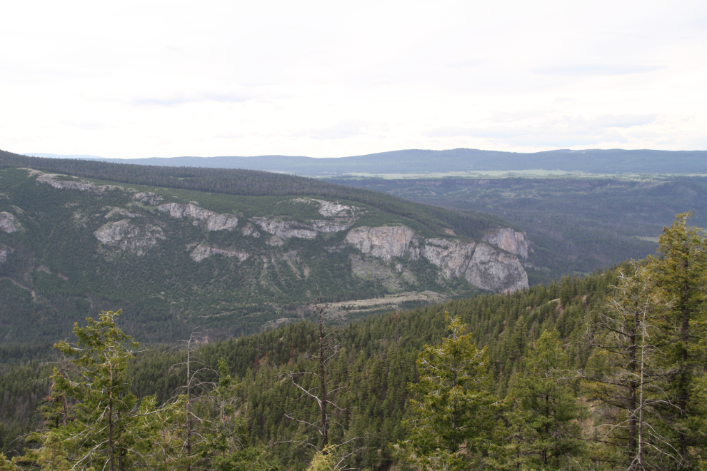
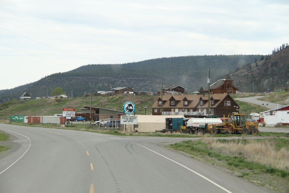
  5. Vancouver to Bella Coola

    The cheapest way to get from Vancouver to Bella Coola costs only $173, and the quickest way takes just 2 hours. ... The distance between Vancouver and Bella Coola is 457 km. The road distance is 997.9 km. ... Find all the transport options for your trip from Vancouver to Bella Coola right here. Rome2Rio displays up to date schedules, route maps ...

  6. How to Spend a Perfect Weekend in Bella Coola

    The most adventurous option is driving to Bella Coola, a 14-16-hour road trip from Vancouver that takes you through some of British Columbia's wildest scenery and includes an infamous stretch of Highway 20 known as "the Hill," a winding gravel mountain pass of nerve-shattering switchbacks, grades as steep as 18%, blind corners and a descent of more than 5,000 feet — and no, there are ...

  7. Road Trip to Bella Coola and the Chilcotins, Canada

    This was just the beginning of our trip to Bella Coola and the Chilcotins last September, starting with the ferry ride from Port Hardy. We visited 5000-year-old petroglyphs accompanied by a guide from the Indigenous peoples of the area, the Nuxalk and then experienced our guide chanting and drumming his people's stories of the Creator.

  8. Vancouver to Bella Coola via Comox drive

    Here's a sample itinerary for a drive from Vancouver to Bella Coola. If you're planning a road trip to Bella Coola, you can research locations to stop along the way. Make sure you check road conditions to double check the weather. Traveling with a dog or cat? Find pet-friendly stops. Camping along the way?

  9. Bella Coola: A Gateway to Wilderness Adventures

    The towering mountains, lush forests, and glacier-fed waters of the Bella Coola valley is where the Nuxalk people have called home for over 10,000 years. The valley saw its first European encounter in 1793 when Alexander Mackenzie, his voyageurs, and Native guides completed the first recorded land trek across Canada.

  10. Road Trip from Bella Coola to Vancouver: Part Two

    Road Trip on the Chilcotin Highway. Of all stretches of road to learn how to drive an RV on, I certainly picked a winner. The Hill is the stretch of Highway 20 that connects the Bella Coola Valley to the Chilcotin Plateau. For 40km (24.8 miles) it climbs approximately 5000 feet (1524 metres) along a steep mountain slope with grades of up to 11%.

  11. Driving the treacherously steep Bella Coola Road in British Columbia

    Bella Coola Road (Highway 20) spans 454 km (282 miles), running east-west from Williams Lake in the Central Interior of British Columbia to Bella Coola in the Bella Coola Valley. It's an amazingly scenic trip, but be prepared for gravel roads and steep grades. Also known as the Chilcotin Highway, it links the Central Coast with the Central ...

  12. Great Bear Circle Route

    Great Bear Circle Route. Part 1: Ferry to Vancouver Island. Part 2: Side Trip to the West Coast. Part 3: Ferries to Bella Coola. Part 4: Bella Coola through Tweedsmuir Provincial Park. Part 5: Lakes and Hoodoos. Part 6: Williams Lake to Clinton. Part 7: Pemberton to Whistler. Part 8: Whistler to Vancouver.

  13. The Road to Bella Coola

    This is the only road leading to the Bella Coola Valley. The highway is paved for the first 319 km to Anahim Lake, through the Chilcotin plateau along prosperous farms and forests. At Anahim Lake, the paved road changes to an all-season gravel road, and that is where the true adventure begins. Highway 20 near Bella Coola.

  14. 2 week road trip Vancouver loop via Bella Coola

    4 posts. 2 week road trip Vancouver loop via Bella Coola. 10 years ago. I am planning a trip for the last 2 weeks in August for 2 adults and 2 teenagers and would be grateful for advice on my proposed itinerary: Arrive Vancouver Friday 15 August. Plan to get ferry from Port Hardy to Bella Coola on Tuesday 19 August.

  15. Bella Coola

    A great way to make a road trip adventure, there are so many things to see and do on the way to Bella Coola. It is well worth the drive and one that I have done three times myself. There is also the option to take a ferry from the north of Vancouver Island. The ferry departs from Port Hardy (Bear Cove) and arrives to the town of Bella Coola.

  16. An Incredible Ferry Ride to Bella Coola, BC

    Bella Coola Camping. Rip Rap Campsite Views Bella Coola. Whenever people ask what the highlight of our entire ten-week trip was, our answers point straight to our time in Bella Coola along with our full-day ferry ride leading up to it. While there were many incredible places and moments of the trip, it seems this one always pops into our mind ...

  17. Bella Coola Bears

    During a summer of taking small road trips relatively close to our Vancouver home, I happened to read that the Bella Coola Valley was reopening to visitors. Like several other communities within B.C.'s Great Bear Rainforest (including Haida Gwaii), Bella Coola had closed to tourism in the spring of 2020.

  18. FAQ

    The drive from Vancouver to Bella Coola is approximately 1,010 kilometers (630 miles) long, and it typically takes around 14-16 hours to complete the journey. However, the actual travel time can vary depending on factors such as road conditions, weather, and traffic. The route from Vancouver to Bella Coola includes a scenic drive along Highway ...

  19. Distance between Vancouver, BC and Bella Coola, BC

    Halfway Point Between Vancouver, BC and Bella Coola, BC. If you want to meet halfway between Vancouver, BC and Bella Coola, BC or just make a stop in the middle of your trip, the exact coordinates of the halfway point of this route are 50.200603 and -126.468742, or 50º 12' 2.1708" N, 126º 28' 7.4712" W. This location is 221.29 miles away from Vancouver, BC and Bella Coola, BC and it would ...

  20. Surviving the Bella Coola: The 'impossible' road that's been terrifying

    The "impossible" road. At the Kopas General Store we learn that this harrowing road was built by the citizens of Bella Coola and Anahim Lake after the British Columbia government deemed the project "impossible." A group led by Cliff Kopas and the Bella Coola Board of Trade raised and borrowed funds, and procured a small grant.

  21. Bella Coola to Vancouver

    The cheapest way to get from Bella Coola to Vancouver costs only $237, and the quickest way takes just 2 hours. ... The distance between Bella Coola and Vancouver is 457 km. The road distance is 998 km. ... Find all the transport options for your trip from Bella Coola to Vancouver right here. Rome2Rio displays up to date schedules, route maps ...

  22. Bella Coola

    Bella Coola terminal is located on the central coast of BC and is a 5 minute drive west of the town of Bella Coola. With a reservation (summer) - Check in at the Bella Coola Co-op parking lot on the south side of 450 MacKenzie Street between 90 to 120 minutes prior to the scheduled sailing departure.Your booking will not be honoured and travel will be based on your order of arrival at the ...

  23. Road conditions from Vancouver to Bella Coola

    Check the road conditions from Vancouver to Bella Coola and plan a trip based on the weather along the way. Road Trip Conditions. Road conditions from Vancouver to Bella Coola. Traffic from Vancouver to Bella Coola. Chilliwack 10°C. Overcast Clouds. Feels like 48.07 Wind speed 4 mph Pressure 1013 hPa