
Planning a trip to Norway? Here you will find a list of the 8 most scenic routes in Norway. As befits one of the most beautiful countries in the world, every road in Norway is amazing in itself.

The most scenic routes in Norway
A Norway road trip passes dramatic landscapes - cliffs plunge into long, narrow bays of water, which are the famous fjords of Norway.
Norway's beautiful roads are interwoven with spectacular scenery and make the trip itself an unforgettable experience.
A special project of the country maps the 18 most beautiful roads of Norway.
How do you measure beauty? Do not measure! Therefore, I will bring you here some of those roads and several other roads that do not belong to the official project, but in my opinion, they are no less beautiful.
Before you discover the scenic routes in Norway, check out my other blogs to help you plan the perfect trip to Norway.
- How to plan a road trip in Norway?
- 2-week Norway Itinerary
- 7 Best multi-day hikes in Norway
- Best things to do in Bergen
1/ Trollstigen - the trolls road
The famous Norway road, This is Road 63, which starts north of the town of Åndalsnes and ends south of the village of Valldal, on the shores of Norddalsfjorden.
In the narrow road 11 sharp twists, passing beautiful waterfalls. Despite the promising name, the trolls, creatures from Norwegian folk legends, can only be seen when displayed in tourist souvenir shops.
Dozens of buses carry tourists on the popular road.
Short walking trails lead to two lookout points on balconies hanging over the cliff, overlooking the winding road and the impressive waterfalls.
You should also stop at the Gudbrandsjuvet Canyon, which is located between Trolls Road and another winding road, called the Eagles Road.
A system of paths and bridges pass over it and at its bottom, a river flows with impressive waterfalls. Above the waterfalls is a friendly cafe - a pleasant place for a coffee break with a cake and a huge noise of falling water. Mesmerizing and relaxing.

2/ Geirangerfjord road
Road 63 continues to the village of Geiranger, located on the shores of one of the most famous fjords in Norway, named after the village of Geirangerfjord.
It's recommended to stay in the area for a few days, and enjoy scenic roads and lookout points that should not be missed.
The area has dozens of hiking trails to lookout points, between snow-capped peaks, cascading waterfalls, winding roads, spectacular blue of the fjord, and all shades of green of the lush vegetation.
Any route you choose will take you to lookout points. It is difficult to choose the most beautiful of them all, but the truth is that you should not choose.
When we already thought it was impossible to see Geiranger Fjord from a more spectacular vantage point, we reached the Flydalsjuvet Observatory, which is about 4 km south of the village. We stood on the edge of the cliff and for a moment felt we could spread our wings Geiranger.
urther along Route 63 south, a particularly beautiful view from the summit of Dalsnibba, towards the fjord and the village of Geiranger.
You can drive independently or join a guided bus tour .
The surrounding mountains are covered with black rocks and chunks of ice, playing an imaginary chess game, while between them, a spectacular blue fjord emerges.
The fjord is a World Heritage Site and is considered a diamond in the crown of the fjords of Norway.
When you stand on the edge of the rock and look out at the landscape that unfolds opposite, you can understand the phrase "breathtaking view".

3/ Aurlandsfjellet - the snow road
The village of Flåm is located next to the Aurlandsfjord, and its port is packed with huge ships, which carry thousands of tourists to souvenir shops. Many tourists choose the Flam tourist train route.
The village is located at the entrance to one of the narrow spurs of Sognefjord. Long tunnels lead to it from both directions, which are part of the E16 road. The Lærdal Tunnel, which leads to Plam from the east, is the longest in the world, 24 kilometers long. But while traveling it loses the spectacular scenery along the way.
For this reason, we chose to come here on the old road, called Aurlandsvegen, which also belongs to the 18 most beautiful roads in Norway.
Although it is longer, about 48 km, it is one of the most beautiful scenic roads in Norway.
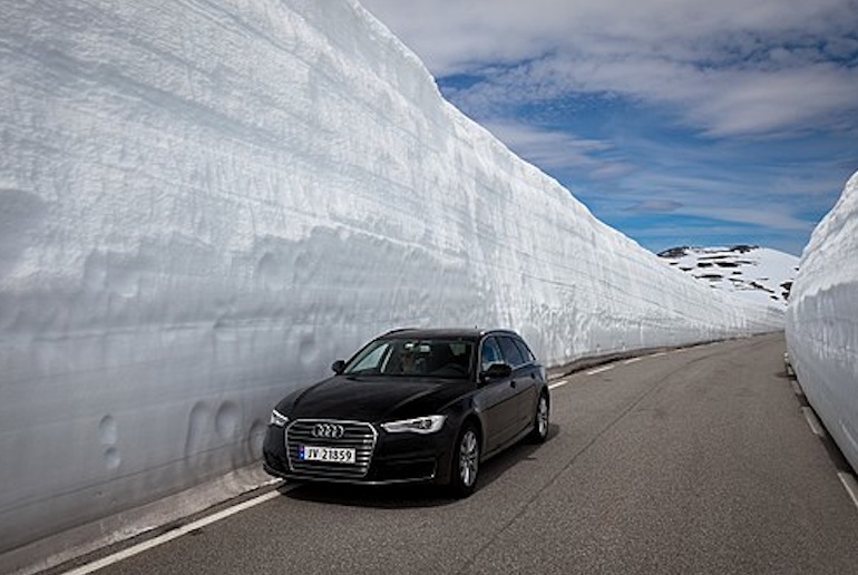
The locals call it the Snow road. , White glaciers, blue lakes, and views of the spectacular landscape.
Towards the end of the road, it is recommended to stop at an observation point, which seems to hang over the fjord and the towns on its shores, and the view is impressive and beautiful.
*The road is open for vehicles from the beginning of June until mid-October, depending on the amount of snow and ice that has accumulated on the road, and make sure you can drive on it, before setting off

4/ The Lysevegen road
The Lysevegen road is one of the most famous tourist routes in Norway and the world.
It’s a curvy mountainous road located in Norway. It’s going from Lysebotn innermost in the Lysefjord to Sirdal and has a length of 29 km (18 miles).
The aerial view of this way is quite impressive.
It features zig-zag hairpins in the high mountains of Rogaland and Vest-Agder. Also, it’s one of the most hair pinned roads in the world, a title that always attracts passionate drivers.
*The road is open during the period May to October/November (depending on snow conditions). The Lysevegen is part of the well-known Suleskarroad from Telemark via Setesdal and Sirdal to Stavanger.

5/ Hardanger National Tourist Route
Located in Fjord Norway, the Hardanger National Tourist Route is one of the most scenic drives in the country.
It follows the scenic Hardangerfjord, the second-longest and the second deepest fjord of Norway.
The road is asphalted with some narrow sections, taking you through some impressive scenic fjord landscapes, mountains, waterfalls and glaciers.
The road is 158-kilometre-long, east of Bergen, in the county of Hordaland in Fjord Norway.
Hardangerfjord is 180 km long and about 850 meters deep. The drive is open for traffic throughout the year.
The section across the Hardangervidda mountain plateau may be closed for short periods during the winter if the weather is bad.
6/ senja route
Senja, Norway’s second-largest island, is filled with gorgeous viewpoints, spectacular hikes, and charming villages. senja road is 102 kilometers long and travels between Gryllefjord and Botnhamn, with detours to the small settlements of Mefjordvær and Husøy.
Norwegian scenic route senja is easily one of Norway’s best road trips for adventurers and can be combined with the Andoya and Lofoten scenic routes to the south.
Some of Senja most enticing adventures are easily accessible along the route.
Take a relaxing walk along Ersfjord Beach, trek up mighty Husfjellet, or summit challenging Segla, the island’s most popular peak.

7/ The Atlantic Road
The Atlantic Road (Atlanterhavsveien), which is about 8 km long, and begins about 30 km southwest of Kristiansund.
It is a system of bridges that connects several islands and wild beaches. When the sea is stormy, the views are especially spectacular.
I must admit that this is indeed a beautiful and impressive road, but on other roads in Norway, there are equally beautiful vantage points.
The area offers a variety of activities, in addition to riding on the beautiful road and stopping for observations, such as picnic areas along the way, jogging, rowing, fishing, and fishing boat rentals.
The moderate slope of the road is ideal for cycling. Once a year, international competition is held here for cyclists from all over Norway, but unlike other competitions, this competition is open to everyone, amateurs and professionals alike, including families.
Once a year, a running competition is held on the Atlantic Road, which attracts local runners and runners from European countries. Amateur runners can also take part in the experience.
The water here is particularly clear and the area is known as one of the best sites for underwater photography.
On hot days you can stretch out on one of the slippery rocks and breathe the clear air of the Atlantic Ocean.
When a huge wave hits the road it is a sight that you will not forget for a long time.

8/ lofoten scenic route
The Lofoten Islands are pristine islands located north of the Arctic Circle and sloping with steep mountains, deep fjords, and small fishing villages.
Recommended for birding and watching natural phenomena such as the Northern Lights and midnight sun.
Along with the entire Lofoten Islands, there is one main road e10 that crosses all the Lofoten Islands, this whole road is one scenic road impressive in its beauty that to and it is recommended to dedicate several days to enjoy the road and stop at all its special places.
If you have already reached this part of the world you will not want to return so fast.
Driving this way guarantees such an impressive and unique scenic experience that you will not forget your whole life.
The Lofoten National tourist route or E10 in short is the only major road that runs north to south on Lofoten islands and ends at the town of A. But there are a lot of off roads that branch off E10 and we had our fair share of driving on most of them.

Final thoughts
Do not be afraid to deviate from the norway famous road....
The scenic routes in Norway are so spectacular and impressive that sometimes you just have to make a mistake.
It happened to us that we accidentally came to places that are a godsend, that do not appear in the tourist guides (and it is doubtful if they appear on the map, and precisely these are the places that we remember particularly well.
If you made a mistake on the way, do not stress.
You may discover a private coveted corner that no human foot has trodden in front of you.
Finally, you always manage to find a first way to integrate into it and return to the lap of familiar roads.
Thanks for reading my blog about the most scenic routes in norway!
My travel resources.
Here are some websites I use whenever preparing for my next journey anywhere around the world.
- Book affordable flights on Expedia , a great website that show the best routes and flight deals to your destination.
- Find a budget-friendly deal on all sorts of accommodation types on Booking.com .
- Buy the most flexible and budget-friendly travel insurance at SafteyWing .
- Check the best tours in Norway to maximize your trip.
Read My Other Blogs:
5 day barcelona itinerary: the perfect guide
2 weeks norway road trip itinerary
How to plan the ultimate norway road trip
15 most amazing places in Norway
3 Day Madrid Itinerary
how to spend weekend in Amsterdam
2 weeks in sicily: the perfect sicily road trip
how to spend 3 days in prague
scotland road trip Itinerary for 14 days
2 days in bergen norway
Annapurna Circuit Solo: The Detailed Itinerary
The complete guide to solo travel in nepal
3 Days In Kathmandu: The Ultimate Kathmandu Itinerary
12 best reasons to visit nepal
Disclaimer: some links on my site are affiliate links. If you choose to purchase through these links, I may receive a small commission at no extra cost to you. By using these you are directly supporting Guy On The Road to remain an independent travel blog. Thank you!
Follow me on Instagram

Most Scenic Routes in Norway
If there is one country that has some of the best scenic routes, Norway is it! Norway is an incredibly beautiful country that needs no introduction.
Between its fjord-filled coastline, stunning mountain ranges, and endless forests, it is a hard place to beat and we think the best way of seeing is by following Norway’s scenic routes.
Join me as I take you through Norway’s top twelve scenic routes that span pretty much every part of the country from the south to the north. Choose your favorite route, rent a bike or a car and enjoy the amazing views along the way.
Atlanterhavsvegen (The Atlantic Road)
Atlanterhavsvegen, also known as the Atlantic Road or The Atlantic Ocean Road is a Norwegian scenic route of note, especially if you want endless views across the sea as you go.
The Atlantic Road begins in north-western Norway in Møre og Romsdal county, starting in Kristiansund it winds its way between islands and skerries, with many bridges, and takes you to Vevang and down to Bud.
The Atlantershavsvegan is recognized as one of the most scenic routes in Norway and you won’t find a scenic route that puts you closer to the ocean. On stormy days, the waves and wind blow the sea onto the road while on calm days, the views across the ocean and into the archipelago are mind-blowing!
You can travel down this scenic route by car or bicycle, and there is even a pedestrian-only footway along the side of it if you would prefer to walk. Along the way, you can stop to do some kayaking, diving, and join the locals fishing on the footway.
Aurlandsfjellet (The Snow Road)
The Norwegian scenic route Aurlandsfjellet also referred to as the snow road, sits in Sogn og Fjordane county in southwest Norway.
The reason this scenic route is known as the snow road is that the road is surrounded by steep mountains on each side that have snow on them most of the year.
What makes this one of the more special scenic routes is the diversity of the landscapes you’ll see on the way. It features everything from fjords to glaciers, blue lakes, mountains, and never-ending pine forests.
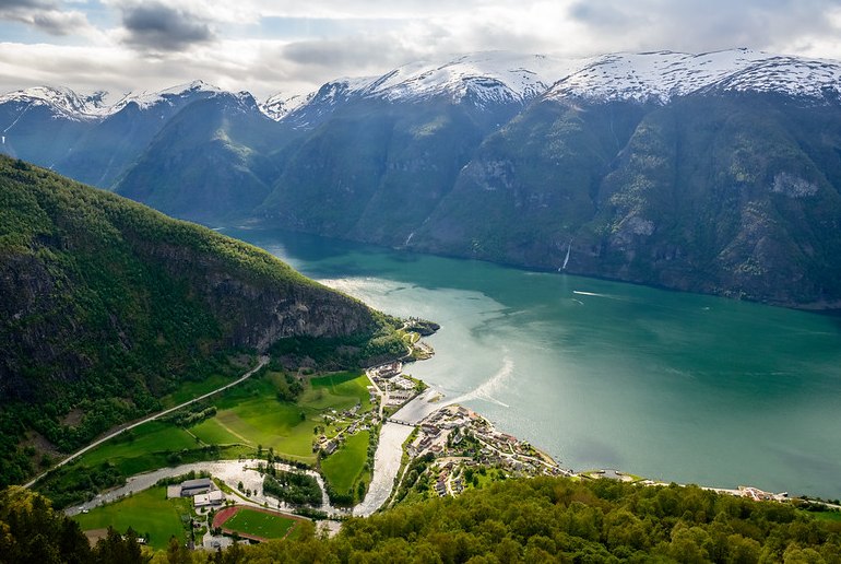
One of the highlights along the way is the Stegastein viewpoint, a modern platform that sits 650 meters above Aurlandsfjord and offers one of the most magical views in the area.
You will also go via the village of Flam which sits at the bottom of the fjord and is home to hundreds of ships that bring tourists on cruises into the area.
The scenic roads, high mountains, and views make this one of the best national scenic routes in the country.
Lofoten National Tourist Route
The Lofoten National Tourist Route takes you through one of the most beautiful parts of Norway, the Lofoten Islands.
The Lofoten Islands sit in northern Norway inside the Arctic Circle and they are incredibly magical. Imagine tall mountains falling into turquoise blue water and fjords with one fishing village after the next to explore along with sandy beaches .
This is an amazing part of Norway to see the Northern Lights, kayak, go fishing, surf, see the midnight sun, walk the sandy beaches, and lots more.
This Norwegian scenic route takes you from the bottom of the Lofoten islands up to the top. Follow the E10 road across all the islands and enjoy the incredible scenery as you go from one island to the next.
To really enjoy this route, take a few days to complete it as you are in one of the most beautiful parts of the world, and you will not want to be leaving in a hurry.
The Norwegian scenic route Hardanger, also known as the Hardanger National Tourist Route is located in the area of Norway simply known as Fjord.
The route follows the second deepest and second longest fjord in Norway called Hardangerfjord. The scenic Hardangerfjord is full of impressive landscapes that feature everything from glaciers to waterfalls and stunning mountains too. You can drive most of this route all year round and it is a long main road that goes on for 158 kilometers. You think this is a bit long for a scenic route but Hardangerfjord is actually 180 km long so you aren’t actually going to drive the whole thing.
One of the most spectacular parts of this route is when you cross the Hardangervidda mountain plateau as it provides you with some incredible views. This part of the road can be closed in the winter due to bad weather, so keep an eye on the forecast in the colder months.
Sognefjellet
The Norwegian scenic route Sognefjellet can only be driven in summer as the road is closed in winter due to snowfall.
Sognefjellet is the highest mountain pass in northern Europe as it connects the west coast of Norway with the eastern inland areas by cutting through the Jotunheimen mountains which sit 1,434 meters above sea level.
It is a very important road in regards to Norway’s historical development as it allowed for the transport of fish and salt from the west to east, and goods like butter from east to west.
The route is 108 kilometers long and starts in Lom and ends in Gaupne as you go you will see some of the highest peaks in the country, be able to see a natural stone amphitheater at Mefjellet, and magical views across the mountains as you go.
Depending on the time of year, you will either be driving through snow-covered mountains between banks of snow (Spring & Fall) or with open greenery in summer.
The Norwegian scenic route Ryfylke is one of the longer national tourist routes at 260 km long. It starts next to Lysefjord in the village of Oanes and runs all the way to Hårå in Røldal.
What makes this route so special is the mix of history, culture, and nature that can be found along the way. There are stunning villages, towns, old buildings, and things like abandoned zinc mines that date back to the 1800s which you will find in Allmannajuvet
Other highlights along the way include stunning waterfalls in Ryfylke, smelting plants in Sauda, and more.
Svandalsfossen waterfall is a must-stop along the way where you will find paths that allow you to see it from many angles. The mountains along the way are hard to beat too.
Being a long road, you are going to want to break this down into a few days and stay at some of the picturesque villages along the way.
Image courtesy of Geir A Granviken
The Norwegian scenic route Jæren sits in the south of Norway along the north sea coast and runs through the main agricultural part of the country.
This route begins in Ogna and runs to bore. Along the way, you will see beautiful coastal landscapes with sandy beaches, pebble beaches, sand dunes, and more. Stop along the way for long beach strolls, picnics, and views across the ocean.
The route is just 41 km long with the coast on one side and ancient dry stone walls on the other. If you like to surf, head to Orrestranda beach where you can also hire gear and get surfing lessons too.
You should also stop at Kvassheim lighthouse along the way. It is open to tourists and dates back to the early 1900s when it was used to help ships navigate through the tricky waters in the area.
Helgelandskysten
The longest of Norway’s scenic routes is Helgelandskysten which is a total of 433 km that also requires six ferries to complete. You may think that you have to drive this one but the route runs along very flat roads so it is a great one to bike on too.
What makes this one of the top Norwegian scenic routes is that it crosses the Arctic Circle, takes you past tall mountain peaks, deep fjords, the biggest tidal maelstrom in the world, the second biggest glacier in Norway, and into a UNESCO World Heritage Site archipelago.
The route starts in Holm, a small village, and follows Route 17 north to Bodo and into the Arctic. The ferry rides give you incredible views of thousands of islands under tall mountains, the sand beach and stone-vault bridge at Storvika Bay are magical, and the Svartisen glacier is hard to beat.
This is not a route that you want to rush and you’ll want to take your time to complete it so you can take it all in as you go.
Geiranger-Trollstigen
The Geiranger-Trollstigen tourist route takes you around the Geirangerfjord, one of the most famous fjords in Norway. It is so stunning that it is also a UNESCO World Heritage Site and while the scenery is mind-blowing, that is not all it has to offer.
The road of Trollstigen that drops down into the port town of Geiranger is home to eleven hairpin bends, an iconic Norwegian sight. It continues along the fjord and it is worth stopping at Ørnesvingen and Flydalsjuvet, two amazing viewpoints with the best views of Geirangerfjord.
Other notable places that you must stop off at include Gudbrandsjuvet gorge which is packed full of drama and the Juvet Landscape Hotel.
Between the drama of the surrounding mountains, the amazing views, incredible landscapes, fjord views, and the lovely quaint town of Geiranger , this is one of the top scenic routes in Norway that simply can not be missed.
Image courtesy of Richard Droker
The Norwegian scenic route Senja runs across the island of Senja in northern Norway. It is the second biggest island in Norway and the route covers a total of 102 km when the 12 km detour is included.
It starts at Gryllefjord, takes you to Botnhamn, and if you want to include the detour, follow the road via Mefjordvær and Husøya,
You should spend a few days doing this route so you can enjoy everything the island of Senja has to offer. The island is covered in mountains that plummet into the sea, home to awesome hiking trails, magical views, and lots of quaint seaside villages.
Enjoy walking on sandy beaches, kayaking, fishing, going on boat tours, and lots more. This is also an excellent route to start a trip with as you can head down to the Lofoten islands and Andoya easily afterward.
Gaularfjellet
Gaularfjellet is another awesome scenic route and is one most tourists don’t know much about which makes it a little more peaceful to explore.
The route is 84 km long and begins at the charming town of Balestrand and follows Sognefjord, the longest Fjord in the world and the deepest fjord in Norway, and then goes up into the mountains and ends in Moskog.
This route is home to magical views and you have to stop at the dangling Utsikten viewpoint. You will also follow a river that changes into waterfalls, rapids, and lakes. Skirting along the fjords is pretty incredible and the river offers some of the best trout fishing opportunities in Norway.
Be aware that this road is open during the summer, and most of it will be in winter too except for the section between Mjell and Mel which opens in April.
Andøya is an island in the north of Norway and one of the most western points of the country. Rumor has it that Andøya is home to the most beautiful beaches in Norway and following the Andøya tourist route will have you seeing the best of them.
Sitting at the end tip of the Vesterålen archipelago, Andøya is often compared to the Lofoten island but is much less busy and touristic. The route follows the west coast of the island offering views into the Atlantic, opportunities for swimming and kayaking, long beach walks, and lots more.
It is also a great place to see Norwegian nature at its best as you will have the chance to see whales, puffins, seals, and sea eagles.
About the Author Roger Timbrook
Roger is a little obsessed with travel. He has been to over 40 countries, broken 3 suitcases and owned over 10 backpacks in 12 months. What he doesn't know about travel, ain't worth knowing!
Leave a Comment:
Save my name, email, and website in this browser for the next time I comment.
- Overview Guide
- 1 Week Itinerary
- Train Journeys
- Epic Drives
- Stunning Lakes
- Historic Castles
- Lauterbrunnen
- Grindelwald
- Chocolate Tours
- Swiss National Park
- Majestic Mountains
- Spectacular Waterfalls
- Famous Things
- Tasty Fondue
- 10 Day Itinerary
- Cherry Blossoms
- Tokyo Shrines
- Dos and Don’ts
- Osaka Guide
- Osaka Itinerary
- Osaka or Kyoto
- Kyoto Day Trips
- Matsumoto Castle
- Tokyo Luxury Hotels
- Island Hopping
- Best Campsites
- Driving Tips
- Beaune, France
- Barcelona Itinerary
- Spain Itinerary
- Greece Itinerary
- Italy Road Trips
- Berlin Day Trips
- Norway Northern Lights
- Netherlands National Parks
- Mostar, Bosnia
- Best Airlines
- Midwest Ski Resorts
- Florida RV Parks
- Washington RV Parks
- Oregon RV Parks
- Utah Camping
- Texas Camping
- Chicago National Parks
- East Coast National Parks
- Colorado National Parks
- Joshua Tree
- Yellowstone
- Alberta Hikes
- Flashlights
- Water Filters
- Sleeping Pads
- Solar Lanterns
- Tent Brands
- 4-Person Tents
- 4 Seasons Tents
- Backpacking Tents
- Beach Tents
- Cabin Tents
- Multi-room Tents
- Pop-up Tents
- Truck Bed Tents
- Underwear (Men)
- Backpacks Under $100
- Microspikes
- Boonie Hats
- In The World
- New Zealand
- Hardisde Luggage
- Lightweight Luggage
- Luggage Sets
- Spinner Luggage
- Durable Suitcases
- Duffel Bags
- Kids Luggage
- Teen Luggage
- Space Saving Luggage
- Business Carry-Ons
- Garment Carry-Ons
- Suitcases Under $50
- Travel Briefcase
- Zipperless Suitcases
- Rolling Briefcase
- Luggage Straps
- Luxury Brands
- American Tourister
- AmazonBasics
- Delsey Chatelet
- Anti-Theft Backpacks
- Backpacks Under $50
- Baby Carrier Backpacks
- Cooler Backpacks
- Backpacking Backpacks
- Climbing Backpacks
- Backpacks for Back Pain
- Beach Backpacks
- Hiking Backpacks
- Business Travel Backpacks
- Laptop Backpacks
- Backpacks for Tablets
- Commuter Backpacks
- Travel Backpacks (Men)
- Travel Backpacks (Women)
- Waterproof Backpacks
- Wheeled Backpacks
- Down Jackets
- Down Parkas
- Fleece Jackets
- Hardshell Jackets
- Rain Jackets
- Softshell Jackets
- Eco Friendly Jackets
- Gore Tex Alternatives
- Heated Jackets
- Lightweight Jackets
- 3-in-1 Waterproof Jackets
- Parajumper Jackets
- Rain Poncho
- Ski Jackets
- Travel Hoodies
- Travel Jackets
- Winter Coats
- Helly Hansen
- Mammut Jackets
- Patagonia Nanopuff
- Survival Jackets
- Flower Captions
- Waterfall Captions
- Tree Captions
- Sunset Captions
- Sunflower Captions
- Rainbow Captions
- Paddle Boarding Captions
- Hot Air Balloon Captions
- Kayaking Captions
- Airplane Captions For Instagram
- Forest Captions

Norway’s scenic routes
Norway’s 18 designated scenic routes ( Nasjonale touristveger ) take you off the main roads and through some of the country’s most awesome scenery. The idea behind these incredible drives is to make it easy to see the country’s best bits and give a boost to the rural economy at the same time.
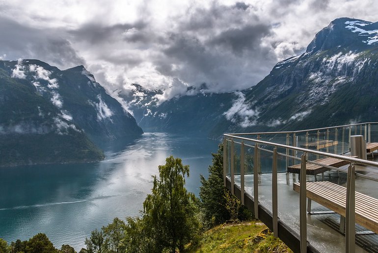
Many of the scenic routes include the bonus of cutting-edge architecture in the form of rest stops and viewpoints along the way.
From a loo-with-a-view to a platform hanging off the mountainside where you can snap pictures of waterfalls, fjords and distant glaciers, they give a focus to your drive and encourage you to get out of the car and explore.
Where do Norway’s scenic routes go?
The 18 scenic routes (also known as golden routes) are spread across Norway, from the Fjord region to the Arctic Circle. They take you through an unbelievable variety of terrain.
Some such as the Aurlandsfjellet – aka the Snow Road – include a stretch across an icy landscape with the sun bouncing off the drifts on either side of the narrow carriageway.
Others like the 433km-long Helgelandskysten involve ferry crossings across sparkling inlets, and are even flat enough to be cycled in stages.
A full list of Norway’s scenic routes
- Helgelandskysten
- Atlanterhavsvegen
- Geiranger-Trollstigen
Gamle Strynefjellsvegen
- Sognefjellet
- Valdresflye
- Gaularfjellet
Aurlandsfjellet
Hardangervidda, can you drive them all year round.
Some scenic routes include steep mountain passes or stretches of road at high altitude, and these sections are shut in winter – so check the list of typical seasonal closures before planning a road trip.
And whatever time of the year you go, make sure you give yourself plenty more time than you think you’ll need so that you can stop off and take it all in.
Can you travel Norway’s scenic routes by public transport?
Some of the routes can be done by public bus (we’ve given details for those routes where this is feasible), but for the majority of the roads you’ll need a car.
And travelling by bus sort of misses the point. The real joy of these routes is taking your time, getting away from the crowds and stopping whenever you fancy for a walk or just to wonder at the surrounding scenery.
How to hire a car
So, you’ll probably be needing a car… Over 21 years old, and have held your driver’s licence for 12 months? A yes to both, and you’ll have no problem hiring one.
But, as car hire in Norway is expensive compared with other European countries, keeping costs down is a priority. Shop around and pre-book, making sure you pick a deal you can cancel without penalty with 24–48 hours notice so you can take advantage of better last-minute prices as they come online.
International hire companies such as Sixt, Avis, Rentalcars.com, Hertz and Thrifty all have good coverage across Norway. See our guide to Renting a car in Norway for the low-down.
10 of the best scenic routes in Norway
All Norway’s scenic routes have something special to offer, but if you only have a short holiday and want the highlights, here’s our pick of Norway’s ten most scenic roads.
Leave the fjordside cabins of Laerdal and the lush Erdalen valley behind and drive up to rolling moorland at Vedahaugane, where you’ll find a rest stop and art installation inside the mountain.
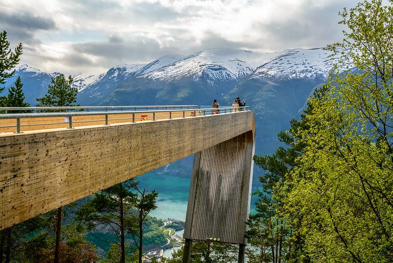
After crossing the snowy highlands with views across to peaks and glaciers in the distance, you’ll reach the Stegastein viewpoint, a walkway jutting out 650m above the emerald water of the Aurlandsfjord.
The route ends at the village of Aurlandsvangen, an action-packed 47km from the start.
What to do: American artist Mark Dion has created an underground art installation at the Vedahaugane rest stop – a bear’s winter lair-with-a-twist called Den.
Where to stay: Sanden Pensjonat is a cosy B&B in Laerdal in a traditional timber house dating from 1897.
Geiranger–Trollstigen
It’s hairpin bends all the way on the first stretch of this 104km drive: the road snaking up the mountainside is called Trollstigen, or Troll’s Ladder, and the viewpoint suspended in mid-air from the mountainside gives a bird’s-eye view of an otherworldly terrain of silver threads of waterfalls plunging from mighty massifs.
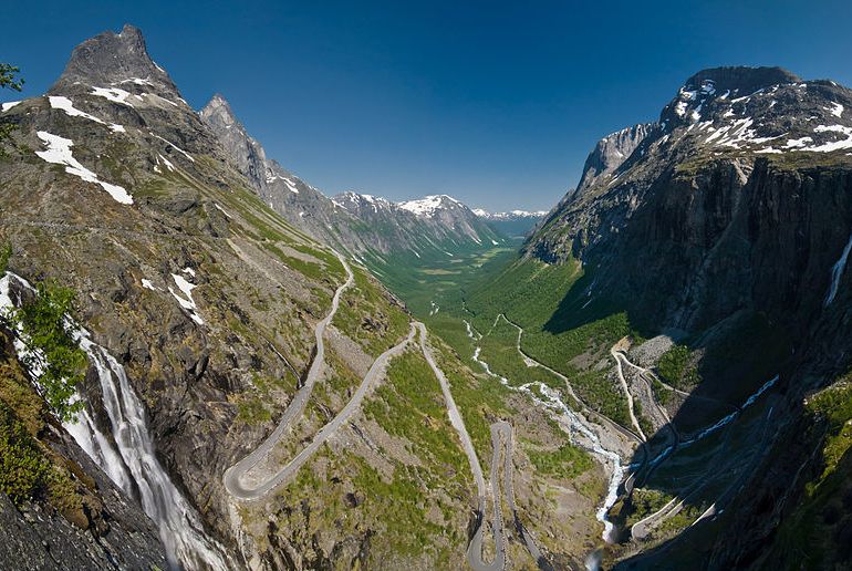
This route runs between Sogge Bru, just outside Åndalsnes, and Langvatnet. Along the way you get to enjoy a brief ferry crossing and a leisurely stop at Geirangerfjord, the country’s most famous fjord.
It is possible to do the Åndalsnes to Geiranger part of the route by bus – the journey takes three hours: see the Fram website for details.
What to do: Hike from Geiranger, and stop at ‘gramworthy viewpoints at Ørnesvingen and the Flydalsjuvet gorge.
Where to stay: The Juvet Landscape Hotel , in a forested river canyon, is Scandinavia’s most zen-like place to stay.
This drive takes you across Europe’s largest mountain plateau, from the fjordside village of Eidfjord to Haugastøl, 67km away.
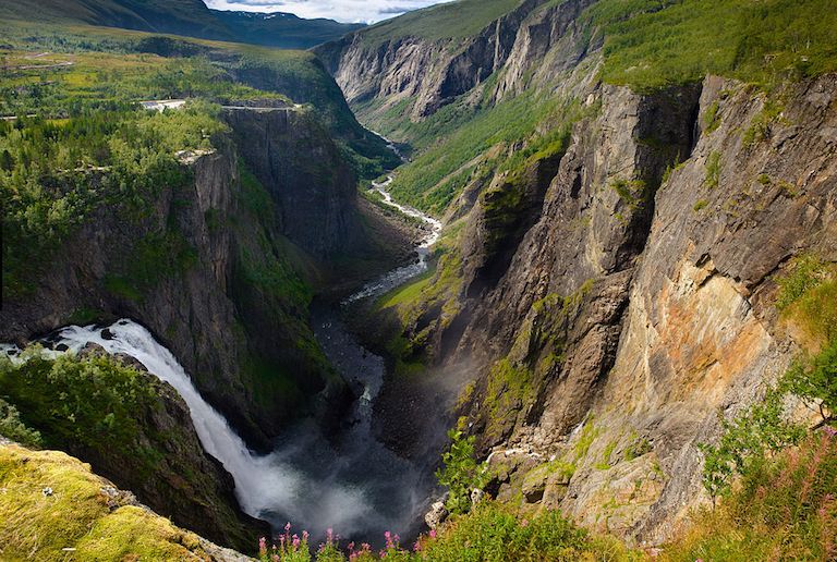
The route sets off through the Måbødalen valley, where a narrow, steep, scenic road built in 1916 climbs to a rocky wilderness that’s home to herds of reindeer.
In winter, don’t be surprised if there’s a snowplough ahead of you, clearing your way. One public bus daily runs this route, taking 1hr 36min: for details visit the Skyss website.
What to do: Park at Fossatromma and follow the old road down to a 19th-century footpath leading to the thundering Vøringsfossen waterfall which cascades 182m off the mountainside.
Where to stay: Vik Pensjonat & Hytte is a modern B&B with cabins in the centre of Eidfjord, with a zero-food-mile café.
The scenery is stunning along this 19th-century road that skirts the Jotsdalsbreen and Breheimen national parks. Marvel at brooding snow-capped peaks and tiny dots of farms in the valley far below on this 27km drive from Grotli to Videsaeter.
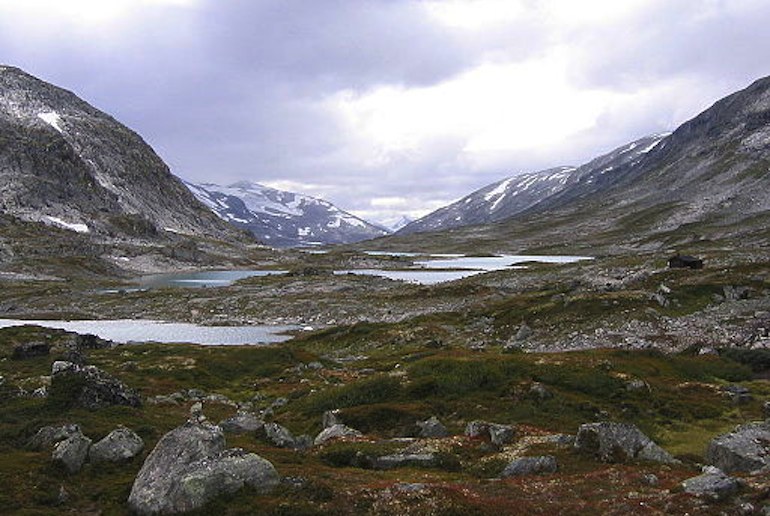
One bus daily covers this route, taking 20–30 minutes: for details visit the Nettbuss website .
What to do: Snap away at the Øvstefoss and Videfossen waterfalls, tourist hot-spots since the late 19th century, then drive down to Hjelle in an idyllic setting on Strynsvatnet lake.
Where to stay: Fossheim hotel in Lom is a special place, run by the same family for several generations. Rooms are spread between the main lodge and several cabins (one of them dating back to the 16th century) with ornately painted furniture and open fireplaces.
Atlantershavsvegen
The Atlantic Road is world famous, its swooping bridges and curvaceous carriageways making a fluid 36km route across islets and skerries from Kårvåg (nearest town Kristiansund) to Bud.
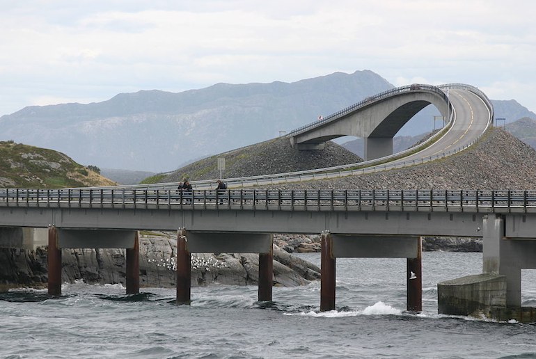
On calm days the water is limpid and there’s a “Blue Remembered Hills” feel to the views across the archipelago. But when waves whipped up by a storm are lashing the road, the drama is like none other – in the 1980s the construction workers endured 12 hurricanes during the six-year build.
What to do: Go scuba diving, kayaking and birdwatching. Or try fishing from the pedestrian-only footways alongside the Myrbaerholm road bridge.
Where to stay: Try Håholmen , a cluster of sea cottages has been turned into a chic hotel.
Take the E10 from Å to Raftsundet through the Lofoten archipelago and soak up the scenery of mountains, fishing villages and beaches: with detours, you’ll clock up 230km on this route, which gets very busy in summer.
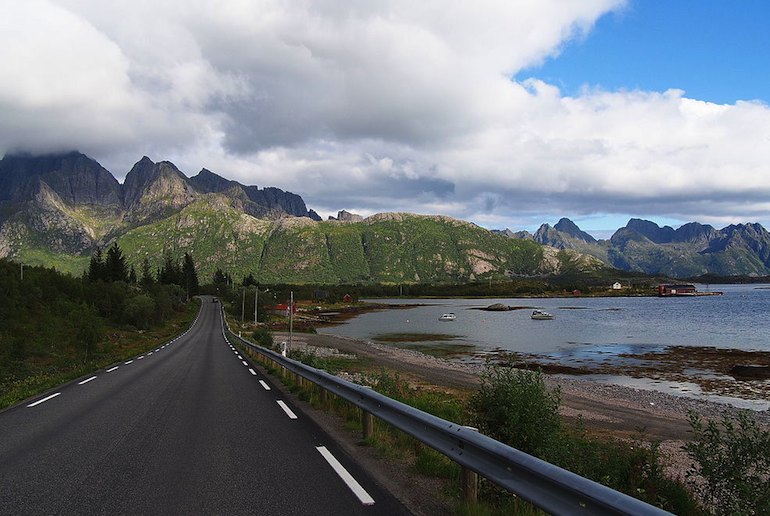
Buses do this 4hr 23min journey twice daily; the Nordland fylkeskommune website has details.
What to do: Experience the midnight sun; feast on freshly caught fish cooked over a wood-burning stove; take a boat trip around the islands or go fishing, kayaking or hiking.
Where to stay: The Lofoten islands are famous for their rorbuer (wooden fisherman’s shacks) accommodation; the Nusfjord Arctic Resort has rorbuer that have been refurbished in modern-rustic style complete with a wood-fired hot tub.
This laid-back 58km drive from Bjørnskinn to Andenes along the wild Vesterålen coast combines well with one of Norway’s other highlights – a trip on the Hurtigruten coastal express , which calls at Risøyhamn near the start of the drive.
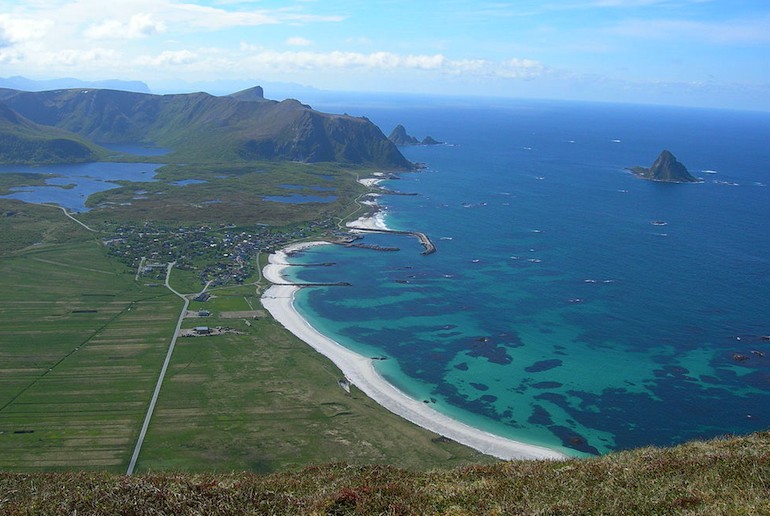
Make time for a stop at Bleik beach, which looks as though it belongs in the Caribbean until you jump in the sea and the wake-you-up temperature sets you straight.
The tiny fishing village backing onto the strand and the 40,000 puffins on Bleiksøya island are equally photogenic – check out the latter on a bird safari.
Five buses a day travel the route, and the journey takes 1hr 5min; visit the Nordland fylkeskommune website for details.
What to do: Looking for a place to watch the midnight sun hanging low over the sea? Chill out on the giant lozenge-shaped slabs at Kleivodden or head for Bukkekjerka, a rocky promontory and an old Sámi sacrificial site – the name means “crevice in the rock” in Sámi.
Where to stay: Kristina Apartment & Alma House near Andenes harbour is a cluster of 19th-century buildings that includes a bright-and-breezy guesthouse, self-catering apartments, an art and crafts shop and a museum of fishing and farming life.
This 160km ocean route starts in Varangerbotn near the north-eastern border with Russia, passing birch woods, wetlands and mountains.
An incredible spot for Arctic species, it’s a magnet for birders and anyone who loves wild places: the northern light and the lunar landscape towards the drive’s end at Hamningberg have a steely “land’s end” quality.
This is a drive for summer or autumn – the road is usually open from May until early November.
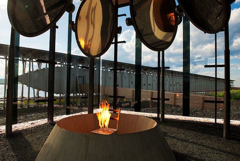
What to do: World-renowned artist Louise Bourgeois and architect Peter Zumthor joined forces to create the 100m-long Steilneset memorial complete with burning chair to commemorate the 91 people who were burnt at the stake for witchcraft in the 17th century.
Birders have the design treat of a half-dozen shelters to protect them from the elements, including a beautiful asymmetric timber hide at Vadsø.
Where to stay: There’s self-catering accommodation at Emelie House and apartments in the fishing community of Ekkerøy near Vadsø, with 1950s Scandi-style interiors and a birch-log sauna.
The Helgeland coast (Helgelandskysten)
This 433km road trip runs north along Route 17 from the village of Holm to the Godøystraumen whirlpool near Bodø, crossing into the Arctic Circle at 66 degrees north. This is not a route to be rushed – allow yourself at least three days to make the most of it.
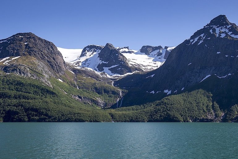
If you’re the designated driver, you’ll love the time out that the six ferry crossings provide, with a chance to focus on the scenery – on a clear day the view of hundreds of islands beneath jagged peaks and the Svartisen glacier is just stunning.
The closest you can get to travelling the entire route via public transport is on the Hurtigruten ferry .
What to do: This route’s architecture is among the best and includes the famous wave-shaped concrete Ureddplassen rest room.
Other highlights include strolling along the wet-sand beach at Storvika and kicking back and admiring at the view of Engabreen, Europe’s lowest-lying glacier, from the Braset viewpoint.
Where to stay: Norsk Havbrukssenter, Brønnøysund has modern red-painted cabins with loft bedrooms lined up along a waterside jetty.
This route is all about being buffeted by onshore winds from the North Sea as you wend your way for 41km from Ogna to Bore near Stavanger.
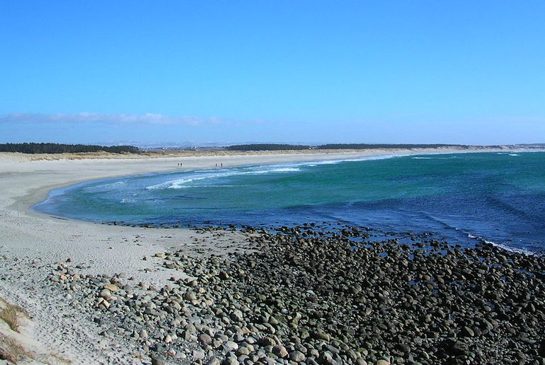
The flat landscape of farmland bordered by drystone walls made with rocks the size of small boulders, the superb sand or pebble beaches, and the changing light on the silvery sea as clouds skud across the sky make this drive special.
What to do: Beach combing and botanising on Orrestranda beach or surfing at Borestranda.
The Kvassheim lighthouse is open to visitors; built in 1912 it was fitted with a foghorn to help guide ships along the Jaeren coast, though unfortunately, it was not always successfully – the area is famous for historical shipwrecks.
Where to stay: Boretunet Hostel and tiny houses at Borestranda was built in 2018 from an upcycled oil-and-gas industry floatel and is a favourite with both surfers and Norwegian royals.
Planning an adventure? You need insurance
The Scandinavian countries are some of the safest places in the world to explore, and all have excellent health care systems. But even so, unexpected things can happen when you’re travelling that could land you with a large bill.
So taking out travel insurance is definitely a good idea. It’s always worth getting several quotes and shopping around for a policy that suits your trip best.
If you’re planning to do any winter or extreme sports, such as skiing, white-river rafting or abseiling, make sure that the policy you pick covers you for these or that you can add them on as extras.
World Nomads provides travel insurance for travelers in over 100 countries. As an affiliate, we receive a fee when you get a quote from World Nomads using this link. We do not represent World Nomads. This is information only and not a recommendation to buy travel insurance.
The Hurtigruten in Norway: all you need to know
Five of the best Scandinavian road trips
The 15 best places to visit in Norway
Polar bear spotting in Svalbard, Norway: the ultimate guide
You may also like.
The 16 best fjords in Norway
What to see, do and eat in Tromsø

Dog sledding in Norway

The spectacular train ride from Bergen to Flåm
Norway in a Nutshell: the DIY option
The best beaches in Norway
A guide to Norway’s best waterfalls
Oslo to Bergen: Europe’s Most Breathtaking Train Journey?
Get the Routes North newsletter delivered once a month. No spam.
Norwegian Scenic Route Geiranger-Trollstigen
Experience Norway's leading tourist road icon! The dramatic Trollstigen winds its way up the steep mountain side through 11 hairpin bends, and can take anyone's breath away.
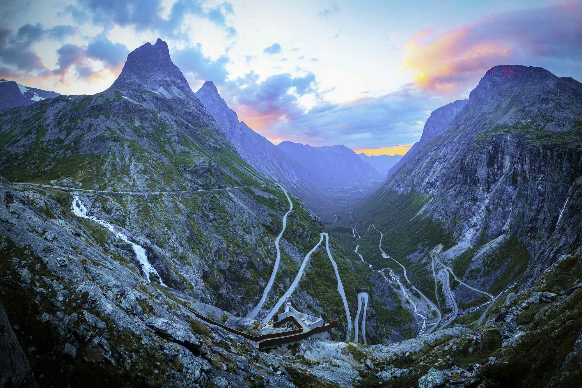
The road is a result of hard work and an impressive piece of engineering work dated 100 years back in time. His Majesty King Haakon VII opened the road in the summer of 1936.
At top of Trollstigen there are viewpoints and steel walkways which allow you to get close to the dramatic mountains and waterfalls. The service building houses a café with panoramic windows, souvenirshop and toilets. The Trollstigen Plateau and the two spectacular viewpoints that provide full overview of the countryside, is designed by Reiulf Ramstad Architects. Everything is built in steel and glass and provides good protection against rough weather. The structure is designed so that it blends in with the surroundings, some parts are carved into the rock, while other parts are built on stone walls. There are different ways to access Trollstigen. Trollstigen opens normally in May, and it closes in late Autumn, depending on the weather and driving conditions. You can use your own vehicle. Vehicles with a maximum length of 13,1 metres are allowed to drive in Trollstigen. If you don't have your own car it is possible to rent a car in Åndalsnes town. You can also rent e-bike or take bus
- Trollstigen
- 6300 Åndalsnes
Where is Norwegian Scenic Route Geiranger-Trollstigen ?
- Contributors
- Accommodation
- Architecture
- Attractions
- Fine arts/music

- Uncategorized
The Beautiful Tourist Roads in Norway

The Project ‘Norwegian Tourist Roads’ was started 21 years ago. Trollstigen (The Troll Ladder) is one of Norway’s most important sights and the biggest of the 18 projects.
Each of the 18 National Tourist Routes has its particular characteristics and passes through landscapes with unique natural features along the coast and fjords, by mountains and waterfalls, from Jæren in the south to Varanger in the north. On these stretches you will find viewing points, rest areas, architecture and artworks that enhance the experience of the beautiful landscape through which you are driving.

National Tourist Route Varanger runs from Varangerbotn to Hamningberg, a total distance of 160 km (Road 75/341). Experience one of Norway’s most beautiful round trips by combining this route with the Hurtigruten coastal express and National Tourist Route Havøysund.
Varanger is about the long lines in the landscape as well as the long lines of history. Varanger not only offers a physical experience; you will also find serenity on this road. It is difficult to explain other than by saying that this is a place where you feel as if time stands a bit still. You drive past birch woods, marshland and a rugged cliff landscape.
The light is special and the bird and animal life are unique. Species of birds that you can’t see anywhere else in the world are relatively easily accessible. It’s not only because of its geographical location that Varanger is perhaps the most exotic stretch.
A trip along the route leading to the Arctic Ocean will reveal natural surroundings full of contrasts, and the lunar landscape out towards Hamningberg in many ways feels like this is a journey to the world’s end. If you drive along this road in the autumn perhaps you will experience the steely grey light, and the barren landscape will emerge as even more magical.
History History is not always pretty and at the Steilneset memorial we encounter episodes of history that may be difficult to comprehend. The witch trials in Finnmark in the 17th century claimed 91 victims and it was here that the greatest number of people were found guilty of witchcraft and burnt at the stake. Its closeness to Russia, immigration from Finland and Sámi traditions pervade this area with an exciting cultural diversity.

The landscape is stark and dramatic and there are few signs other than the road to show that anyone has ventured here before. But in the middle of this apparently barren land you can actually spot both sea eagles and reindeer. The drive offers a varied and thrilling experience that is without comparison – with a picturesque, unique final stop.
The little fishing village of Havøysund located at 71° north is literally the end of the road. The village suddenly pops up, taking you by surprise. Strange to think that there is a viable community situated at the spot where the northernmost point of the national tourist routes ends on the edge of the ocean. That is quite something.
For several hundred years people have defied wind and weather and clung to the outermost point of the coast of Finnmark, but it was only at the end of the Second World War that Havøysund became an important fishing community. There was a large fishing fleet consisting of everything from small fishing smacks to large trawlers, and fish landing stations and fish processing plants were established there.

Experiences The ocean and fisheries have been the principal industry for people living in the North, and deep-sea fishing also attracts many people to the area. This stretch is also perfect for those who want to cycle in an extraordinary landscape. The Havøysund plateau is just as far north, but it gets far fewer visitors than the North Cape. Here on the edge of the Barents Sea you can experience the midnight sun in summer and the northern lights in winter.

At Bergsbotn you will find a viewing platform that lifts you above the magnificent surroundings, allowing you to look out over Bergsfjorden to the ocean in the background. The drive continues in a dramatic landscape on a road which is occasionally quite narrow and winding, and you will find tiny fishing villages and houses clinging to the most surprising spots.
Senja reflects the robustness and hardship of a time when people had to survive on fishing and agriculture that yielded little, but the island also reveals a less harsh side with its sheltered fjord inlets. And above all, it is so beautiful that you will wonder why you haven’t found your way here before.
History It’s not just the scenery that is special on Senja. The story-telling tradition is not something you can spot from your car window, but it is as rich as the landscape. Two of the best-known stories are Senjatrollet – the tale of the troll who was seen on both land and sea, and Mannen i Ausa – the story of how the Ausa mountain acquired a face as well as eyes. Amid the stunning scenery daily life was hard for those who lived here, and this is also reflected in the stories.

Experiences Senja is like an enormous playground for outdoor types who like a challenge. For everyone who wants to do hiking, paddling, diving or freeriding down steep hills, Senja is an eldorado. There are ample opportunities to explore nature. There are also less demanding activities that both big and small can find pleasure in. Find one of the many lovely beaches, follow the ebb of the water and run back when the waves crash into shore without being caught by the icy-cold water. Sometimes that’s all it takes to have fun.

This is a trip that is designed for enjoyment. The road itself follows a broad shelf of cultivated land where people have put down roots between the wide ocean and the jagged peaks. If you’re lucky you might see seals, whales and eagles from your car window. In the late summer you can try tasting wonderful cloudberries on the moorland that stretches towards the mountains, or earlier in the summer you can visit the bird cliff on the island of Bleiksøya.
The Gulf Stream makes for a hospitable climate and turns the ocean into an abundant source of food for a rich variety of bird and animal life. Here you can also discover some little-known highlights such as the tiny fishing village of Bleik. Between Nordmæla and Nøss you will find the rock formation Bukkekjerka, where nature itself has contrived to build a natural altar and pulpit. Andøya also provides a fine stretch of road for cyclists and if you want to view the island from the sea, there are lots of opportunities for kayaking.
History Fishing and fish processing have been Andøya’s main industries but the climate has also favoured agriculture. The armed forces have played an important role in the community, and the air-base was built with NATO funds. Andenes lighthouse has been a landmark since 1859.

Experiences Spaceship Aurora is a completely new attraction for the public at the Andøya Space Center enabling you to learn more about outer space and the northern lights. Maybe not everyone thinks of Norway as a space nation but since the launching of its first research rocket in 1962, Andøya has been at the centre of an exciting part of our space travel history. For those who prefer dry land, picking cloudberries or bird watching are good alternatives. If you prefer the sea, we recommend deep-sea fishing or a whale safari – both great alternatives.

The combination of the untamed ocean and stormy seas, jagged alpine mountains plunging into the water, tiny sheltered fishing villages and white beaches with crystal clear waters will never cease to enchant us. That’s also the reason why the road can be so busy in the high season. Then it’s good to know that you can seek out little, secluded corners and fine detours along the route. There are also many tourists who have discovered that winter can be just as beautiful as summer. The Arctic winter is the perfect time to see the northern lights, an overwhelming play of light and colour.
You are guaranteed a unique experience with fewer people to share it with. No matter what time of year you decide to visit Lofoten, you will experience its distinctive qualities, and for many people Lofoten leaves lasting memories. If you are a fitness enthusiast who at worst can put up with a puff of wind or a shower of rain, cycling is a good alternative to driving on Lofoten.
History Lofoten is particularly well known for its cod fisheries. Between February and April, huge quantities of cod migrate to Lofoten to spawn. Throughout the centuries this has provided an economic basis for the local population. Stock-fish from the Lofoten fisheries was the first export product of economic importance for Norway.

Experiences There are innumerable options for trips and you can choose how great a challenge you want. There is a variety of options and most are close and easily accessible. Even in the town of Svolvær and the fishing village of Henningsvær you are in close contact with the ocean and nature. It almost goes without saying that you should try your hand at the Lofoten cod fishing, or perhaps a sea eagle safari, a stimulating boat trip in a RIB boat, or you can do your own thing in a kayak or go snorkelling in the Arctic waters.

Helgeland Coast The National Tourist Route Helgelandskysten is the longest of the 18 National Routes. The six ferry trips and the contrasts the route presents mean that you must set aside plenty of time for the drive. Going from Jektvik to Kilboghamn you cross the Arctic Circle at 66 degrees northern latitude.
On this journey you will also encounter many other unique natural phenomena. Saltstraumen is the world’s largest tidal maelstrom while Svartisen is Norway’s second largest glacier. You can also marvel at the hole through the Torghatten peak and ponder on whether the legend of the Seven Sisters is true. The road follows the coast but its character changes underway from the long line of peaks in the north to the fjords and mountains until the scenery becomes more gentle with the archipelago and the islands out at sea. Even in the fertile cultivated landscape to the south, the vicinity of the sea is essential to the experience.
Keep in mind that you can also see the midnight sun south of the polar circle, even though it just barely dips into the sea. The Vega Island features on UNESCO’s World Heritage list, but you can also pick another of the thousands of islands where you can experience something equally special. Four hundred kilometres abrim with natural and cultural experiences will have an impact on you ‒and will do you the world of good.
History Along the coast of Helgeland the main livelihood of the population has been agriculture and fishing. This is still the case but there are other sides to the story. It’s all about exploiting the resources – hydropower, industry and mining operations – and about people who have sought to realize nature’s potential ever since the Stone Age. The Petter Dass museum is the millennium site of the County of Nordland and presents exciting exhibitions all year round. You will also find war memorials and war cemeteries along the route.

Experiences Helgelandskysten is perfect for cycle trips – the terrain is flat and the roads are wonderful. You can take breaks wherever you want to. Since the landscape surrounding the mountains is fairly flat, the view from the summits makes the trip to the top very worthwhile. There is a wealth of trips to lofty mountain tops and to islands, and in the archipelago a kayak is a splendid means of transport. The multitude of islands ensures that you can paddle for long distances without having to cross wide expanses of open sea.

Atlantic Road Nothing is as mighty as the ocean ‒ our most important transport route for centuries, a source of income and the starting point for innumerable recreational options. Few places bring you closer to the ocean and let you feel part of it in the same way as Atlanterhavsvegen.
Here you will feel the effects of winter storms and enjoy days of sunshine in the summer. The road is a visual delight as it curves elegantly from islet to islet over its seven bridges. The natural surroundings and feats of modern engineering combine to create a unique driving experience.
The trip takes you from the fertile cultural landscape of the coast across moorland to bare crags along the weather-beaten, open bay of Hustadvika.Take time to watch the sun disappearing below the horizon from here. Atlanterhavsvegen has been described as the world’s most beautiful car drive. It is an intense experience that will give you an insight into a harsh world where you must withstand a gust of wind.
History The fisheries and wealth awaited in the open sea off Atlanterhavsvegen. The fishing industry needed better transport arteries to strengthen trade and export. The islanders on Averøy worked hard to put a road in place but it was not until 1983 that work commenced. Working conditions were very demanding and the construction workers experienced a total of twelve hurricanes during the six-year-long construction period. The road was opened in 1989, and in 2005 it was chosen as the Norwegian construction of the century.

Experiences The proximity to the ocean dominates and on the fishing bridges you are guaranteed a catch. This is the place for everyone who loves angling, regardless of whether you are a hobby fisherman or a professional. If you have a diving certificate, we recommend a dive down to the dense forest of seaweed where you can experience the rich, exciting life underwater. At the end of the breakwater at Aksvågen you can feast your eyes on the view when the weather is good, and when storms roll in you can feel your body buffeted by the power of nature. Cycling along the road will expose you to the vagaries of the weather, the wind, the ocean and stunning natural experiences. You can also make short detours on the many coastal paths and experience even more of nature and the landscape.

Geiranger The drive along Trollstigen is undoubtedly more dramatic than most people are used to, but what is special about driving in Norway is that in fact people live just about everywhere. Even on the narrowest mountain ledge or small crag there will be a house. We are bound to the landscape and the natural surroundings through settlements that have offered us a livelihood throughout history.
Geiranger-Trollstigen offers numerous highlights, and the eleven hairpin bends of Trollstigen as well as the view from Ørnesvingen down to the Geirangerfjord may set your pulse racing. Lush valleys, sheltered strawberry-growing areas, precipitous mountains and vantage points guaranteed to make you dizzy offer some of Norway’s most scenic views.
Allow plenty of time for the trip − stops are welcome whether you want the challenge of a hike to a lofty summit or just to enjoy the view. For those who take the time, there’s such a lot more to be discovered.
History For several centuries the road was an important transport artery between Valldal and Åndalsnes, first as a path and then as a bridleway, until construction of the Trollstigvegen road started up in 1916. Parts of the original pack horse track are still visible and passable on foot. It’s an exciting alternative for everyone who would like to experience the road as it was in days of old.

Experiences You will find some of the most sensational installations we have constructed on this stretch. Here, viewing points such as Ørnesvingen, Gudbrandsjuvet gorge and Flydalsjuvet gorge let you explore the natural surroundings in a unique manner. Taking the ferry on the Geirangerfjord will bring you up close to the well-known waterfalls of Dei Sju Systre, Friaren and Brudesløret while at the same time you will experience the most renowned fjord in the world – the Geirangerfjord, which is on UNESCO’s World Heritage List.
Traffic information: Single-lane traffic on county road 63 below Ørnesvingen due to a landslide. encounter difficulties. The Norwegian Public Roads Administration therefore urges all road users to exercise caution.
Winter notice: The road is open for the summer. Parts of National Tourist Route Geiranger – Trollstigen are closed during the winter season. The stretch from Langevatnet -Geiranger is usually closed in November and reopens in May. Trollstigen is usually closed in October and reopens in May. Red flags in the map In May, a landslide occurred 60 metres below county road 63 at Ørnesvingen between Geiranger and Eidsdal. The Norwegian Public Roads Administration has therefore closed one half of the road to traffic, which is routed through the other lane over a distance of approximately 35 metres. This single-lane solution will remain in place until October. A temporary guardrail will be installed, and the NPRA will ensure that manual traffic control is put in place if required. There may be queues of traffic, and buses may show where the road will be closed.

Gamle Strynefjell Route Sometimes it is the road itself that is the destination, and this is true of Gamle Strynefjellsvegen. As well as being staggeringly beautiful, the tourist route from Western Norway to the eastern part of Southern Norway is also designated as a listed road. The road itself is a landmark and a testimony to a masterpiece of engineering design from a bygone time.
Built by manual labor towards the end of the 19 th century, it conveys a historical presence. Old stone masonry and long rows of guard stones provide a sense of journeying backwards in time. The old road offers imposing contrasts in the landscape: to the east rounded shapes bearing the stamp of the ice age and to the west precipitous mountainsides.
If you take a kayak with you on the trip, you can paddle in the turquoise-coloured mountain tarns. It’s not without reason that the old tourist road has impressed travellers for over a century.
History When tourism started to emerge as an important industry in the rural areas bordering on the fjords in the last decades of the 19 th century, the first thoughts arose of a road over Strynefjellet. In 1881 therefore the decision was taken to build a road, and migrant workers from Sweden joined local forces to begin the heavy construction work. The road was completed in 1884, and it still impresses us as relatively untouched. Here you will find long rows of guard stones and the old hand-built drystone walls along the road. These are the crash barriers of a time when horses and carts were more usual than cars. Traces of former bridleways that were used for transport between east and west can be seen alongside the road. At Gamle Strynefjellsvegen you will also find old stone slabs that travellers used for shelter at night.

Experiences When the mountains don their autumn garb, Gamle Strynefjellsvegen looks really magnificent. Nature is beautiful at all times, but the glowing autumn colours convey a completely different radiance and experience. Everyone who likes to be close to rushing cascades must take the time to stop at the viewpoints at the Øvstefossen and Videfossen waterfalls. If you prefer to cycle, you will be richly repaid for your exertions on Norway’s oldest tourist route.

This is when you get the feeling that Rondane is a place you must visit. Perhaps it is this feeling that has led so many artists and writers to derive inspiration from Rondane – and maybe this is why people return to Rondane again and again over generations. Like ancient giants the mountains stand at rest on the road that takes you alongside the Rondane national park. Experiencing the slowly changing landscape with its towering mountains is very special – almost magical.
Here you must find repose and let your impressions sink in. The bluish light will accompany you on your way. If you have the opportunity, you should stop at the curving Sohlbergplassen viewing platform at Atnsjøen. The atmosphere in Harald Sohlberg’s famous painting from 1914 “Winter’s Night in Rondane” is bewitching. The architect wanted to recreate this atmosphere and from Sohlbergplassen you can take in the view of Rondane from the same angle as portrayed in the painting.
History National Tourist Route Rondane is a well preserved cultural landscape relating the history of human settlement in such barren areas since the Stone Age. In 1962 Rondane was the first national park to be established in Norway. As a result the mountain roads grew in importance not only for the summer mountain farms, agriculture and transport: they also opened up for a wonderful natural experience.

Experiences The area is perfect for families who love hiking, and offers easy terrain for children as well as activities that are easily accessible. Here you will find an abundance of tourist cabins and hiking paths that are well signposted without this detracting from the grandeur of the mountains. And the fact that you’re also in one of Norway’s most beautiful areas makes the experience quite unique.

Sognefjellet From the verdant meadows and the lush cultural landscape of Bøverdalen you can catch a glimpse of towering mountains in the far distance, as the road slowly ascends through the valley. It makes its way up to the summit at 1,434 metres, making the road northern Europe’s highest mountain pass.
From the starting point in Lom, your expectations rise even before you drive out of the small village. Not every tourist route provides such a natural dramatic setting with a profusion of powerful impressions. Along the road you will be tempted to stop at the viewing points to soak in the beauty of the natural surroundings. At the Mefjellet stop you will find Knut Wold’s stone sculpture which allows us to view the mountain landscape from a different perspective. Continuing down towards the Sognefjord the mountain region appears untamed.
Where the Hurrungane massif towers up to the heavens the mountains suddenly open up and the landscape changes once again. Towards Gaupne, the final point on this stretch, the road descends to skirt the beautiful Sognefjord whose clear waters change colour from green to blue in tune with the light and the weather. What should you do when you arrive? Relax and let your impressions sink in. Some people turn and drive the same way back, and are surprised to see how different everything is. Although everything is the same, it’s as if you see the surroundings anew.
History The road over Sognefjellet was an important transport artery linking the coast and inland areas. Trading led to the transport of salt and fish eastwards while butter, pitch and leather were transported west. Travelling across the mountain in the old days was not without its perils – vagabonds robbed travellers and merchants.
The forces of nature can also be difficult for us humans to defy. In the winter the weather is so severe and the snow masses so enormous that it is impossible to keep the road open. If you make the trip just after the road opens in springtime, the almost ten-metre high banks of snow at the side of the road will be visible proof of the power relationship in the mountains in winter. Nature is the deciding force and this is a reminder that it is we who must adapt.

Experiences Lom Stave Church is well worth a visit and is a good place to mark the start or end of your trip. Lom has become a kind of culinary hub in Norway and there are many opportunities to eat a fine meal with local products and delicious tastes. There is an infinite number of hiking options in the Jotunheimen mountains and almost regardless of where you stop, you will find alternatives to suit everyone – no matter what your level of fitness and ambitions.

The landscape can appear drowsy and friendly but the road is closed in the winter for good reasons. When winter tightens its icy clutch and remorseless winds sweep over the plateau, the huge snow masses make the task of keeping the road open too demanding. When everything is bathed in light in the summer there are no dark shadows. Regardless of where you stop you don’t need to go far before feeling you’re on an expedition.
The open landscape needs little human intervention, and the rest areas and art works blend into the background and draw your attention to individual features. Valdresflye forms a composite picture rather than presenting hidden secrets. Serenity is the dominating quality in the experience of this vast landscape.
History The construction of roads in the mountains helped to link the various regions of Norway. More people were able to experience the mountains and the roads were very useful for summer mountain farms. The majority of mountain roads in Norway have therefore been a key factor for the tourist industry ever since they were built, allowing us to explore the mountains easily and safely. Valdresflya is a good example of such a road.

Experiences You can make a stop almost anywhere and go for long or short hikes in the mountains. Rjupa and Vargbakkene are specially adapted stops but they are by no means the only places where you should have a break from driving. At summer mountain farms you have the opportunity to buy butter, sour cream and cheese produced in the traditional manner.

Gaularfjellet For most people Gaularfjellet is a well-kept secret, but for all those who have discovered the road it is quite special. A journey along the road leading across Gaular, the mountain between Dragsvik and the Sognefjord, is a serene experience where the quality is in the details.
The drive skirts the fjord before snaking up towards the highest point of Gaularfjellet. At the rest area at Utsikten you can admire the panorama of mountains and valleys. The road follows Gaularvassdraget, one of the few watercourses that is protected, offering everything from wild rapids and waterfalls to calm stretches where the water glides quietly on its way.
Simply driving along the watercourse and following the natural route the water takes in its descent is a wonderful experience, but if you go on foot you can be at one with nature. A continuous “waterfall path” of almost 25 km has been established from Nystølen to Eldal. You can walk the entire length or just take a short stroll to admire the watercourse at close hand. For many people the bridge over the Likholefossen waterfall is a highlight, since it provides a feeling of being in the midst of the swirling cascade.
History In 1853 a request was made for money to establish a road over the mountain, but almost 100 years would pass before this became a reality. The road swiftly became a key transport route after its opening in 1938, but today it is a peaceful alternative to the main roads that absorb most of the traffic.

Experiences There are a number of simple, easily accessible places along the entire stretch of road where you can stop, stretch your legs or just admire the natural features or the view. There are endless opportunities to try your hand at fishing for brown trout, and anyone with experience of angling knows it’s just a matter of throwing out a line and waiting. Almost like driving on this road, where you should take ample time to allow the experience to sink in.
Likholefossen has been mentioned already and Balestrand, where you can also take a boat to Fjærland and visit the glacier museum, is a wonderful place to begin the trip. This is a great way to experience the fjord and an excellent starting point for the drive across the mountains.

The road is closed in winter but the stretch from Aurlandsvangen is open as far as the viewing point at Stegastein all year round. Many people find this point as spectacular as the view. In winter especially it’s fascinating to see how the landscape changes character from the colourful tapestry of summer to a symphony in black and white with grey nuances.
We don’t always regard such things as anything special but it’s often about taking time to look. Allow time to experience the installation “DEN” by the American artist Mark Dion at Vedahaugane, and keep in mind that art is intended to stir the emotions
History The road was opened in 1967 and its forerunner was a construction access road. The road runs from Lærdalsøyri to Aurlandsvangen over the mountains and the highest point is 1,306 metres above sea level. The road is closed in the winter and snow lies on the mountain throughout large parts of the summer, so the name “the snow road” is truly befitting.

Experiences Sometimes it’s all about having the opportunity to experience something exactly as it is, neither more nor less. For many the feeling of being in a place where there are few traces of mankind is what makes the greatest impact at Aurlandsfjellet. It’s like being a guest somewhere you are not expected. The real quality lies in the little things, like touching the snow or dipping your toes into an icy mountain tarn. The desolate landscape itself offers something unique, and the drive takes you from fjords to mountains, from lush valleys to the stony wasteland of the high mountain region. You will encounter many striking contrasts over a short distance.
There are restrictions on the length of buses and the maximum length is 12.4 meters. In the menu below you will find useful links that we hope will be helpful. For more tourist information, please contact local and regional tourist agents.

The roads in Hardanger impose their own pace and you must adapt to the natural tempo. The road may follow a shelf along a steep-sided valley or it might literally pass through apple orchards; perhaps it is this closeness that is the unique quality of the stretch. Here the experience is in the drive.
The perfect holiday would be to drive in springtime at the height of the fruit blossoming season, stop to fish in the Hardangerfjord and then return when fruit picking is underway in late summer. Then Hardanger will reveal its unique aspects that change with the season and are all equally worth exploring.
History Fruit has been grown in Hardanger since the 14th century, and boat building and the quarrying industry have been vital for the local community. Artists and tourists have always drawn inspiration from nature and its grandeur. Not all roads in Hardanger have retained their former importance and new and more modern alternatives have been built, but as tourist routes the old roads are as attractive and eminent as at any time.

Experiences Waterfalls exert a magnetic attraction on us and Hardanger is the perfect destination for waterfall enthusiasts. Hardanger is framed by large waterfalls: Steinsdalsfossen, Vøringsfossen, Skjervefossen, Låtefoss and Furebergfossen. They are all different but all have the power to hypnotise us. The force of these waterfalls is so enormous that often we simply stand and stare. Discussing which of them is most beautiful then becomes merely an academic exercise. They all possess their unique qualities, like Steinsdalsfossen where you can follow the path behind the cascade, or Låtefoss with its twin falls that perhaps attracts more admirers than most tourist attractions.

Hardangervidda offers a variety of experiences starting from where the road snakes lazily across the wide plains to the narrow, steep, untamed valley of Måbødalen, until suddenly you are no longer in the high mountain region but in the little village of Eidfjord innermost in the Hardangerfjord. In winter, road conditions over the mountains change from hour to hour and often you will find yourself driving in a convoy behind large snowploughs striving to clear the road for drivers.
This is also a thrilling experience. The plateau can be inhospitable in wintertime but in summertime it is far more welcoming. The terrain is ideal for walking and you have the chance to catch your own dinner if the fish are biting in one of the many wonderful mountain tarns. Remember that at this high altitude the weather can be changeable even in summer but that in itself is an integral part of your contact with nature.
The Hardangervidda plateau boasts one of the biggest populations of wild reindeer in Europe and if you are very patient and very lucky you can marvel at these amazing animals in their proper element. Perhaps that’s when we first understand who belongs here and who is just a passing guest.
History People have crossed the mountains for perhaps more than 1,000 years but it was only at the beginning of the last century that roads were established. Many of these follow the original paths and cart tracks, so even though much has changed, it’s gratifying to think that we are often following in the footsteps of those who roamed the mountains many centuries ago.

Experiences Vøringsfossen is Norway’s best-known waterfall, and it’s easy to understand why it makes such an impact on people. The water thundering down the mountainside in a free fall of 145 metres is an impressive sight. The valley of Måbødalen is a spectacular part of the route and can be admired from the car window although you should perhaps make a stop to discover the rare and beautiful flora. Once you’ve reached the high mountain plateau, you will experience a stunning panorama with the Hardangerjøkulen glacier in the background.

At the Svandalfossen waterfall you can walk up the steps and really feel the force of the rushing water and the might of the cascade. Sometimes the water runs so high that the police must take charge, directing cars one at a time through the mist of spray that covers the road. It is quite an exotic experience. At the southern point of this road you will find Lysefjorden.
This fjord is perhaps most enchanting when dark clouds hover above, only penetrated by bands of golden light. Since Ryfylke National Tourist Route is a long and varied stretch of road, it is worth taking your time. There are lots of opportunities on the way to make short detours and to take a break from driving, whether you are keen to find out more about Sauda’s industrial history or just want to explore one of the lovely little shore villages such as Sand.
Along this route you can take part in a salmon fishing safari and rafting, or you can set off on a hike in constantly changing terrain. The drive through Ryfylke offers a versatile experience on a challenging road with many charming aspects.
History Hellandsbygd exemplifies how the social structure in the community was built up around energy-intensive industry and access to cheap electricity. Industry is also the reason for the actual location of the road over Saudafjell, since this was the shortest and fastest route eastwards.

Experiences Many tourists make a pilgrimage to Ryfylke. Here you will find some of the most spectacular natural attractions Norway has to offer. Both Preikestolen (Pulpit Rock) and the Kjerag boulder with Lysefjorden in the background are popular as destinations and photographic motifs. There are also many idyllic spots along the road that are worth looking out for. In addition there are two short ferry trips where you can breathe in fresh sea air and admire the fjords at close hand.

Just treat this as part of the experience, and keep in mind that being stuck behind a farmer on his tractor in fact gives you a better opportunity to spot all the nuances and features of the landscape – the cultural heritage, the ocean, the fields and the eternally changing light. This coastal landscape is unique and completely unlike anything you will find in other parts of Norway. To get the strongest impressions you should probably stop the car or take time to drive on some of the little side roads.
That way you draw closer to the ocean and discover much more than you can from the main road. The beaches of Jæren are a joy no matter what the weather, and the weather changes frequently, so be prepared. It’s as if the landscape is tranquil and languid and nature is unyielding and hard, but then it can flare with explosive force. Here you are part of everyday life and it’s been said that you haven’t seen the whole of Norway if you haven’t seen Jæren.
History It is the ocean and not the road that dominates here. Yet the road plays a key role in the big picture as it cuts through beautiful cultural landscape often bordered by old drystone walls that are not only historic monuments but also a visible link to bygone times. The road continues to be part of the everyday life of all those who live along the Jæren coast and lies ready to welcome everyone who wants to visit this unique region.

Experiences At first glance the road is uneventful but then you experience the subtle shifting patterns of light, the undulating landscape, the ever-changing sky and the horizon far out over the ocean. The beaches each have their own personality no matter where you happen to stop – you will find both sandy beaches and pebbly beaches. Orrestranda is perhaps one of the most magnificent and here you can walk for many kilometres on the white sand and admire the rich flora and fauna. Many shipwrecks have occurred along the Jæren coast and the unique coastline necessitated the development of special rescue techniques. Kvassheim lighthouse was equipped with a foghorn when it was built in order to guide shipping traffic safely past the coast of Jæren.The lighthouse is splendidly situated against the background of the open ocean. Today it is open for everyone who wants to take a break and learn something new.
Feature image (on top) Trollstigen National Tourist Route

NORWAY – WESTERN NORWEGIAN FJORDS
A local's guide to the fjords in Western Norway.
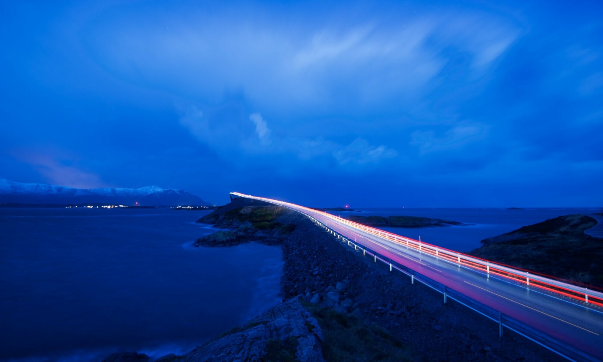
SCENIC ROADS IN THE FJORDS
There are eighteen national tourist routes in norway. ten of them are located in western norway. common to them all is that the roads are going through some of the wildest and most beautiful scenery that norway has to offer..

We give you a brief overview of the National Tourist Routes in Western Norway. Power up your car, fasten the seat belts and have a fabulous trip with beautiful scenery along the roads in Western Norway.
Season: Summer. This also depends on whether the winter-closed roads are open.
Road Trips: In Western Norway, we have fantastic opportunities for active leisure . The fjord area is like a great playground for those who love activities and adventures . Fill up the car with your gear and take a road trip in Western Norway. Here you can explore the stunning scenery. You can be active and use the nature around you. Or you can also just relax and enjoy the beautiful and wild nature.
National Tourist Routes in Western Norway
There are eighteen National Tourist Routes in Norway. Ten of them are located in Western Norway, in the fjords. Common to them all is that the roads are going through some of the wildest and most beautiful scenery that Norway has to offer.
Here is a brief overview of the National Tourist Routes in the fjords.
Road Trip – Geiranger – Trollstigen – The Atlantic Road
The route between Geiranger via Trollstigen to the Atlantic Road , Kristiansund and Molde includes one UNESCO World Heritage (the Geirangerfjord), two National Tourist Routes (Geiranger – Trollstigen and the Atlantic Road), one National Park (the Aursjøvegen Road) and one “construction of the twentieth century” (the Atlantic Road).


The Atlantic Road
The Atlantic Road zigzags across low bridges that jut out over the Atlantic Ocean, linking the islands between Molde and Kristiansund in the western fjords.
The eight kilometer long road is voted as the construction of the century in Norway, and is one of ten National Tourist Routes in the Norwegian Fjords.

Go West – A Road Trip in the Fjords of Western Norway
If you want to see Norway, you should spend some days on a roundtrip in the western part of the country. This is a travelogue where you will meet the best of the fjords, mountains, rivers and glaciers.

Road Trip in Sogn og Fjordane
Late summer 2022, I had a great road trip in the deep fjords of the Sognefjord and the beautiful coastal landscapes in Sunnfjord and Nordfjord . The road trip went through the old county of Sogn og Fjordane , now part of the larger county of Vestland . It started and ended in Oslo.
Great hikes, boat trips, a church from the middle ages, national tourist route, rib-boat trip, fjord cruise, an outdoor museum and beautiful nature are some key words from this fantastic adventure which took eight days to complete.
Road Trip from Nordfjord to the Sognefjord
Sometimes the road is the goal. I was heading towards Sogndal and the Sognefjord , but decided to take a detour to Nordfjord to see more of the beautiful county of Sogn og Fjordane.
Road Trip from Ryfylke to Hardanger
A few years ago I had a roundtrip in the Ryfylke and Hardangerfjord area visiting some of Norway´s most famous and beautiful tourist-icons.
I hiked to Preikestolen by the Lysefjord and experienced the waterfalls in Odda , Lake Bondhusvatnet in Kvinnherad, Vøringsfossen Waterfall in Eidfjord and hiked parts of Dronningsstien Panoramic Trail in Hardanger.

HOTELS - LINKS - FAQ
Scenic routes – map overview.
This website uses cookies to improve your experience. We'll assume you're ok with this, but you can opt-out if you wish. Read More
- Preferences Preferences Preference cookies enable a website to remember information that changes the way the website behaves or looks, like your preferred language or the region that you are in.

Geiranger Trollstigen National Tourist Route Road (Norway Travel Guide)
by Aileen Adalid Norway , Road Trips 33 comments
- All About YOU: Letters from My Readers / Volume 2
- Henn na Hotel (変なホテル): Japan’s Unique Robot-Staffed Accommodations
- GIVEAWAY: Win a Trip to New Zealand with Singapore Airlines!
- Batanes Itinerary: Travel Guide to Batan, Sabtang & Itbayat Islands (5 Days or More)
- Luxury Living in Makati Diamond Residences, Philippines (Hotel Review)
- Top 5 Reasons to Visit Universal Studios Singapore Halloween Horror Nights 8
- Best Hotels in Queenstown, New Zealand: From Cheap to Luxury Accommodations and Places to Stay
- Villingardalsfjall Hike: How-To and Travel Guide (Faroe Islands, Denmark)
- Best Hotels in Copenhagen, Denmark: From Cheap to Luxury Accommodations and Places to Stay
- 20 Best Spots for Autumn in Japan: Top Places for Fall Foliage Viewing
Did you know? There are eighteen (18) highways in Norway called ‘National Tourist Routes’ and these are well-known picturesque paths — or “visual feasts” — that each combines Norwegian nature and modernity. With that in mind, setting off on a road trip in Norway is an absolute MUST! But of course, going through all 18 routes might be overkill especially if you only have a few days or weeks in the country… So: if you’re looking for a National Tourist Route that you should absolutely include in your itinerary, that would be the famous Geiranger-Trollstigen journey!
Best Tours in Norway?
Come and check out this list of the top things to do in Norway which features the best activities and tours to do in Oslo and more!
From the breathtaking serpentine mountain roads in Trollstigen up to the grand World Heritage Site in Geiranger, I can assure you that this route will not only give you the chance to glimpse Norway’s magnificent fjords (inlets with steep cliffs created by glacial erosion) but also of its stunning landscapes, high waterfalls, and towering mountains.
Some of these mountains are charmingly called Bispen (“the Bishop”), Dronningen (“the Queen”), Kongen (“the King”) , and Trollveggen (“the Troll’s Wall”).
Table of Contents
About Geiranger Trollstigen
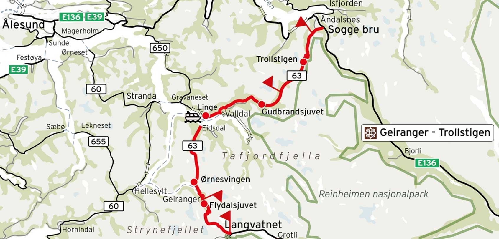
The National Tourist Route Geiranger-Trollstigen runs a total distance of 104km on the Norwegian County Road 63, and it includes a single ferry crossing over the Norddalsfjorden as it starts from Langevatn to Strynefjellet and Sogge Bru in Romsdalen.
It helps to note, however, that parts of this route are closed during winter:
- The stretch from Langevatnet to Geiranger is usually closed in November and reopens in May.
- Whereas Trollstigen is usually closed in October and reopens in May.
When I first landed in Norway, this National Tourist Route was the 2nd great sight that I saw after a day of exploration in Oslo , and it goes without saying that I absolutely recommend this for your itinerary!
That being said, if you’re coming from Oslo, I suggest that you head on to the small town of Åndalsnes to start your Geiranger-Trollstingen road trip…
BY TRAIN. There are daily train departures from Oslo (5.5 hours) and Trondheim (4-5 hours) to Åndalsnes. From Oslo, I took a scenic train ride with Dovrebanen (Dovre Railway) followed by Rauma Railway and it. Was. Amazing! (Upon arrival at Åndalsnes, we picked up our rental car from the Avis office).
BY ROAD . You can drive to Åndalsnes via the E6 road (or E6 to E136 road) from Oslo. Rest assured, there are daily buses to the area if you’re coming from Bergen and Trondheim.
BY PLANE. The nearest airport is Molde Airport, located 1.5 hours from Åndalsnes. There are daily flights to and from major cities in Norway here.
– – –
Upon arrival in Åndalsnes, you can continue by car or by tourist bus. But I’m telling you this now: I urge you to simply get your own car so you can control your own stops along the way (besides, you will be seeing plenty of beautiful views all over).
Speaking of stops, below are just some of the MANY sights and landmarks that we saw up until we reached Geiranger.
» Trollstigen
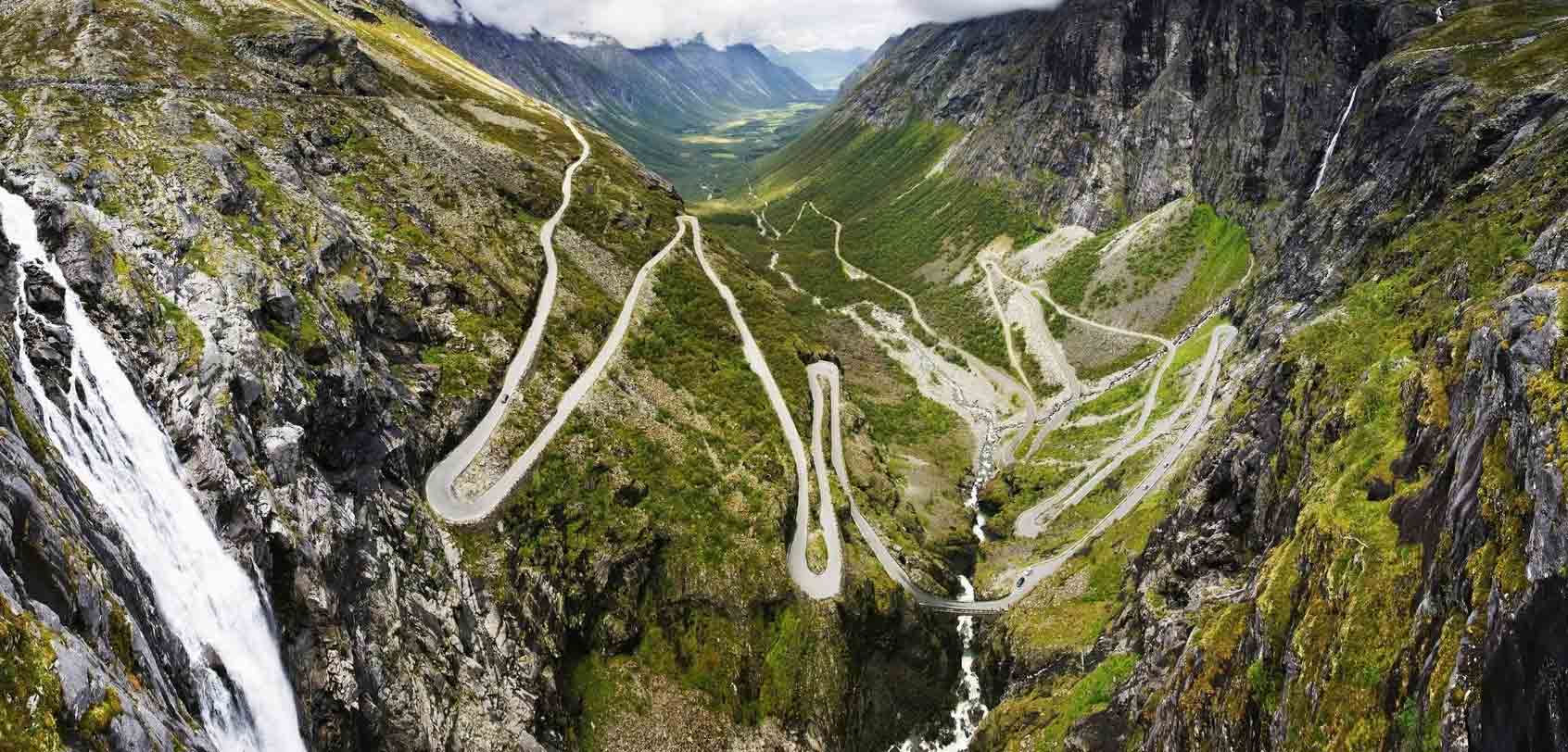
Bottom photos by: Jarle Wæhler / Statens vegvesen
Trollstigen or ‘ Troll’s Path’* itself lies within the Trollstigen landscape protection area and it snakes up its way from the town of Åndalsnes in Rauma to the village of Valldal in Norddal Municipality through steep mountain cliffs and waterfalls.
* TRIVIA : Norway is well-known for its trolls. After all, these mythical cave or mountain-dwelling beings have been a part of a LOT of Norwegian mythology and folklore. Naturally, you would often see places like Trollstigen that are attributed to trolls, as well as towns who have troll statues or souvenirs. Additionally, you would even glimpse road signs that quirkily remind you to watch out for trolls!
As you can see from the pictures above, Trollstigen is a true example of incredible construction and engineering; and though the road can be extremely narrow with sharp bends (about 11!) , a steep incline of 10%, and edges lined only with guard stones, it remains to be an exhilarating view (albeit also nerve-wracking) thereby making it a popular tourist attraction in Norway.
Rest assured, some parts of this path were widened from 2005 to 2012, but vehicles over 12.4 meters (41 feet) long remain to be prohibited from driving Trollstigen.
- In summer, about 2,000 cars are said to pass over Trollstigen which means that there is about 1 car for every 10 seconds.
- Apart from riding the car or a bus, there are a lot more people now who choose to see the view from a bike (electric or not) and you can easily rent those from the nearby town of Andalsnes.
- You will find somewhere along this road an impressive bridge that runs in front and across the Stigfossen waterfall (falls at 320 meters or 1,050 feet down the mountainside). .
» Trollstigen Visitor Centre
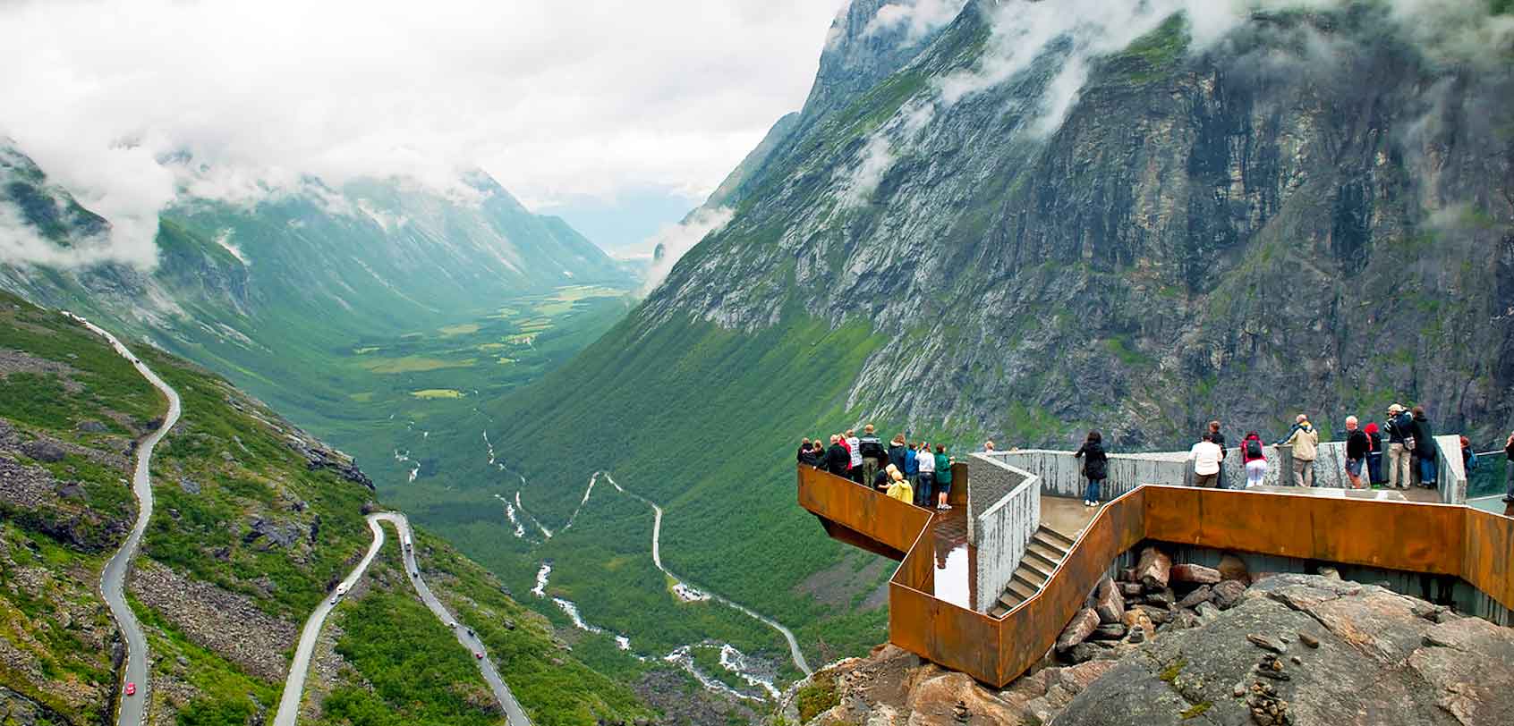
Photos by: Jiri Havran / Statens vegvesen
There are several great vantage points that you can stop by along the route in order to admire Trollstigen in its full glory. But if I have to pick the best one, it would be the largest viewing area: Trollstigen Visitor Centre.
Opened in June 2012, this project was initiated and designed in 2004 by Reiulf Ramstad Architects. It includes a waterside restaurant, gallery, and footpath that leads to an iconic hovering platform jutting out 200 meters above Trollstigen and the Stigfossen waterfall.
It was quite a sight!
If you would notice as well, this whole center was built in a way that perfectly blends in with its rocky environment. Naturally, I really admired how the Norweigan architects put so much thought into the center’s overall look and use so as not to diminish the experience but rather enhance it!
» Gudbrandsjuvet
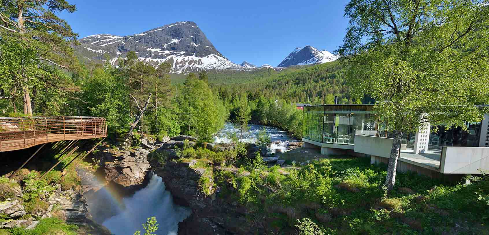
Photo by: Jarle Wæhler / Statens vegvesen
Before reaching the upcoming ferry crossing on the Geiranger-Trollstigen route, there is but one viewing point that I would love you to see as well: Gudbrandsjuvet .
This is basically a gorge that has a 5-meter wide and 25-meter high ravine in which the foaming Valldøla River forces itself through. Over the millenia, the river waters formed a complex of deep and large potholes as well as intricate formations on the surrounding rocks — hence, a sight that’s worthy to be seen.
Make time then to stop by here and admire the ravine over its gorgeous viewing platform that’s shaped like a garland. If you want a cup of jo, there’s a café found at the very edge of the river.
» Linge Ferry Quay
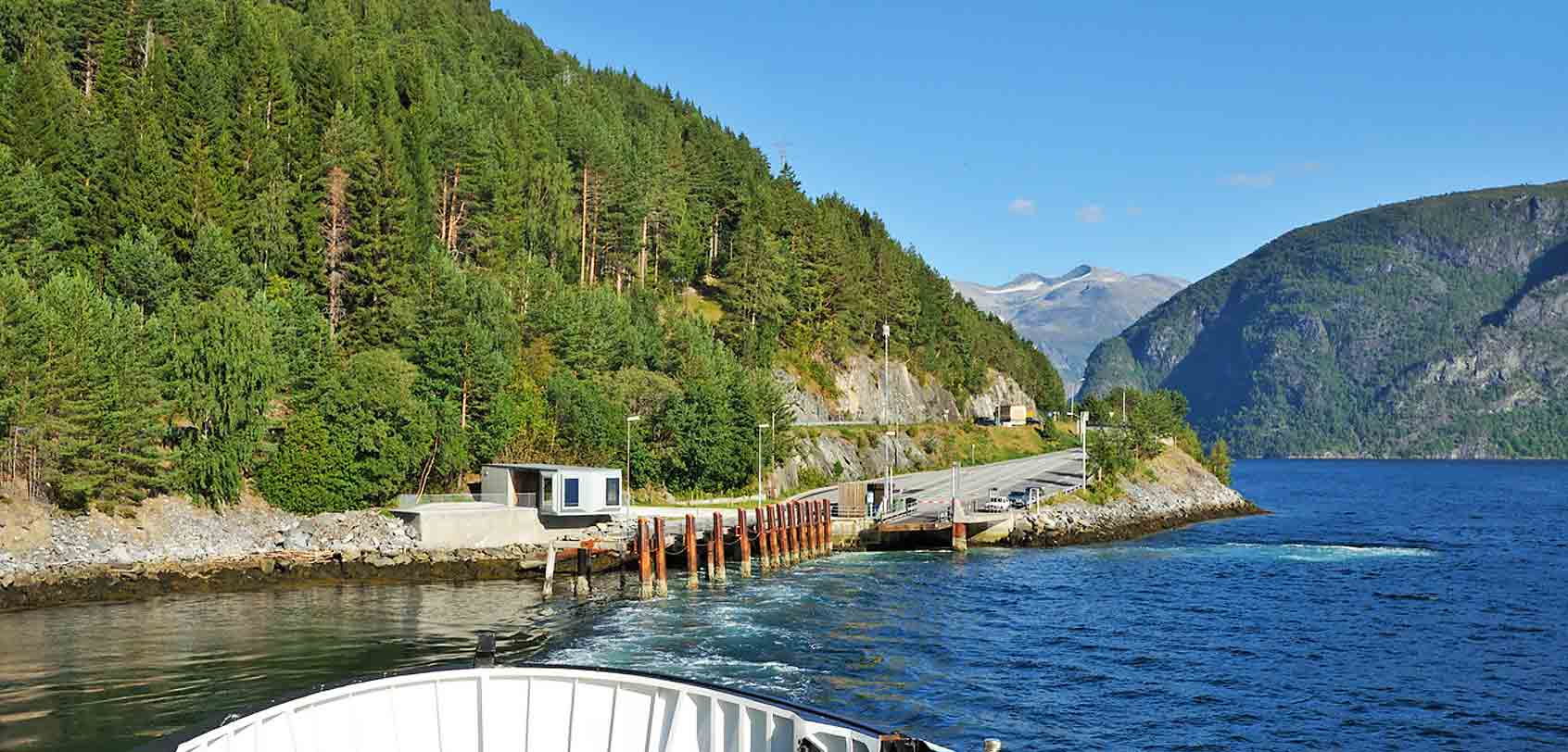
Photo by: Roger Ellingsen / Statens vegvesen
As I’ve already mentioned, this is the only ferry crossing that you’ll need to do along the Geiranger-Trollstigen path and it’s called as the Linge Ferry Quay.
The ferry here shuttles back and forth across the Storfjord (from Norddalsfjord to Eidsdal) , and if in case you arrived too early, feel free to hang out at the quay’s passenger waiting room that has bays and large windows (designed by Oslo architect Knut Hjeltnes).
I found it quite interesting as well that there was a nearby orchard!
INFO : It runs every 30 minutes. It costs 33 NOK for adults and 16 NOK for children and seniors. If you’re coming with your car, depending on the type of vehicle you have, the cost starts at 79 NOK.
» Ørnevegen, Ørnesvingen, Geirangerfjord, to Geiranger
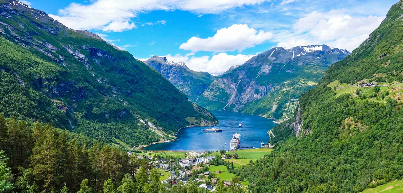
Bottom photo by: Jarle Wæhler / Statens vegvesen.
ØRNEVEGEN : (“The Eagle Road”) Upon landing in Eidsdal from the ferry, you will eventually encounter this road — a steep mountain path that leads down to the town of Geiranger. Much like Trollstigen, Ørnevegen also has 11 hairpin bends!
ØRNESVINGEN : This is the highest of the hairpin bends in Ørnevegen and naturally, a viewing point was built here so as to give visitors a magnificent panorama over the town of Geiranger, the Geirangerfjord, the “Seven Sisters Falls” and the historic alpine farm of Knivsflå. (You will often see cruise ships passing through the fjord below as they make their way in and out of Geiranger).
GEIRANGERFJORD : Deep blue waters and snow-covered mountain peaks with thundering waterfalls, Geirangerfjord was listed back in 2005 as a UNESCO World Heritage Site (together with Nærøyfjord) — which is rightfully so! With its unique natural landscape, it deserves to be one of the most incredible places in the world. But other than glimpsing its grand vistas from afar, you can also experience Geirangerfjord furthermore by doing some sightseeing trips, hiking, fishing, cycling, or even kayaking.
GEIRANGER : This small town has plenty of restaurants that could fill you up after your long ride from Trollstigen. And if you’re up for more adventure, you can hike to Storseterfossen waterfall. The trail is well-marked once you reach Westera’s Farm. We did this during our stop at Geiranger and it was superb to see the mighty waterfall up close!
TIP: If you want great views over Geiranger, make sure to book your accommodation at Hotel Utsikten . It offers views at a great vantage point. Aaah, just imagine staying in a room that offers you these scenes all day long! . Meanwhile, for an established viewing point that’s placed even higher above the town of Geiranger, go to the rest area of Flydalsjuvet that is about 5 kilometers up from Geiranger on the Stryn road. . Additionally, if you’re into an exhilarating ordeal and want to achieve the classic photo on the right, you’ll have to go down the hill for about 150 to 200 meters in order to descend a rather indistinct track to the edge. . Since it can get slippery, be careful as you make your way here!
» Dalsnibba
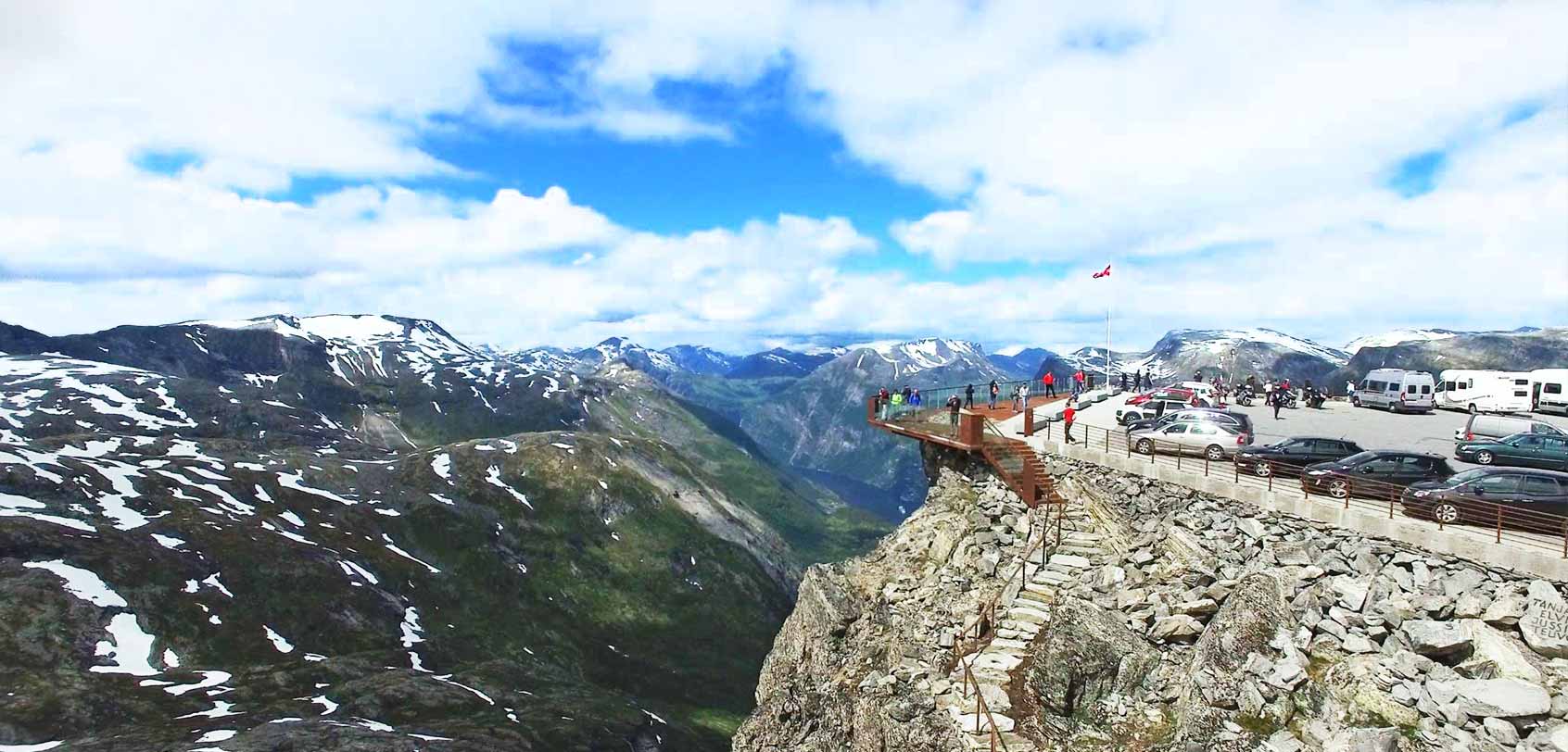
Bottom photo by: Dalsnibba.no
Want to go even higher to get a better view over Geiranger? Head over to this last viewing point that we stopped for: Dalsnibba.
This is a very popular mountain top in Norway that was opened just last 2016, and it is actually referred to as Europe’s highest fjord view by road – at 1,500 meters! What’s more, it has a ‘ Skywalk ‘ that somehow gives you the sensation as if you’re floating up in the air and this is mainly because its steel floor surface is see-through and its rails are made of glass.
As someone who’s afraid of heights, it made my feet shake just by walking on its floor surface because I could clearly see the 500-meter drop beneath my feet! Still and the same, this area was beyond spectacular and surely a photographer’s dream spot.
INFO : To reach Dalsnibba (just a 30m-minute drive from Geiranger), just follow the Nibbevegen Road. Take note that this viewing point is open 24 hours until mid-September or October. Toll prices are payabale by vehicle and if you’re coming by car, motorbike or motorhome, you’ll have to pay 130 NOK
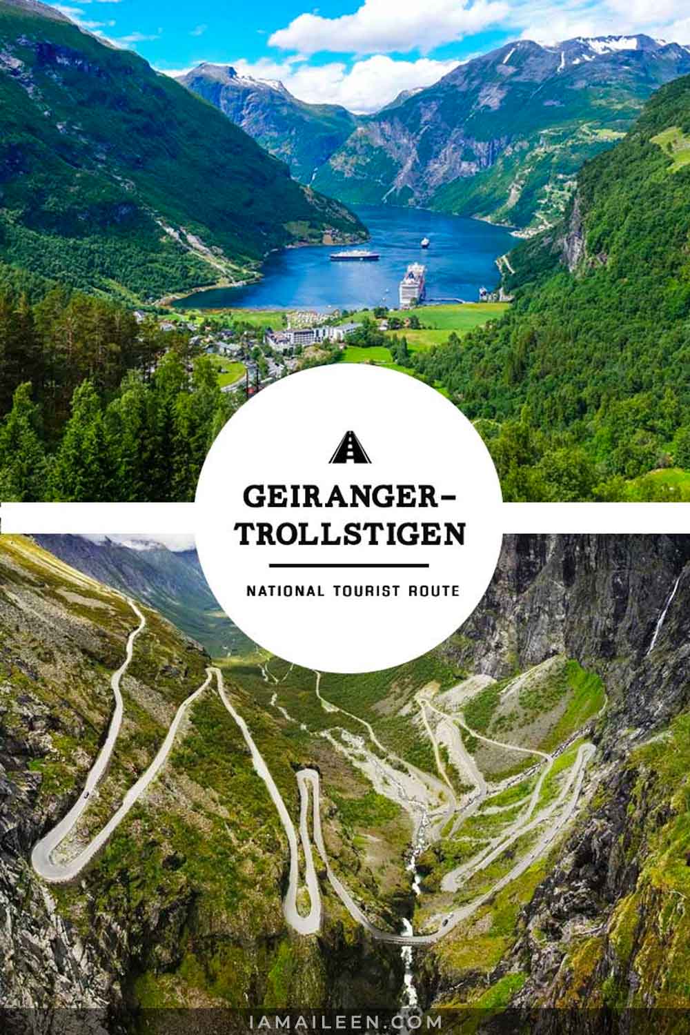
With roads that snake and climb their way up steep mountainsides and fjords, making our way through the Geiranger-Trollstigen route during the first few days of our stay in Norway was an experience that was beyond AMAZING — and a truly wonderful prelude to the rest of the country’s magnificent natural landscapes!
Truth be told, before I set out on this trip with Innovation Norway, I have surely expected the surreal range of beautiful vistas that I will be seeing… But seeing everything up close with my own eyes overwhelmed me in so many ways than one.
All in all, Norway is undoubtedly one of the most gorgeous countries on Earth and the Geiranger-Trollstigen path is but one of the MANY proofs as to why this country is remarkable!
Have you seen my latest vlog?

Hey there! I am Aileen Adalid. At 21, I quit my corporate job in the Philippines to pursue my dreams. Today, I am a successful digital nomad (online entrepreneur, travel writer, & vlogger) living a sustainable travel lifestyle.
My mission? To show you how it is absolutely possible to create a life of travel no matter the odds — and I will help you achieve that through my detailed travel hacks, guides, resources, tips, and MORE!
Follow Along
CURRENTLY BASED IN: The Philippines
- 100k Followers
- 51k Followers
- 80k Followers
- 10k Followers
- 23.1k Followers
Join over 1 million readers worldwide and get my FREE packing checklist, gain exclusive access to travel giveaways and more!
Success! Next, please check your email to confirm your subscription.
GET FREE PRINTABLE NOW!
Trending Now
Korean visa application requirements for filipino tourists in manila, philippines (single / multiple entry).
Make your South Korea travel dreams come true and get a single or multiple South Korean visa in Manila, Philippines!
Top 10 Things to Do on a Trip to South America
South America is one of the most diverse continents — full of natural wonders and fascinating cultures. Join us as we explore the top 10 things to do.
Top 10 Things to Do for Your First Tibet Travel
Make the most of your Tibet travel with these top 10 must-do activities, from exploring ancient monasteries to trekking mountains!
Geisha of Japan: Understanding the Facts, History & Myths
Japan’s geisha are cloaked in mystery & secrecy resulting in a number of false ideas about them — so let’s get the facts straight!
Maximizing Your Miles: Unlock Budget-Friendly Travel Hacks & Tips
Start traveling smart! Take note of these travel hacks that will help you in maximizing your miles or do points hacking.
Latest Posts
Learn Today
How to start a successful blog, 33 comments.
Oooh. Planning and hoping that the covid situation improves and we can book our trip to Norway for 2021 soon! Thanks for helping with our research – some great ideas and beautiful images shared to keep my inspired.
Aileen – GORGEOUS pics! Planning a trip in last week of May. Flying in and out of Oslo. Where did you pick=up and drop-off your rental car to do this trip?
Hey Nee! This was actually a part of a long road trip I did (see here: https://iamaileen.com/norway-road-trip-itinerary-for-1st-time-visitors-best-travel/ ). So my pick up and drop off were two different places.
Submit a Comment Cancel reply
Your email address will not be published. Required fields are marked *
Be notified of follow-up comments by email
Be notified of new posts by email
Submit Comment
Pin It on Pinterest
- Inspiration
The Most Scenic Routes in Norway
Norway is home to some spectacular scenic routes. With breathtaking views around every corner, your drive or ride is bound to fly by. There are lots of ways to explore these scenic routes. There are hiking trails to walk, roads to drive, and waterways to explore. You might even find yourself enjoying the view of a spectacular fjord on a train ride.
This article will take a look at some of the most beautiful routes in Norway and the most eco-friendly ways to explore them!

Trollstigen Road
Trollstigen is a stunning mountain road in Western Norway. It is one of the most popular National Tourist Routes in the country. This weaving road is fairly short but once you get to the top you’ll see why so many tourists flock to Trollstigen every year. Be sure to stop at the two viewpoints on your way up and then take in the panoramic views of the mountains on the top platform lookout.
Fair warning: this drive is not for the faint of heart. Vehicles longer than 13.1 meters are not permitted to drive on this road and it is also closed during the winter months. Trollstigen Road has 11 hairpin loops each at the top of a steep cliff. Make sure you take the drive slowly! If you’re a bit nervous it’s best to let someone else take the wheel. Drivers on this road should feel confident and secure in their ability to safely navigate the turns.
Scenic Railways
There are a number of beautiful scenic railways in Norway. Whether you are looking to catch a glimpse of a glacier or a waterfall, you’ll be able to find the right route for you. We love the option of travelling a scenic route by train for a few different reasons. Firstly, it allows you to sit back, relax, and take in the view without having to worry about driving or navigating. Additionally, trains are an amazing eco-friendly travel option. You’ll feel great knowing your mode of travel is having a minimal negative impact on the stunning natural environment.

Coastal Route
If you’re looking to combine a ferry ride and a car ride so you can also explore the ocean on your trip, we recommend traveling the road between Bodø and Tromsø . This route showcases Arctic nature in all its glory. Stunning and awe-inspiring mountains jut out of the sea. You’ll pass through rugged beaches and quaint, small fishing towns. Plus, your ferry ride from Andenes to Gryllefjord will give you a chance to spot some marine wildlife. This route pretty much has it all!

There is no shortage of beautiful scenic routes in Norway. Each one offers a unique view of this country’s beautiful, natural landscape. The hardest part of your travels will be deciding which adventure you want to tackle first! As you plan your travels, keep in mind some of the great eco-friendly options available for your trip. Have questions on how to plan the most eco-friendly trip ? Contact us at Fjord Tours to find out how we can help!

National Tourist Route Aurlandsfjellet
Aurlandsfjellet, Aurland, Aurland
- Facebook page
- View in Map
The mountainroad between Aurland and Lærdal is normally open from the 1st of June to approx. 15th of October. From Aurland to the viewpoint- Stegastein (7,5 km), the road is open all year. The crossing Aurland - Lærdal- Aurlandsfjellet is 48 km and the highest point 1306 m a.s.l. You will come away with powerful impressions, and the contrasts between the fjord and the high mountain region where snow lies on the ground for most of the year are compelling. The roas is also called "the snowroad", since you can see snow along the road most of the summer. Recommended Bus lenght 12,4 meter. VIEWPOINT PLATFORM at Stegastein - here you will find parking and toilet
The mountainroad between Aurland and Lærdal is normally open from the 1st of June to approx. 15th of October. From Aurland to the viewpoint- Stegastein (7,5 km), the road is open all year. The crossing Aurland - Lærdal- Aurlandsfjellet is 48 km and the highest point 1306 m a.s.l.
You will come away with powerful impressions, and the contrasts between the fjord and the high mountain region where snow lies on the ground for most of the year are compelling. The roas is also called "the snowroad", since you can see snow along the road most of the summer.
Recommended Bus lenght 12,4 meter.
VIEWPOINT PLATFORM at Stegastein - here you will find parking and toilet. Also parking 3 km direction Lærdal to marked hiking trails with fjordview and mountain peak Prest - 1363 m.a.s.l.
The road was opened in 1967 and its forerunner was a construction access road. The road runs from Lærdalsøyri to Aurlandsvangen over the mountains and the highest point is 1,306 metres above sea level. The road is closed in the winter and snow lies on the mountain throughout large parts of the summer, so the name "the snow road" is truly befitting.
Last updated: 03/25/2024
Source: Visit Sognefjord AS
Your recently viewed pages

National Cycle Routes
- Atlantic Coast Route
- Norse All-Road Series (M)
- Norse Gravel Series (M)
- Norse Loops Series (M)
- Scandi Loops Series (M)
- Scenic Routes (M)
- Base/Day Rides
By Location
- East Norway
- West Norway
- South Norway
- North Norway
- Across Norway
- Getting to Norway
- Accommodation
Public Transport
- Food & Drink
- Weather & Climate
- Difficulty of Routes
- E-Bike Info
- Bike Rental & Repairs
- Opening & Closure of Roads
- Bike Box Travel
- Clothing List
- Personal Journey
- Business & Media Inquires
- Members Forum

In total there are 9 routes that offer something for everyone. For example, if you’re looking for relatively flat terrain then Route 1 from Trondheim to Tromsø is a great option. If you’re after remoteness with traffic-free roads then perhaps try Route 9 which follows the far east of the country. And if glaciers, mountains, and fjords are what makes you pedal harder check out Routes 3, 4, and 6 for some of the most outstanding beauty anywhere on the planet. Over 80% of the routes are on paved roads and the rest are on cycle paths, gravel roads, and mixed surfaces.
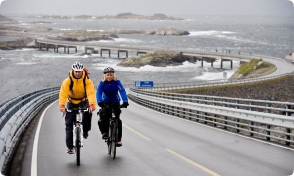
Good to know
Many people may imagine that a signed cycling route means quiet back roads away from traffic and danger. Indeed, the routes try to follow this script but unfortunately, there are several occasions when only main roads are available. For example, on route 7 there is a 20km section on the E6 which is far from ideal. On route 3 you have the E39 to contend with and road 13 on route 1 can be unpleasant at certain times of the day. Having a high-visibility vest and lights should be an essential part of your setup.

Sometimes the surface of the route can be less than pleasing removing you from a flat well paved road and off on a hilly detour through demanding forest terrain. Use your own judgment and never just religiously follow every sign. Sometimes it might be best to stick with a paved road if the traffic is light and your legs are tied. Other times the forest detour might be a welcome adventure to experience.
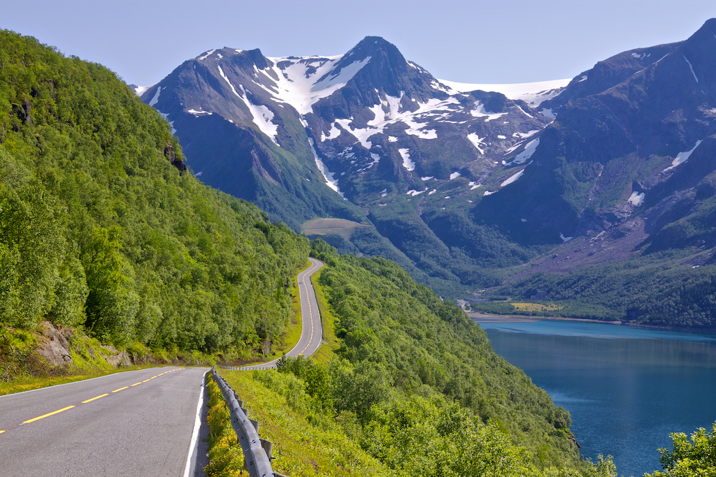
Degree of Difficulty
On each individual route page, we have stated the difficulty using a scale of 1-10. Some routes are demanding and a good level of fitness is recommended. Other areas are more manageable for less experienced cyclists. However, Norway is a mountainous country. Feedback from European cyclists from flatter countries finds Norway more challenging than they had expected. E-bikes will certainly be a part of Norway’s growing cycling industry and if you’re unsure about what you can manage we recommend this be a good option to consider.
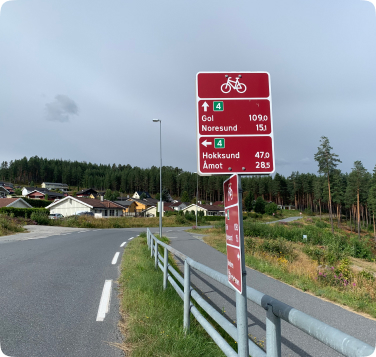
Around half of the routes are signposted, but it varies from area to area depending the popularity of the route and it’s location. The good news is more signs are going up each year in collaboration with county councils and municipalities. The signs are reddish-brown with green route numbers from 1 to 9. Even with the development of advanced gps cycling computers. Many people find having them on a route a psychology reassurance and it also gives drivers a warning to expect cyclists.
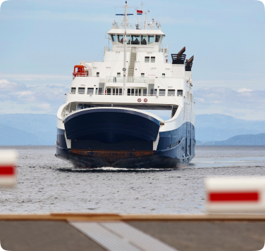
On some of the routes, you will need to take ferries across the fjords, lakes, and, islands. On rare occasions, you may prefer to take a bus through a long tunnel. In addition, there are many opportunities to take a bus, train, or boat to skip or bypass certain sections of a route. You will find more info about this on the specific route pages.
Organisations that support our work

Cycle Norway is dedicated to making Norway, safer and more enjoyable to experience by bike and to inspire and inform a growing audience of the opportunities available.
Subscribe to our newsletter
© Copyright 2023 CYCLENORWAY.com / all designs, text, photos (unless stated), & articles are property of CYCLENORWAY.com
Get Your Free Cycle Norway Gear Check-List
Subscribe To Our Monthly Newsletter
This website requires javascript to be enabled in your browser. If you want to use the website without javascript enabled, try to search or use the site map for navigation.
Scenic route Geiranger – Trollstigen
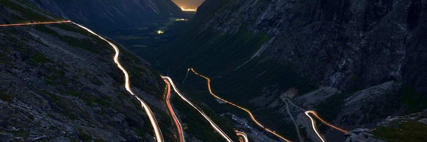
Bendy roads along precipitous mountains
A driving experience along a tourist route rich in tradition with the dramatic scenery that is distinctive to Western Norway.
A driving experience along a long-established scenic route with the dramatic west coast scenery of mountains and fiords, attracting tourists travelling by road or by boat.
Geiranger-Trollstigen offers numerous highlights, and the eleven hairpin bends of Trollstigen as well as the view from Ørnesvingen down to the Geiranger fiord may set your pulse racing.
Lush valleys, sheltered strawberry farms, precipitous mountains and viewpoints guaranteed to make you dizzy offer some of Norway’s most scenic views. Allow yourself enough time for the trip; stops will be welcome, whether to embrace the challenge of a summit hike or just to enjoy the view.
Map of the route
Closed for the winter, rest areas and viewpoints, trollstigen.
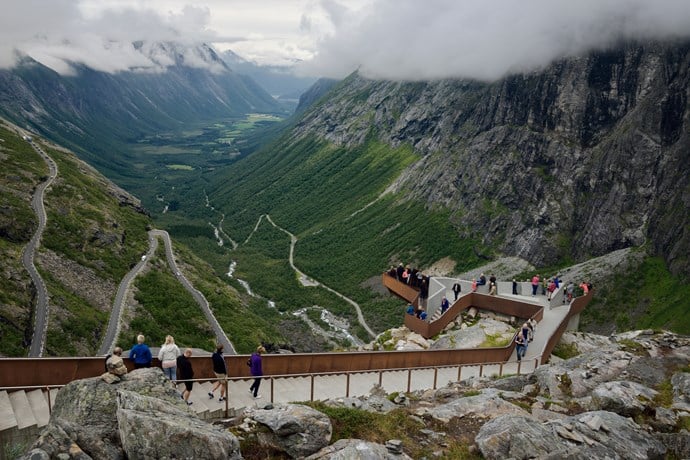
Gudbrandsjuvet
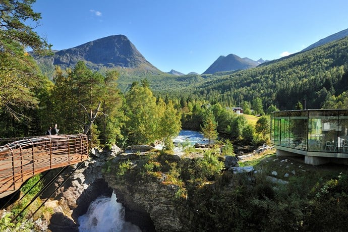
Linge ferjekai
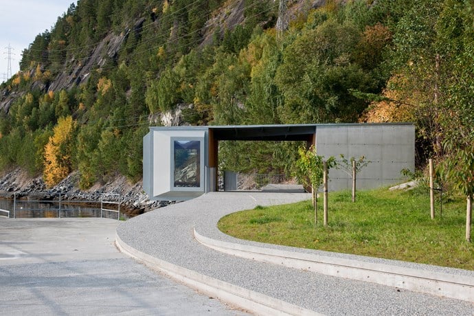
Ørnesvingen
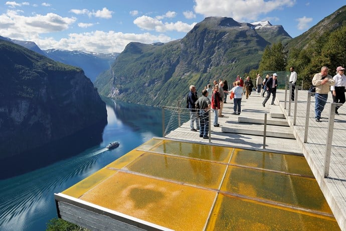
Flydalsjuvet
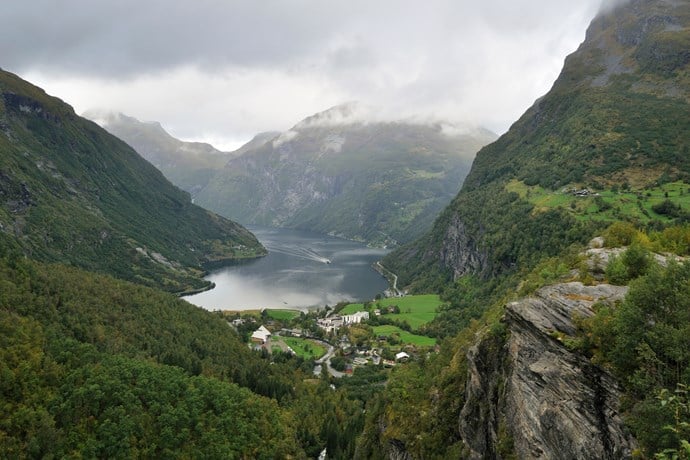
Travel information
Norwegian Scenic Route Geiranger-Trollstigen runs from Sogge Bru in Romsdalen and Langvatnet to Strynefjellet [63]. On part of this stretch you must take a ferry from Eidsdal to Linge (click on the ferry icon for timetable)
For cyclists:The route is a demanding mountain ride with occasional long and steep climbs and descents. The easiest bike ride starts from Grotli. Traffic is heavy on this route during high season, so you might prefer to schedule your trip for early June or September.
Traffic and road information
Telephone +47 815 48 991
Traffic alerts in map (Norwegian only) Traffic alerts in telephone app (Norwegian only)
Map information
Gpx file download for gps and navigation app. In this file, the direction of travel is from Langvatnet to Sogge bru. Gpx files for all Scenic Routes . Any alternative driving pattern must be adapted by the users themselves.
Information
Emptying toilets from motorhomes and caravans is not permitted in our toilets. The facility is not designed for such use. The nearest dump stations are at Isterdalen, Valldal and Geiranger.
Winter information
The road is closed for the winter!
The roads in Trollstigen and Langvatnet to Geiranger are closed in winter. TROLLSTIGEN: Previous closures are 5 October and 7 December. Previous openings are 11 May and 12 June. NOTE: Opened road may be closed for a period at night and closed at short notice in bad weather. LANGVATNET to GEIRANGER: Previous closures are 18 November and 9 January. Previous openings are 9 May and 17 June. Time for closing and estimated opening can be seen by clicking on the snow icon in the map.
Road condition
The stretch Trollstigen is narrow with a number of bends. There are restrictions on the length of buses on this section and the maximum length is 13.3 metres.
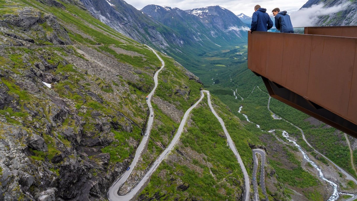
Experiences
For centuries, the Trollstigen route has been important to travellers between Valldal and Åndalsnes. First as a trail, then as a bridleway, until the Trollstigvegen road was started in 1916. Parts of the original pack trail are still visible and passable on foot.
Taking the ferry on the fiord will bring you close to the famous waterfalls of Dei Sju Systre (“the Seven Sisters”), Friaren (“the Suitor”) and Brudesløret (“the Bride’s Veil”), while at the same time letting you experience the most famous fiord in the world, the Geiranger fiord, which is on UNESCO’s list of World Heritage Sites. You may include the ferry route between Geiranger and Hellesylt, as part of a round trip of the World Heritage area, or as part of the stretch from Geiranger to Trollstigen.
Norwegian Scenic Route Geiranger -Trollstigen provides a wealth of hiking options in an amazing and spectacular landscape of fiord and mountains. Another attractive but very steep hike is the hike up to the abandoned mountain farm of Skageflå, starting with a boat trip on the Geiranger fiord. The trail from Trollstigen up to Lake Bispevatnet offers a peaceful walk under the mighty mountains. At the foot of Trollstigen you can go for an easy circular walk along the cascading river.
Useful links
VISITNORWAY
The official travel guide to Norway
Map with information on sleep, eat and do
Ferry routes and timetables (Norwegian)
Entur - Travel planner
Travel by bus, train, ferry, metro and plane
Norwegian Scenic Routes nearby
Atlanterhavsvegen.
“The road across the sea” is the iconic experience with bridges that arch between the islets and reefs along the rough Hustadvika Bay.
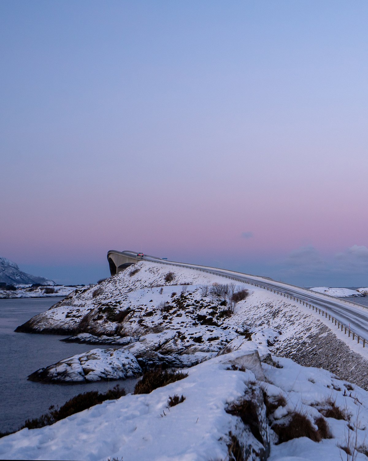
Gamle Strynefjellsvegen
The old roadway between east and west is a museum experience in itself. It is a historic alternative to the new trunk road across Strynefjellet Mountain.
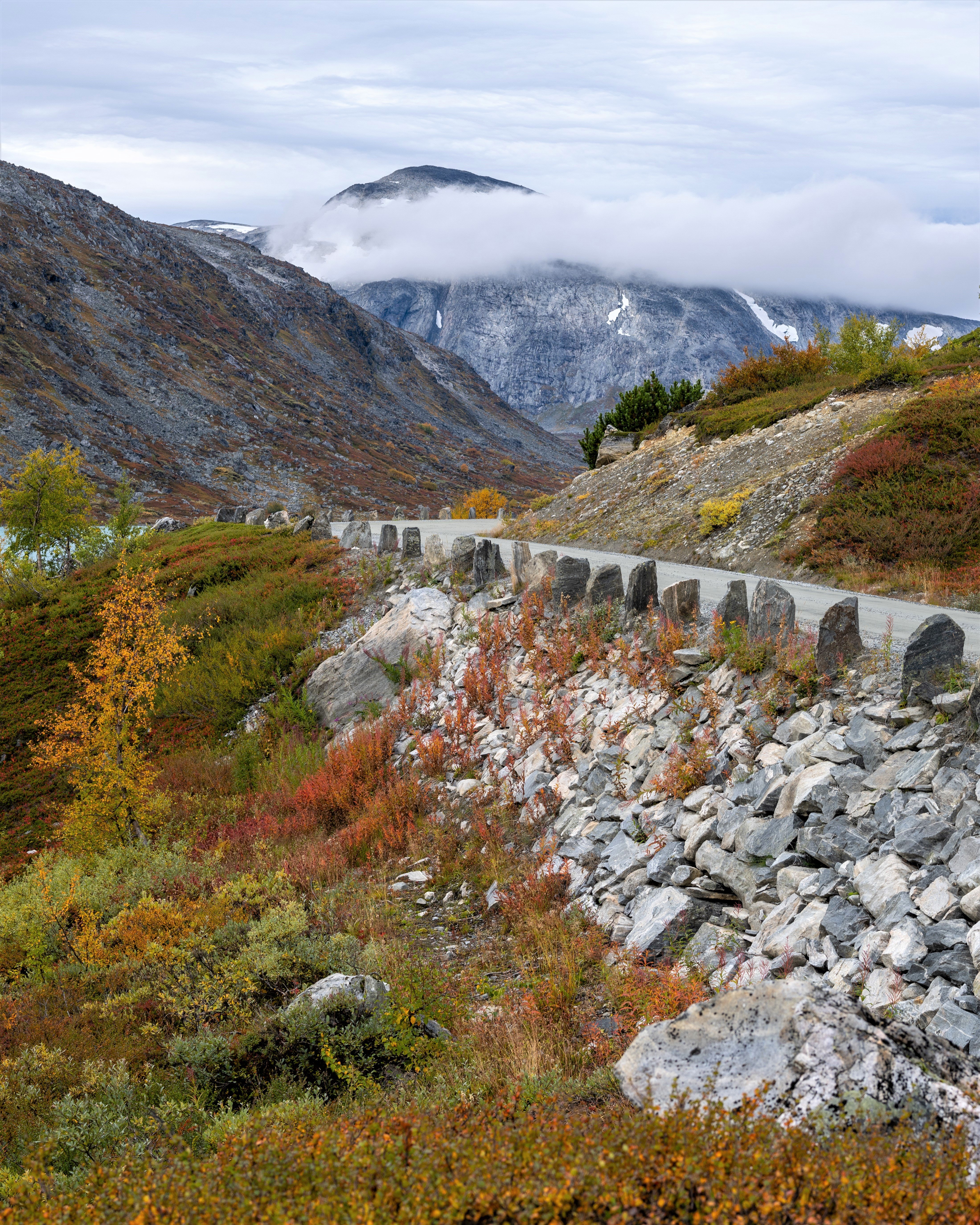
A drive that offers close encounter with Norwegian nature in the easily accessible borderland between high mountains and ancient cultural landscapes.
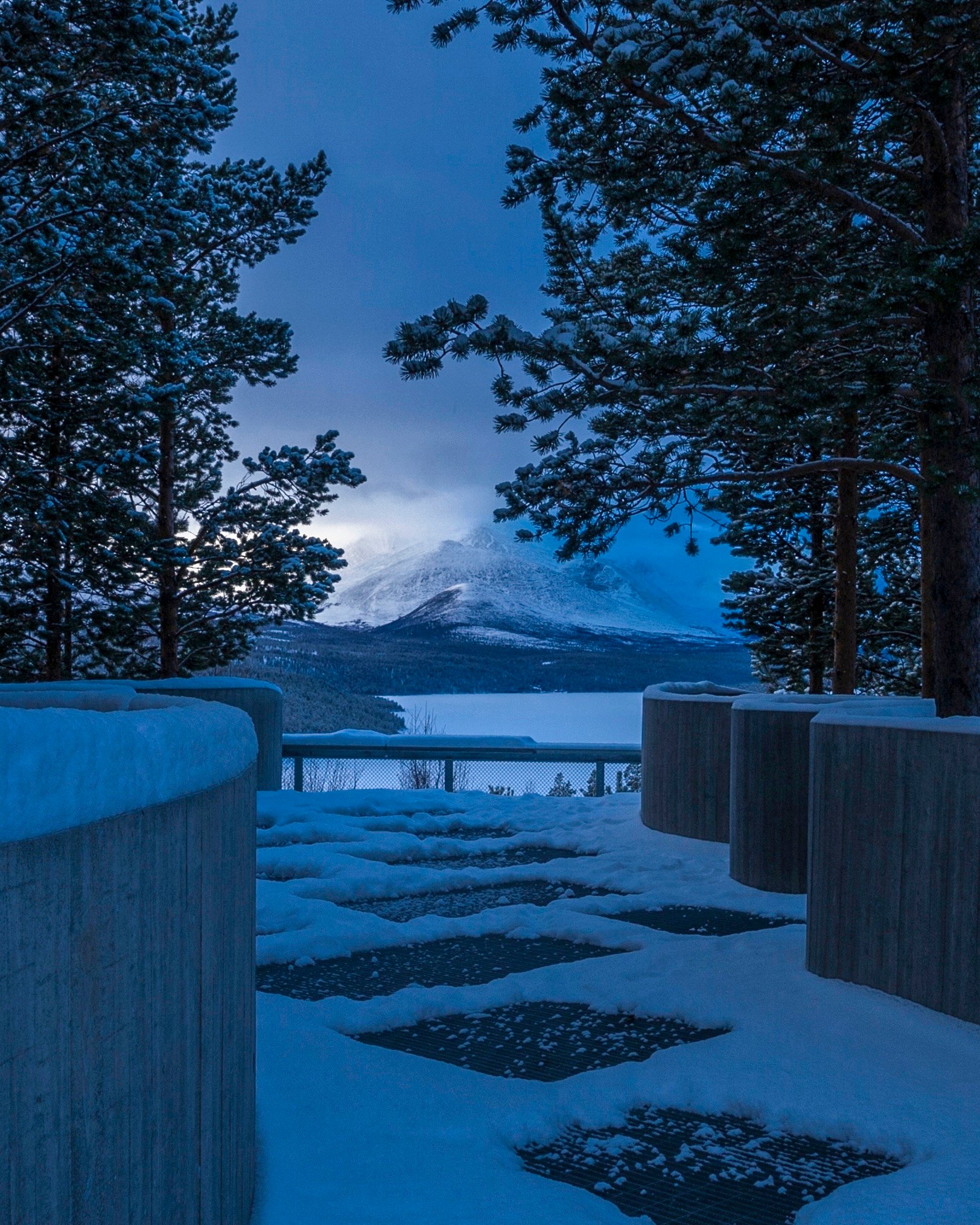
The 18 Norwegian Scenic Routes
Norwegian Scenic Routes are roads that run through unique Norwegian nature. Along the roads you will find artworks, viewpoints and rest areas with innovative architecture in beautiful landscapes.
View all Scenic Routes

IMAGES
VIDEO
COMMENTS
Norwegian Scenic Routes. Norwegian Scenic Routes are 18 selected roads that run through landscapes with unique natural qualities, along coasts and fjords, mountains and waterfalls. The routes are intended as alternatives to the main roads, and the drive itself should be an enjoyable experience.
The Scenic Route travels from the cultural landscape in Lom across the highest mountain pass in Norway to the innermost part of Sognefjorden. Parts of the road are closed for the winter! See where in the map for this route. Length 108 km. 0 - 1434 Masl.
Discover the ultimate road trip experience in Norway. These 18 iconic routes offer unparalleled scenic drives, enhanced by unique attractions along the way. Soar over the stunning Atlantic Road bridges, where the sea stretches out on either side. Or, navigate the thrilling hairpin bends of Trollstigen, where each turn reveals memorable views of ...
National Tourist Routes ( Norwegian: Nasjonale turistveger) are eighteen highways in Norway designated by the Norwegian Public Roads Administration for their picturesque scenery and tourist-friendly infrastructure, such as rest stops and viewpoints. [1] The routes cover 1,850 kilometres (1,150 mi) and are located along the West Coast, in ...
The Lysevegen road is one of the most famous tourist routes in Norway and the world. It's a curvy mountainous road located in Norway. It's going from Lysebotn innermost in the Lysefjord to Sirdal and has a length of 29 km (18 miles). ... The Lofoten National tourist route or E10 in short is the only major road that runs north to south on ...
Ryfylke. The Norwegian scenic route Ryfylke is one of the longer national tourist routes at 260 km long. It starts next to Lysefjord in the village of Oanes and runs all the way to Hårå in Røldal. What makes this route so special is the mix of history, culture, and nature that can be found along the way.
10 of the best scenic routes in Norway. ... The scenery is stunning along this 19th-century road that skirts the Jotsdalsbreen and Breheimen national parks. Marvel at brooding snow-capped peaks and tiny dots of farms in the valley far below on this 27km drive from Grotli to Videsaeter. ... Five buses a day travel the route, and the journey ...
Experience Norway's leading tourist road icon! The dramatic Trollstigen winds its way up the steep mountain side through 11 hairpin bends, and can take anyone's breath away. The road is a result of hard work and an impressive piece of engineering work dated 100 years back in time. His Majesty King Haakon VII opened the road in the summer of 1936.
The Norwegian Scenic Route Hardanger leads through a mighty fjord landscape. On your way, you will get close to the fjord, mountains, waterfalls, and fruit farms. The route is 158 km long and consists of four sections: Granvin - Steinsdalsfossen (road 79/49), Norheimsund - Tørvikbygd (road 49), Jondal-Utne (road 550) and Kinsarvik-Låtefoss ...
Trollstigen (The Troll Ladder) is one of Norway's most important sights and the biggest of the 18 projects. Each of the 18 National Tourist Routes has its particular characteristics and passes through landscapes with unique natural features along the coast and fjords, by mountains and waterfalls, from Jæren in the south to Varanger in the ...
Norwegian Scenic Route Ryfylke travels between Håra and Oanes at Lysefjorden [46] [520] [13] [523]. From Håra the tourist route splits into two sections. One section travels [13] down Brattlandsdalen and Suldalslågen with a small detour to Høse Bridge at Sand [4716]. The other section [520] [46] to Sauda, with a short detour to Ropeid rest ...
National Tourist Routes in Western Norway. There are eighteen National Tourist Routes in Norway. Ten of them are located in Western Norway, in the fjords. Common to them all is that the roads are going through some of the wildest and most beautiful scenery that Norway has to offer. Here is a brief overview of the National Tourist Routes in the ...
The National Tourist Route Geiranger-Trollstigen runs a total distance of 104km on the Norwegian County Road 63, and it includes a single ferry crossing over the Norddalsfjorden as it starts from Langevatn to Strynefjellet and Sogge Bru in Romsdalen. It helps to note, however, that parts of this route are closed during winter:
Trollstigen Road. Trollstigen is a stunning mountain road in Western Norway. It is one of the most popular National Tourist Routes in the country. This weaving road is fairly short but once you get to the top you'll see why so many tourists flock to Trollstigen every year. Be sure to stop at the two viewpoints on your way up and then take in ...
Now the villages are linked by roads and tunnels, so you can drive along most of outer Senja. In summer, ferries run from Botnhamn to Brensholmen, one hour from Tromsø, and from Gryllefjord to Andenes. Below are a few of the highlights on the trip from Botnhamn in the north to Gryllefjord in the south, today one of the 18 designated National ...
The program reminds me very much of the national scenic routes program for tourist roads in the country. 18 designated routes have received substantial funding for improvements and facilities over the years. Hardangervidda is one of the 18 national scenic routes in Norway. Photo: Geir Brekke / Nasjonale Turistveger
The route may have quite a lot of traffic during high season. Norwegian Scenic Route Atlanterhavsvegen is part of National Cycle Route 1, which runs along the entire coast of Norway. From Bergen to Nordkapp the route also coincides with EuroVelo 1 «Atlantic Coast Route». The route is signposted. Traffic and road information. Telephone +47 815 ...
The Norwegian Scenic Route Sognefjellet is northern Europe's highest mountain pass, and runs from Lom to Gaupne, a total distance of 108 km (Road 55). From the verdant meadows and the lush cultural landscape of Bøverdalen you can catch a glimpse of towering mountains in the far distance, as the road slowly ascends through the valley.
The mountainroad between Aurland and Lærdal is normally open from the 1st of June to approx. 15th of October. From Aurland to the viewpoint- Stegastein (7,5 km), the road is open all year. The crossing Aurland - Lærdal- Aurlandsfjellet is 48 km and the highest point 1306 m a.s.l. You will come away with powerful impressions, and the contrasts between the fjord and the high mountain region ...
National Cycle Routes. In total there are 9 routes that offer something for everyone. For example, if you're looking for relatively flat terrain then Route 1 from Trondheim to Tromsø is a great option. If you're after remoteness with traffic-free roads then perhaps try Route 9 which follows the far east of the country.
Use the local bike ferry between Nusfjord and Ballstad to avoid the Nappstraum tunnel. Book your ticket at ballstadgutt.no. Norwegian Scenic Route Lofoten is part of National Cycle Route 1, which runs along the entire coast of Norway. From Bergen to Nordkapp the route also coincides with EuroVelo 1 «Atlantic Coast Route». The route is signposted.
a_____ghostMay 31, 2023 on : "Selvika National Tourist Route, Norway - 2012 The Selvika National Tourist Route in Norway, established in 2012, is a breathtaking sceni ...
1 ferry. Norwegian Scenic Route Geiranger-Trollstigen runs from Sogge Bru in Romsdalen and Langvatnet to Strynefjellet [63]. On part of this stretch you must take a ferry from Eidsdal to Linge (click on the ferry icon for timetable) For cyclists:The route is a demanding mountain ride with occasional long and steep climbs and descents.